Cote Sans Dessein, Missouri
Cote Sans Dessein is an extinct town within the much larger and still extant Cote Sans Dessein Township in southern Callaway County in the U.S. state of Missouri. The site was on the Missouri River floodplain across the river from Dauphine or Bonnots Mill [1] in Osage County. The town of Cote Sans Dessein survived repeated destruction by flooding, until it was finally largely abandoned and its population mostly dispersed.
History
A Native American settlement near here meant "upland forest" in the Osage language.[2] Some references indicate that a settlement specifically at Cote Sans Dessein was made around 1803 by a colony of French traders (near the time of the historic "Louisiana Purchase" treaty).[3] Cote Sans Dessein is a French name often interpreted as "coast without design".[4]
A post office was established at Cote Sans Dessein in 1818, and remained in operation until 1907.[5] At the time of initial Missouri statehood in 1821, the town was among those proposed as the site for the new state capital of Missouri after its transfer from St. Charles, but it was later decided to locate the capital in Jefferson City.[6]
Following early destruction by Missouri River floods, the town was relocated about one mile inland from the Missouri River shore in west-south-central Cote Sans Dessein Township, or about 2 miles southwest of the village of Tebbetts. Maps of 1876 show it on the rivershore, and maps of 1897 show it inland from there.[7] The second location was also substantially destroyed by floods, at which time many or most survivors moved elsewhere, followed by the shutdown of the post office in 1907.
Etymology
"Côte" means "coast" or "shore" or (sometimes interpreted as) "hill" in English; "sans" usually means "without"; "dessein" usually means "design" or "intention"[8]. Among the various possible translations, this would logically refer to a river shoreline or possibly a hill-like or island-like formation sometimes altered due to a periodically changing river current. The exact "intention" of the name would require records of those who originally named the settlement, if such records exist.
References
- Chamois, Missouri, 15 Minute Topographic Quadrangle, USGS, 1890
- Bright, William. "Native American Place Names in the Louisiana Purchase". University of Colorado at Boulder: 358. CiteSeerX 10.1.1.1015.3344. Cite journal requires
|journal=(help) - "Callaway County Place Names, 1928–1945 (archived)". The State Historical Society of Missouri. Archived from the original on 24 June 2016. Retrieved 7 September 2016.CS1 maint: BOT: original-url status unknown (link)
- U.S. Geological Survey Geographic Names Information System: Cote Sans Dessein (historical)
- "Post Offices". Jim Forte Postal History. Archived from the original on 6 March 2016. Retrieved 7 September 2016.
- Kingdom of Callaway Historical Society "A History of Callaway County Missouri 1984". Fulton MO: (author published), 1983.
- Kingdom of Callaway Historical Society: "Combined Illustrated Historical Atlas of Callaway County, Mo. 1876-1897-1919". Mt Vernon IN: Windmill Publications, 1994.
- Oxford Hachette French Dictionary / Le Grand Dictionnaire Hachette-Oxford, Oxford University Press, Oxford UK, 2007.
External links
Municipalities and communities of Callaway County, Missouri, United States | ||
|---|---|---|
| Cities | 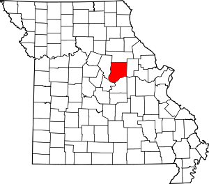 Map of Missouri highlighting Callaway County | |
| Village | ||
| Townships | ||
| Unincorporated communities | ||
| Ghost towns | ||
| Footnotes | ‡This populated place also has portions in an adjacent county or counties | |