Moulin-sous-Touvent
Moulin-sous-Touvent is a commune in the Oise department in northern France.
Moulin-sous-Touvent | |
|---|---|
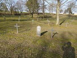 The German military cemetery in Moulin-sous-Touvent | |
Location of Moulin-sous-Touvent 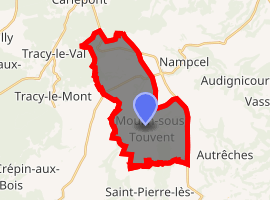
| |
 Moulin-sous-Touvent  Moulin-sous-Touvent | |
| Coordinates: 49°27′25″N 3°04′19″E | |
| Country | France |
| Region | Hauts-de-France |
| Department | Oise |
| Arrondissement | Compiègne |
| Canton | Compiègne-1 |
| Government | |
| • Mayor (2001–2008) | Yves Leroux |
| Area 1 | 18.14 km2 (7.00 sq mi) |
| Population (2017-01-01)[1] | 213 |
| • Density | 12/km2 (30/sq mi) |
| Time zone | UTC+01:00 (CET) |
| • Summer (DST) | UTC+02:00 (CEST) |
| INSEE/Postal code | 60438 /60350 |
| Elevation | 68–158 m (223–518 ft) (avg. 93 m or 305 ft) |
| 1 French Land Register data, which excludes lakes, ponds, glaciers > 1 km2 (0.386 sq mi or 247 acres) and river estuaries. | |
History
First World War
Lying on the front lines of the Western Front, the commune was occupied by Germany and liberated by the Allies. .[2]
The stone quarries of Moulin-sous-Touvent, exploited since the Middle Ages, were occupied in 1914 by the German forces, who took over the dormitories and expanded the underground network, creating hundreds of meters of new galleries.[3]
See also
References
- "Populations légales 2017". INSEE. Retrieved 6 January 2020.
- Section photographique de l'armée (Army Photographic Section) (August 20, 1918). "Photo : August 20, 1918 Moulin-sous-Touvent area. The 75th Artillery pursues the retreating enemy". Fonds des Albums Valois - Département de l'Oise - Volume 4. Argonnaute - Bibliothèque de documentation internationale contemporaine. Retrieved December 5, 2019..
- David Sbrava. "Stone quarries during the Great War" (pdf). Un petit peu d'histoire. http://www.moulinsoustouvent.com. Retrieved June 12, 2019..
| Wikimedia Commons has media related to Moulin-sous-Touvent. |
| Authority control |
|
|---|
This article is issued from Wikipedia. The text is licensed under Creative Commons - Attribution - Sharealike. Additional terms may apply for the media files.