Montgérain
Montgérain is a communes in the Oise department in northern France.
Montgérain | |
|---|---|
%2C_calvaire_4.jpg) The calvary in Montgérain | |
Location of Montgérain 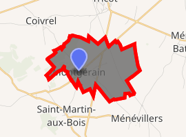
| |
 Montgérain  Montgérain | |
| Coordinates: 49°32′15″N 2°34′33″E | |
| Country | France |
| Region | Hauts-de-France |
| Department | Oise |
| Arrondissement | Clermont |
| Canton | Estrées-Saint-Denis |
| Intercommunality | Plateau Picard |
| Government | |
| • Mayor (2001–2008) | Christine Warmé |
| Area 1 | 4.91 km2 (1.90 sq mi) |
| Population (2017-01-01)[1] | 183 |
| • Density | 37/km2 (97/sq mi) |
| Time zone | UTC+01:00 (CET) |
| • Summer (DST) | UTC+02:00 (CEST) |
| INSEE/Postal code | 60416 /60420 |
| Elevation | 100–134 m (328–440 ft) (avg. 107 m or 351 ft) |
| 1 French Land Register data, which excludes lakes, ponds, glaciers > 1 km2 (0.386 sq mi or 247 acres) and river estuaries. | |
Montgérain is located 40 km northeast of Beauvais and 23 km northwest of Compiègne. Its nearest neighbors are Saint-Martin-aux-Bois, Coivrel, and Ménévillers. Other neighboring communities are Tricot to the north, Maignelay-Montigny to the northwest, and Wacquemoulin to the south.
See also
References
- "Populations légales 2017". INSEE. Retrieved 6 January 2020.
| Wikimedia Commons has media related to Montgérain. |
| Authority control |
|
|---|
This article is issued from Wikipedia. The text is licensed under Creative Commons - Attribution - Sharealike. Additional terms may apply for the media files.