Boulogne-la-Grasse
Boulogne-la-Grasse is a commune in the Oise department in northern France.
Boulogne-la-Grasse | |
|---|---|
.svg.png) Coat of arms | |
Location of Boulogne-la-Grasse 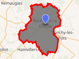
| |
 Boulogne-la-Grasse  Boulogne-la-Grasse | |
| Coordinates: 49°36′43″N 2°42′20″E | |
| Country | France |
| Region | Hauts-de-France |
| Department | Oise |
| Arrondissement | Compiègne |
| Canton | Estrées-Saint-Denis |
| Intercommunality | Pays des Sources |
| Government | |
| • Mayor (2008–2014) | Charline Dézérable |
| Area 1 | 9.41 km2 (3.63 sq mi) |
| Population (2017-01-01)[1] | 471 |
| • Density | 50/km2 (130/sq mi) |
| Time zone | UTC+01:00 (CET) |
| • Summer (DST) | UTC+02:00 (CEST) |
| INSEE/Postal code | 60093 /60490 |
| Elevation | 77–153 m (253–502 ft) (avg. 130 m or 430 ft) |
| 1 French Land Register data, which excludes lakes, ponds, glaciers > 1 km2 (0.386 sq mi or 247 acres) and river estuaries. | |
Population
| Year | Pop. | ±% |
|---|---|---|
| 1793 | 790 | — |
| 1800 | 792 | +0.3% |
| 1806 | 801 | +1.1% |
| 1821 | 720 | −10.1% |
| 1831 | 786 | +9.2% |
| 1836 | 770 | −2.0% |
| 1841 | 728 | −5.5% |
| 1846 | 694 | −4.7% |
| 1851 | 698 | +0.6% |
| 1856 | 648 | −7.2% |
| 1861 | 603 | −6.9% |
| 1866 | 557 | −7.6% |
| 1872 | 545 | −2.2% |
| 1876 | 515 | −5.5% |
| 1881 | 482 | −6.4% |
| 1886 | 510 | +5.8% |
| 1891 | 476 | −6.7% |
| 1896 | 503 | +5.7% |
| 1901 | 465 | −7.6% |
| 1906 | 452 | −2.8% |
| 1911 | 417 | −7.7% |
| 1921 | 414 | −0.7% |
| 1926 | 383 | −7.5% |
| 1931 | 369 | −3.7% |
| 1936 | 381 | +3.3% |
| 1946 | 395 | +3.7% |
| 1954 | 409 | +3.5% |
| 1962 | 424 | +3.7% |
| 1968 | 411 | −3.1% |
| 1975 | 321 | −21.9% |
| 1982 | 295 | −8.1% |
| 1990 | 251 | −14.9% |
| 1999 | 286 | +13.9% |
| 2006 | 407 | +42.3% |
| 2009 | 459 | +12.8% |
See also
References
- "Populations légales 2017". INSEE. Retrieved 6 January 2020.
| Wikimedia Commons has media related to Boulogne-la-Grasse. |
| Authority control |
|
|---|
This article is issued from Wikipedia. The text is licensed under Creative Commons - Attribution - Sharealike. Additional terms may apply for the media files.