Auger-Saint-Vincent
Auger-Saint-Vincent is a commune in the Oise department in northern France.
Auger-Saint-Vincent | |
|---|---|
%2C_%C3%A9glise_Saint-Caprais%2C_vue_depuis_l'ouest_2.JPG) The church in Auger-Saint-Vincent | |
Location of Auger-Saint-Vincent 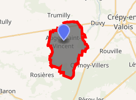
| |
 Auger-Saint-Vincent  Auger-Saint-Vincent | |
| Coordinates: 49°13′10″N 2°48′32″E | |
| Country | France |
| Region | Hauts-de-France |
| Department | Oise |
| Arrondissement | Senlis |
| Canton | Crépy-en-Valois |
| Intercommunality | CC Pays Valois |
| Government | |
| • Mayor (2014-2020) | Fabrice Dalongeville |
| Area 1 | 13.97 km2 (5.39 sq mi) |
| Population (2017-01-01)[1] | 518 |
| • Density | 37/km2 (96/sq mi) |
| Time zone | UTC+01:00 (CET) |
| • Summer (DST) | UTC+02:00 (CEST) |
| INSEE/Postal code | 60027 /60800 |
| Elevation | 73–135 m (240–443 ft) (avg. 87 m or 285 ft) |
| 1 French Land Register data, which excludes lakes, ponds, glaciers > 1 km2 (0.386 sq mi or 247 acres) and river estuaries. | |
Population
| Year | Pop. | ±% |
|---|---|---|
| 1793 | 336 | — |
| 1800 | 391 | +16.4% |
| 1806 | 397 | +1.5% |
| 1821 | 378 | −4.8% |
| 1831 | 426 | +12.7% |
| 1836 | 396 | −7.0% |
| 1841 | 413 | +4.3% |
| 1846 | 381 | −7.7% |
| 1851 | 358 | −6.0% |
| 1856 | 365 | +2.0% |
| 1861 | 395 | +8.2% |
| 1866 | 430 | +8.9% |
| 1872 | 410 | −4.7% |
| 1876 | 401 | −2.2% |
| 1881 | 399 | −0.5% |
| 1886 | 414 | +3.8% |
| 1891 | 390 | −5.8% |
| 1896 | 375 | −3.8% |
| 1901 | 380 | +1.3% |
| 1906 | 377 | −0.8% |
| 1911 | 361 | −4.2% |
| 1921 | 370 | +2.5% |
| 1926 | 376 | +1.6% |
| 1931 | 374 | −0.5% |
| 1936 | 379 | +1.3% |
| 1946 | 350 | −7.7% |
| 1954 | 370 | +5.7% |
| 1962 | 362 | −2.2% |
| 1968 | 342 | −5.5% |
| 1975 | 302 | −11.7% |
| 1982 | 324 | +7.3% |
| 1990 | 395 | +21.9% |
| 1999 | 440 | +11.4% |
| 2006 | 493 | +12.0% |
| 2009 | 521 | +5.7% |
| 2012 | 492 | −5.6% |
| 2015 | 496 | +0.8% |
See also
References
- "Populations légales 2017". INSEE. Retrieved 6 January 2020.
| Wikimedia Commons has media related to Auger-Saint-Vincent. |
| Authority control |
|
|---|
This article is issued from Wikipedia. The text is licensed under Creative Commons - Attribution - Sharealike. Additional terms may apply for the media files.