Crouy-en-Thelle
Crouy-en-Thelle is a commune in the Oise department in northern France.[2]
Crouy-en-Thelle | |
|---|---|
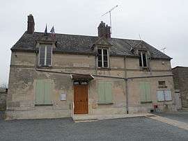 The town hall in Crouy-en-Thelle | |
Location of Crouy-en-Thelle 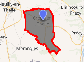
| |
 Crouy-en-Thelle  Crouy-en-Thelle | |
| Coordinates: 49°12′57″N 2°19′23″E | |
| Country | France |
| Region | Hauts-de-France |
| Department | Oise |
| Arrondissement | Senlis |
| Canton | Chantilly |
| Intercommunality | Pays de Thelle |
| Government | |
| • Mayor (2008–2014) | Nelly Kerzak |
| Area 1 | 5.87 km2 (2.27 sq mi) |
| Population (2017-01-01)[1] | 1,098 |
| • Density | 190/km2 (480/sq mi) |
| Time zone | UTC+01:00 (CET) |
| • Summer (DST) | UTC+02:00 (CEST) |
| INSEE/Postal code | 60185 /60530 |
| Elevation | 64–137 m (210–449 ft) (avg. 120 m or 390 ft) |
| 1 French Land Register data, which excludes lakes, ponds, glaciers > 1 km2 (0.386 sq mi or 247 acres) and river estuaries. | |
Population
As of the 2009 census, Cruoy-en-Thelle had a population of 1075, with a population density of 170.02 per km². There were approximately 364 residential buildings in the commune in 2007. Of these, five were seasonal residencies and nine were vacant.[3]
| 1999 | 2006 | 2007 | 2009 |
|---|---|---|---|
| 988 | 986 | 988 | 1075 |
Geography
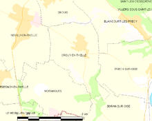
Map of the commune
Cruoy-en-Thelle's average elevation is 120 metres (390 ft) above sea level. It spans across approximately 5.87 square kilometres (2.27 sq mi). The town is surrounded by Ercuis, Blaincourt-lès-Précy, Morangles, Neuilly-en-Thelle, and Presy-sur-Oise.[4]
See also
References
- "Populations légales 2017". INSEE. Retrieved 6 January 2020.
- "Commune de Crouy-en-Thelle (60185)". INSEE. Retrieved 2020-05-12.
- "CROUY-EN-THELLE - Map of Crouy-en-Thelle 60530 France". www.map-france.com. Retrieved 2017-12-16.
- "CROUY-EN-THELLE - Carte plan hotel village de Crouy-en-Thelle 60530 - Cartes France.fr". www.cartesfrance.fr (in French). Retrieved 2017-12-16.
| Wikimedia Commons has media related to Crouy-en-Thelle. |
| Authority control |
|
|---|
This article is issued from Wikipedia. The text is licensed under Creative Commons - Attribution - Sharealike. Additional terms may apply for the media files.