Mansfield Township, Warren County, New Jersey
Mansfield Township is a township in Warren County, New Jersey, United States. As of the 2010 United States Census, the township's population was 7,725,[9][10][11] reflecting an increase of 1,072 (+16.1%) from the 6,653 counted in the 2000 Census, which had in turn declined by 501 (-7.0%) from the 7,154 counted in the 1990 Census.[19] The township is part of the eastern region of the Lehigh Valley.
Mansfield Township, New Jersey | |
|---|---|
| Township of Mansfield | |
 Perry-Petty Farmstead | |
 Map of Mansfield Township in Warren County. Inset: Location of Warren County highlighted in the State of New Jersey. | |
 Census Bureau map of Mansfield Township, Warren County, New Jersey | |
| Coordinates: 40.808466°N 74.91023°W[1][2] | |
| Country | |
| State | |
| County | Warren |
| Formed | May 30, 1754, as Mansfield-Woodhouse Township |
| Incorporated | February 21, 1798 |
| Named for | William Murray, 1st Earl of Mansfield[3] |
| Government | |
| • Type | Township |
| • Body | Township Committee |
| • Mayor | Joseph Watters (R, term ends December 31, 2020)[5][6] |
| • Municipal clerk | Dena Hrebenak[7] |
| Area | |
| • Total | 29.928 sq mi (77.514 km2) |
| • Land | 29.815 sq mi (77.221 km2) |
| • Water | 0.113 sq mi (0.293 km2) 0.38% |
| Area rank | 91st of 566 in state 3rd of 22 in county[1] |
| Elevation | 820 ft (250 m) |
| Population | |
| • Total | 7,725 |
| • Estimate (2019)[12] | 7,361 |
| • Rank | 295th of 566 in state 4th of 22 in county[13] |
| • Density | 259.1/sq mi (100.0/km2) |
| • Density rank | 488th of 566 in state 11th of 22 in county[13] |
| Time zone | UTC−05:00 (Eastern (EST)) |
| • Summer (DST) | UTC−04:00 (Eastern (EDT)) |
| ZIP Code | 07865 - Port Murray[14] |
| Area code(s) | 908[15] |
| FIPS code | 3404143320[1][16][17] |
| GNIS feature ID | 0882249[18] |
| Website | www |
What is now Mansfield Township was formed on May 30, 1754, as Mansfield-Woodhouse Township from portions of Greenwich Township, while the area was still part of Sussex County, and was incorporated as Mansfield Township on February 21, 1798, as one of New Jersey's initial group of 104 townships by an act of the New Jersey Legislature. The township became part of the newly formed Warren County on November 20, 1824. Portions of the township were taken to form Franklin Township (April 8, 1839) and Washington Township (April 9, 1849).[20] The township was named after William Murray, 1st Earl of Mansfield.[3]
Geography
According to the United States Census Bureau, the township had a total area of 29.928 square miles (77.514 km2), including 29.815 square miles (77.221 km2) of land and 0.113 square mile (0.293 km2) of water (0.38%).[1][2]
Anderson (with a 2010 Census population of 342[21]), Beattystown (4,554[22]) and Port Murray (129[23]) are unincorporated communities and census-designated places (CDPs) located within the township.[24][25][26]
Other unincorporated communities, localities and place names located partially or completely within the township include Karrsville, Mount Bethel, Penwell, Rockport and Stephensburg.[27]
The township borders the municipalities of Hackettstown, Independence Township, Liberty Township, Oxford Township and Washington Township in Warren County; Lebanon Township in Hunterdon County; and Washington Township in Morris County.[28][29]
Demographics
| Historical population | |||
|---|---|---|---|
| Census | Pop. | %± | |
| 1810 | 2,058 | — | |
| 1820 | 2,787 | 35.4% | |
| 1830 | 3,310 | 18.8% | |
| 1840 | 3,057 | * | −7.6% |
| 1850 | 1,615 | * | −47.2% |
| 1860 | 1,688 | 4.5% | |
| 1870 | 1,997 | 18.3% | |
| 1880 | 1,709 | −14.4% | |
| 1890 | 1,362 | −20.3% | |
| 1900 | 1,324 | −2.8% | |
| 1910 | 1,238 | −6.5% | |
| 1920 | 1,133 | −8.5% | |
| 1930 | 1,139 | 0.5% | |
| 1940 | 1,254 | 10.1% | |
| 1950 | 1,497 | 19.4% | |
| 1960 | 2,130 | 42.3% | |
| 1970 | 3,546 | 66.5% | |
| 1980 | 5,780 | 63.0% | |
| 1990 | 7,154 | 23.8% | |
| 2000 | 6,653 | −7.0% | |
| 2010 | 7,725 | 16.1% | |
| Est. 2019 | 7,361 | [12][30][31] | −4.7% |
| Population sources: 1810-1920[32] 1840[33] 1850-1870[34] 1850[35] 1870[36] 1880-1890[37] 1890-1910[38] 1910-1930[39] 1930-1990[40] 2000[41][42] 2010[9][10][11] * = Lost territory in previous decade[20] | |||
The Township's economic data (as is all of Warren County) is calculated by the US Census Bureau as part of the Allentown-Bethlehem-Easton, PA-NJ Metropolitan Statistical Area.
Census 2010
The 2010 United States Census counted 7,725 people, 2,972 households, and 2,000.156 families in the township. The population density was 259.1 per square mile (100.0/km2). There were 3,316 housing units at an average density of 111.2 per square mile (42.9/km2). The racial makeup was 86.73% (6,700) White, 4.89% (378) Black or African American, 0.18% (14) Native American, 3.21% (248) Asian, 0.03% (2) Pacific Islander, 3.06% (236) from other races, and 1.90% (147) from two or more races. Hispanic or Latino of any race were 10.94% (845) of the population.[9]
Of the 2,972 households, 31.4% had children under the age of 18; 51.8% were married couples living together; 10.7% had a female householder with no husband present and 32.7% were non-families. Of all households, 25.5% were made up of individuals and 7.7% had someone living alone who was 65 years of age or older. The average household size was 2.54 and the average family size was 3.08.[9]
22.9% of the population were under the age of 18, 7.9% from 18 to 24, 26.8% from 25 to 44, 29.7% from 45 to 64, and 12.8% who were 65 years of age or older. The median age was 40.7 years. For every 100 females, the population had 94.6 males. For every 100 females ages 18 and older there were 93.4 males.[9]
The Census Bureau's 2006-2010 American Community Survey showed that (in 2010 inflation-adjusted dollars) median household income was $74,063 (with a margin of error of +/- $8,316) and the median family income was $87,434 (+/- $8,330). Males had a median income of $56,567 (+/- $5,612) versus $41,583 (+/- $1,597) for females. The per capita income for the borough was $32,259 (+/- $2,751). About 5.1% of families and 6.3% of the population were below the poverty line, including 8.3% of those under age 18 and 3.9% of those age 65 or over.[43]
Census 2000
As of the 2000 United States Census[16] there were 6,653 people, 2,334 households, and 1,750 families residing in the township. The population density was 222.3 people per square mile (85.9/km2). There were 2,415 housing units at an average density of 80.7 per square mile (31.2/km2). The racial makeup of the township was 90.91% White, 4.51% African American, 0.24% Native American, 1.22% Asian, 1.59% from other races, and 1.53% from two or more races. Hispanic or Latino of any race were 4.37% of the population.[41][42]
There were 2,334 households, out of which 39.0% had children under the age of 18 living with them, 61.3% were married couples living together, 9.0% had a female householder with no husband present, and 25.0% were non-families. 18.9% of all households were made up of individuals, and 6.3% had someone living alone who was 65 years of age or older. The average household size was 2.76 and the average family size was 3.18.[41][42]
In the township the population was spread out, with 27.0% under the age of 18, 6.2% from 18 to 24, 32.4% from 25 to 44, 22.7% from 45 to 64, and 11.7% who were 65 years of age or older. The median age was 37 years. For every 100 females, there were 94.8 males. For every 100 females age 18 and over, there were 91.2 males.[41][42]
The median income for a household in the township was $61,763, and the median income for a family was $76,102. Males had a median income of $50,295 versus $35,737 for females. The per capita income for the township was $26,277. About 2.7% of families and 3.9% of the population were below the poverty line, including 3.9% of those under age 18 and 5.9% of those age 65 or over.[41][42]
Government
Local government
Mansfield Township is governed under the Township form of New Jersey municipal government, one of 141 of 565 municipalities statewide that use this form, the second-most commonly used form of government in the state.[44] The Township Committee has five members, who are elected directly by the voters at-large in partisan elections to serve three-year terms of office on a staggered basis, with either one or two seats coming up for election each year as part of the November general election in a three-year cycle.[4][45] At an annual reorganization meeting conducted during the first week of January, the Township Committee selects one of its members to serve as Mayor and another to serve as Deputy Mayor.
As of 2020, members of the Mansfield Township Committee are Mayor Joseph Watters (R, term on committee ends December 31, 2021; term as mayor ends 2020), Deputy mayor Ron Hayes (R, term on committee and as deputy mayor ends 2020), Desiree Mora Dillon (R, 2022) and Joseph Farino (R, 2020), with one seat vacant.[5][46][47][48][49][50]
In January 2020, Tony Cardell, who had been elected as a Republican in November 2019, announced that he would not be taking office for the seat expiring in December 2022.[51]
Federal, state and county representation
Mansfield Township is located in the 5th Congressional District[52] and is part of New Jersey's 23rd state legislative district.[10][53][54]
For the 116th United States Congress, New Jersey's Fifth Congressional District is represented by Josh Gottheimer (D, Wyckoff).[55][56] New Jersey is represented in the United States Senate by Democrats Cory Booker (Newark, term ends 2021)[57] and Bob Menendez (Paramus, term ends 2025).[58][59]
For the 2018–2019 session (Senate, General Assembly), the 23rd Legislative District of the New Jersey Legislature is represented in the State Senate by Michael J. Doherty (R, Washington Township, Warren County) and in the General Assembly by John DiMaio (R, Hackettstown) and Erik Peterson (R, Franklin Township, Hunterdon County).[60][61]
Warren County is governed by a Board of Chosen Freeholders whose three members are chosen at-large on a staggered basis in partisan elections with one seat coming up for election each year as part of the November general election. At an annual reorganization meeting held in the beginning of January, the board selects one of its members to serve as Freeholder Director and other as Deputy Director. As of 2014, Warren County's Freeholders are Freeholder Director Edward J. Smith (R, Asbury / Franklin Township, 2015), Freeholder Deputy Director Richard D. Gardner (R, Asbury / Franklin Township, 2014) and Freeholder Jason Sarnoski (R, Lopatcong Township, 2016).[62] Constitutional officers elected on a countywide basis are County Clerk Patricia J. Kolb (Blairstown Township),[63] Sheriff David Gallant (Blairstown Township) and Surrogate Kevin O'Neill (Hackettstown).[64][65] The County Administrator, Steve Marvin, is responsible for overseeing the day-to-day operation of the county and its departments.[66]
Politics
As of March 23, 2011, there were a total of 4,443 registered voters in Mansfield Township, of which 779 (17.5% vs. 21.5% countywide) were registered as Democrats, 1,784 (40.2% vs. 35.3%) were registered as Republicans and 1,877 (42.2% vs. 43.1%) were registered as Unaffiliated. There were three voters registered to other parties.[67] Among the township's 2010 Census population, 57.5% (vs. 62.3% in Warren County) were registered to vote, including 74.6% of those ages 18 and over (vs. 81.5% countywide).[67][68]
In the 2012 presidential election, Republican Mitt Romney received 1,789 votes (57.6% vs. 56.0% countywide), ahead of Democrat Barack Obama with 1,232 votes (39.7% vs. 40.8%) and other candidates with 45 votes (1.4% vs. 1.7%), among the 3,105 ballots cast by the township's 4,596 registered voters, for a turnout of 67.6% (vs. 66.7% in Warren County).[69][70] In the 2008 presidential election, Republican John McCain received 1,925 votes (57.5% vs. 55.2% countywide), ahead of Democrat Barack Obama with 1,328 votes (39.7% vs. 41.4%) and other candidates with 50 votes (1.5% vs. 1.6%), among the 3,349 ballots cast by the township's 4,504 registered voters, for a turnout of 74.4% (vs. 73.4% in Warren County).[71] In the 2004 presidential election, Republican George W. Bush received 2,043 votes (64.6% vs. 61.0% countywide), ahead of Democrat John Kerry with 1,076 votes (34.0% vs. 37.2%) and other candidates with 34 votes (1.1% vs. 1.3%), among the 3,163 ballots cast by the township's 4,227 registered voters, for a turnout of 74.8% (vs. 76.3% in the whole county).[72]
In the 2013 gubernatorial election, Republican Chris Christie received 74.1% of the vote (1,251 cast), ahead of Democrat Barbara Buono with 23.7% (401 votes), and other candidates with 2.2% (37 votes), among the 1,715 ballots cast by the township's 4,683 registered voters (26 ballots were spoiled), for a turnout of 36.6%.[73][74] In the 2009 gubernatorial election, Republican Chris Christie received 1,415 votes (66.5% vs. 61.3% countywide), ahead of Democrat Jon Corzine with 482 votes (22.6% vs. 25.7%), Independent Chris Daggett with 171 votes (8.0% vs. 9.8%) and other candidates with 29 votes (1.4% vs. 1.5%), among the 2,129 ballots cast by the township's 4,360 registered voters, yielding a 48.8% turnout (vs. 49.6% in the county).[75]
Education
Students in public school for pre-kindergarten through sixth grade are served by the Mansfield Township School District at Mansfield Township Elementary School.[76] As of the 2018–19 school year, the district, comprised of one school, had an enrollment of 607 students and 56.8 classroom teachers (on an FTE basis), for a student–teacher ratio of 10.7:1.[77]
Public school students in seventh through twelfth grades attend the schools of the Warren Hills Regional School District, which also serves students from the municipalities of Franklin Township, Washington Borough and Washington Township, along with those from Oxford Township (for 9-12 only, attending on a tuition basis).[78][79][80] Schools in the district (with 2018–19 enrollment data from the National Center for Education Statistics[81]) are Warren Hills Regional Middle School[82] with 542 students in grades 7 and 8 (located in Washington Borough) and Warren Hills Regional High School[83] with 1,205 students in grades 9 - 12 (located in Washington Township).[84][85] Seats on the high school district's nine-member board of education are allocated to based on the population of the constituent municipalities, with three seats assigned to Mansfield Township.[86][87]
Students from the township and from all of Warren County are eligible to attend Ridge and Valley Charter School in Frelinghuysen Township (for grades K-8)[88] or Warren County Technical School in Washington borough (for 9-12),[89] with special education services provided by local districts supplemented throughout the county by the Warren County Special Services School District in Oxford Township (for PreK-12).[84][90]
Transportation
_and_Tunnel_Hill_Road_in_Mansfield_Township%2C_Warren_County%2C_New_Jersey.jpg)
Roads and highways
As of May 2010, the township had a total of 72.40 miles (116.52 km) of roadways, of which 46.85 miles (75.40 km) were maintained by the municipality, 16.79 miles (27.02 km) by Warren County and 8.76 miles (14.10 km) by the New Jersey Department of Transportation.[91]
The only major roads that pass through are Route 31 which passes through briefly in the west, and Route 57 in the southern part.
No limited access roads traverse through. However, they are accessible two towns over such as Interstate 78 (in Franklin, Union, Clinton and Tewksbury townships) and Interstate 80 (in Knowlton, Hope, Allamuchy and Mount Olive townships).
Public transportation
A small general aviation airport, named Hackettstown Airport and holding the official database designation of (FAA LID: N05) is in Mansfield Township, only a few hundred yards from the municipal border with Hackettstown proper.[92]
Rail service is provided into Hackettstown by NJ Transit over Norfolk Southern's Washington Secondary line which, in the Rockport section of Mansfield Township, passes the location of the Rockport Wreck, a train accident that occurred on June 16, 1925, that resulted in 50 fatalities.[93]
Notable people
People who were born in, residents of, or otherwise closely associated with Mansfield Township include:
- Michael Weiner (1961-2013), attorney who served as the fifth executive director of the Major League Baseball Players Association.[94]
References
- 2010 Census Gazetteer Files: New Jersey County Subdivisions, United States Census Bureau. Accessed May 21, 2015.
- US Gazetteer files: 2010, 2000, and 1990, United States Census Bureau. Accessed September 4, 2014.
- Snell, James P. History of Sussex and Warren Counties, New Jersey, With Illustrations and Biographical Sketches of its Prominent Men and Pioneers, p. 726. Everts & Peck, 1881. Accessed September 4, 2015. "The township was formed out of Greenwich in 1754. It received its name in honor of Lord Mansfield, of London, who was a prominent jurist on the Queen's Bench at that time."
- 2012 New Jersey Legislative District Data Book, Rutgers University Edward J. Bloustein School of Planning and Public Policy, March 2013, p. 103.
- Municipal Government, Mansfield Township. Accessed February 26, 2020. "The governing body of Mansfield Township is composed of five committee members, each elected to a three-year term. The committee chooses a mayor from among its members annually."
- 2020 New Jersey Mayors Directory, New Jersey Department of Community Affairs. Accessed February 1, 2020. As of date accessed, Watters is listed with a term-end year of 2021, which is the end of his three-year committee term, not his one-year mayoral term.
- Township Clerk, Township of Mansfield. Accessed February 26, 2020.
- U.S. Geological Survey Geographic Names Information System: Township of Mansfield, Geographic Names Information System. Accessed March 7, 2013.
- DP-1 - Profile of General Population and Housing Characteristics: 2010 for Mansfield township, Warren County, New Jersey Archived 2020-02-12 at Archive.today, United States Census Bureau. Accessed June 10, 2013.
- Municipalities Sorted by 2011-2020 Legislative District, New Jersey Department of State. Accessed February 1, 2020.
- Profile of General Demographic Characteristics: 2010 for Mansfield township, New Jersey Department of Labor and Workforce Development. Accessed June 10, 2013.
- QuickFacts for Mansfield township, Warren County, New Jersey; Warren County, New Jersey; New Jersey from Population estimates, July 1, 2019, (V2019), United States Census Bureau. Accessed May 21, 2020.
- GCT-PH1 Population, Housing Units, Area, and Density: 2010 - State -- County Subdivision from the 2010 Census Summary File 1 for New Jersey Archived 2020-02-12 at Archive.today, United States Census Bureau. Accessed June 10, 2013.
- Look Up a ZIP Code for Port Murray, NJ, United States Postal Service. Accessed June 10, 2013.
- Area Code Lookup - NPA NXX for Mansfield, NJ, Area-Codes.com. Accessed September 30, 2014.
- U.S. Census website , United States Census Bureau. Accessed September 4, 2014.
- Geographic codes for New Jersey, Missouri Census Data Center. Accessed September 1, 2019.
- US Board on Geographic Names, United States Geological Survey. Accessed September 4, 2014.
- Table 7. Population for the Counties and Municipalities in New Jersey: 1990, 2000 and 2010, New Jersey Department of Labor and Workforce Development, February 2011. Accessed June 10, 2013.
- Snyder, John P. The Story of New Jersey's Civil Boundaries: 1606-1968, Bureau of Geology and Topography; Trenton, New Jersey; 1969. p. 247. Accessed June 10, 2013.
- DP-1 - Profile of General Population and Housing Characteristics: 2010 Demographic Profile Data for Anderson CDP, New Jersey Archived 2020-02-12 at Archive.today, United States Census Bureau. Accessed June 10, 2013.
- DP-1 - Profile of General Population and Housing Characteristics: 2010 Demographic Profile Data for Beattystown CDP, New Jersey Archived 2020-02-12 at Archive.today, United States Census Bureau. Accessed June 10, 2013.
- DP-1 - Profile of General Population and Housing Characteristics: 2010 Demographic Profile Data for Port Murray CDP, New Jersey Archived 2020-02-12 at Archive.today, United States Census Bureau. Accessed June 10, 2013.
- GCT-PH1 - Population, Housing Units, Area, and Density: 2010 - County -- County Subdivision and Place from the 2010 Census Summary File 1 for Warren County, New Jersey Archived 2020-02-12 at Archive.today, United States Census Bureau. Accessed June 10, 2013.
- 2006-2010 American Community Survey Geography for New Jersey, United States Census Bureau. Accessed June 10, 2013.
- New Jersey: 2010 - Population and Housing Unit Counts - 2010 Census of Population and Housing (CPH-2-32), United States Census Bureau, p. III-5, August 2012. Accessed June 10, 2013.
- Locality Search, State of New Jersey. Accessed April 5, 2015.
- Municipal Directory, Warren County, New Jersey. Accessed February 26, 2020.
- New Jersey Municipal Boundaries, New Jersey Department of Transportation. Accessed November 15, 2019.
- Annual Estimates of the Resident Population for Minor Civil Divisions in New Jersey: April 1, 2010 to July 1, 2019, United States Census Bureau. Accessed May 21, 2020.
- Census Estimates for New Jersey April 1, 2010 to July 1, 2019, United States Census Bureau. Accessed May 21, 2020.
- Compendium of censuses 1726-1905: together with the tabulated returns of 1905, New Jersey Department of State, 1906. Accessed June 10, 2013.
- Bowen, Francis. American Almanac and Repository of Useful Knowledge for the Year 1843, p. 231, David H. Williams, 1842. Accessed June 10, 2013.
- Raum, John O. The History of New Jersey: From Its Earliest Settlement to the Present Time, Volume 1, p. 272, J. E. Potter and company, 1877. Accessed June 10, 2013. "Mansfield contained in 1850, 1,615 inhabitants; in 1860, 1,688; and in 1870, 1,997."
- Debow, James Dunwoody Brownson. The Seventh Census of the United States: 1850, p. 141. R. Armstrong, 1853. Accessed June 10, 2013.
- Staff. A compendium of the ninth census, 1870, p. 260. United States Census Bureau, 1872. Accessed June 10, 2013.
- Porter, Robert Percival. Preliminary Results as Contained in the Eleventh Census Bulletins: Volume III - 51 to 75, p. 100. United States Census Bureau, 1890. Accessed June 10, 2013.
- Thirteenth Census of the United States, 1910: Population by Counties and Minor Civil Divisions, 1910, 1900, 1890, United States Census Bureau, p. 339. Accessed June 10, 2013.
- Fifteenth Census of the United States : 1930 - Population Volume I, United States Census Bureau, p. 719. Accessed June 10, 2013.
- Table 6. New Jersey Resident Population by Municipality: 1930 - 1990, New Jersey Department of Labor and Workforce Development. Accessed June 28, 2015.
- Census 2000 Profiles of Demographic / Social / Economic / Housing Characteristics for Mansfield township, New Jersey Archived 2004-01-13 at the Wayback Machine, United States Census Bureau. Accessed June 10, 2013.
- DP-1: Profile of General Demographic Characteristics: 2000 - Census 2000 Summary File 1 (SF 1) 100-Percent Data for Mansfield township, Warren County, New Jersey Archived 2020-02-12 at Archive.today, United States Census Bureau. Accessed June 10, 2013.
- DP03: Selected Economic Characteristics from the 2006-2010 American Community Survey 5-Year Estimates for Mansfield township, Warren County, New Jersey Archived 2020-02-12 at Archive.today, United States Census Bureau. Accessed June 10, 2013.
- Inventory of Municipal Forms of Government in New Jersey, Rutgers University Center for Government Studies, July 1, 2011. Accessed November 18, 2019.
- "Forms of Municipal Government in New Jersey", p. 7. Rutgers University Center for Government Studies. Accessed June 3, 2015.
- 2019 Municipal Data Sheet, Mansfield Township. Accessed February 26, 2020.
- 2019 Official Directory Warren County, New Jersey, Warren County, New Jersey. Accessed February 26, 2020.
- General Election November 5, 2019, Warren County Official Tally, Warren County, New Jersey, updated November 12, 2019. Accessed January 1, 2020.
- General Election November 6, 2018, Warren County Official Tally, Warren County, New Jersey, updated November 11, 2018. Accessed January 1, 2019.
- General Election November 7, 2017, Warren County Official Tally, Warren County, New Jersey, updated November 14, 2017. Accessed January 1, 2018.
- Reorganization Meeting Minutes for January 1, 2020, Township of Mansfield. Accessed February 26, 2020. "Ms. Hrebenak stated that a letter of resignation was received from Mr. Tony Cardell, this causes a vacancy on the Township Committee and will be referred to the Municipal County Committee."
- Plan Components Report, New Jersey Redistricting Commission, December 23, 2011. Accessed February 1, 2020.
- 2019 New Jersey Citizen's Guide to Government, New Jersey League of Women Voters. Accessed October 30, 2019.
- Districts by Number for 2011-2020, New Jersey Legislature. Accessed January 6, 2013.
- Directory of Representatives: New Jersey, United States House of Representatives. Accessed January 3, 2019.
- Biography, Congressman Josh Gottheimer. Accessed January 3, 2019. "Josh now lives in Wyckoff, New Jersey with Marla, his wife who was a federal prosecutor, and their two young children, Ellie and Ben."
- About Cory Booker, United States Senate. Accessed January 26, 2015. "He now owns a home and lives in Newark's Central Ward community."
- Biography of Bob Menendez, United States Senate, January 26, 2015. "He currently lives in Paramus and has two children, Alicia and Robert."
- Senators of the 116th Congress from New Jersey. United States Senate. Accessed April 17, 2019. "Booker, Cory A. - (D - NJ) Class II; Menendez, Robert - (D - NJ) Class I"
- Legislative Roster 2018-2019 Session, New Jersey Legislature. Accessed January 22, 2018.
- District 23 Legislators, New Jersey Legislature. Accessed January 22, 2018.
- Board of Chosen Freeholders, Warren County, New Jersey. Accessed September 15, 2014.
- County Clerk's Office, Warren County, New Jersey. Accessed September 15, 2014.
- Message from Surrogate, Warren County, New Jersey. Accessed September 15, 2014.
- Constitutional Officers, Warren County, New Jersey. Accessed September 15, 2014.
- 2013 Official Directory, Warren County, New Jersey. Accessed September 15, 2014.
- Voter Registration Summary - Warren, New Jersey Department of State Division of Elections, March 23, 2011. Accessed June 10, 2013.
- GCT-P7: Selected Age Groups: 2010 - State -- County Subdivision; 2010 Census Summary File 1 for New Jersey Archived 2020-02-12 at Archive.today, United States Census Bureau. Accessed June 10, 2013.
- Presidential November 6, 2012 General Election Results - Warren County Archived January 18, 2014, at the Wayback Machine, New Jersey Department of State Division of Elections, March 15, 2013. Accessed June 10, 2013.
- Number of Registered Voters and Ballots Cast November 6, 2012 General Election Results - Warren County Archived January 18, 2014, at the Wayback Machine, New Jersey Department of State Division of Elections, March 15, 2013. Accessed June 10, 2013.
- 2008 Presidential General Election Results: Warren County, New Jersey Department of State Division of Elections, December 23, 2008. Accessed June 10, 2013.
- 2004 Presidential Election: Warren County, New Jersey Department of State Division of Elections, December 13, 2004. Accessed June 10, 2013.
- "Governor - Warren County" (PDF). New Jersey Department of Elections. January 29, 2014. Retrieved December 24, 2014.
- "Number of Registered Voters and Ballots Cast - November 5, 2013 - General Election Results - Warren County" (PDF). New Jersey Department of Elections. January 29, 2014. Retrieved December 24, 2014.
- 2009 Governor: Warren County Archived 2012-10-17 at the Wayback Machine, New Jersey Department of State Division of Elections, December 31, 2009. Accessed June 10, 2013.
- 2019-2020 Public School Directory, Warren County, New Jersey. Accessed June 6, 2020.
- District information for Mansfield Township Elementary School District, National Center for Education Statistics. Accessed April 1, 2020.
- Warren Hills Regional Board of Education District Policy 0110 - Identification, Warren Hills Regional School District. Accessed June 6, 2020. "Purpose: The Board of Education exists for the purpose of providing a thorough and efficient system of free public education in grades 7 through 12 in the Warren Hills Regional School District. Composition: The Warren Hills Regional School District is comprised of all the area within the municipal boundaries of Franklin Township, Mansfield Township, Washington Borough, Washington Township in the County of Warren."
- Warren Hills Regional School District 2014 Report Card Narrative, New Jersey Department of Education. Accessed June 6, 2020. "At Warren Hills Regional, we provide our students with a strong academic foundation. From the receiving districts of Franklin Township, Mansfield Township, Oxford (high school tuition students), Washington Borough and Washington Township, students progress along the academic continuum led by a faculty committed to planning and implementing a variety of instructional strategies and activities that facilitate the preparation of our students for the challenge of mastering the New Jersey Core Curriculum Content Standards and the Common Core State Standards."
- Our History, Warren Hills Regional School District. Accessed June 6, 2020. "The Warren Hills Regional School District services students from Franklin Township, Mansfield Township, Washington Borough and Washington Township. Oxford Township currently sends its high school students to the Warren Hills Regional High School on a tuition basis."
- Warren Hills Regional School District, National Center for Education Statistics. Accessed April 1, 2020.
- Warren Hills Regional Middle School, Warren Hills Regional School District. Accessed June 6, 2020.
- Warren Hills Regional High School, Warren Hills Regional School District. Accessed June 6, 2020.
- Municipal Guide to Public School Districts, Warren County, New Jersey. Accessed January 5, 2017.
- New Jersey School Directory for the Warren Hills Regional School District, New Jersey Department of Education. Accessed December 29, 2016.
- Warren Hills Regional Board of Education District Policy 0141 - Board Member Number and Term, Warren Hills Regional School District. Accessed June 6, 2020. "The Board of Education shall consist of nine [9] members as follows: Franklin Township - 1 member; Mansfield Township - 3 members; Washington Borough - 2 members; Washington Township - 3 members. The term of a Board member shall be three [3] years."
- Warren Hills Regional Board of Education, Warren Hills Regional School District. Accessed June 6, 2020.
- F.A.Q., Ridge and Valley Charter School. Accessed January 5, 2017. "Enrollment is open, on a space available basis, to all K-8 students residing in N.J. with priority given to students residing in the districts of Blairstown, Hardwick, Knowlton, Frelinghuysen, and North Warren Regional School."
- About Us Archived 2013-09-27 at the Wayback Machine, Warren County Technical School. Accessed September 12, 2013.
- About Archived 2013-09-27 at the Wayback Machine, Warren County Special Services School District. Accessed September 12, 2013.
- Warren County Mileage by Municipality and Jurisdiction, New Jersey Department of Transportation, May 2010. Accessed July 18, 2014.
- Staff. "FOUR PEOPLE INJURED IN SMALL-PLANE CRASH MANSFIELD TWP. - WARREN COUNTY", The Morning Call, August 4, 1998. Accessed June 10, 2013 ."Four New Jersey residents were injured Sunday afternoon when their small plane crashed shortly after takeoff at Hackettstown Airport in Mansfield Township in eastern Warren County."
- Staff. "Mansfield Township was the scene of one of the worst railroad disasters 85 years ago", The Express-Times, June 16, 2010. Accessed June 10, 2013. "Eight-five years ago today, a stretch of the Lackawanna Railway in Mansfield Township became the scene of one of the worst railway disasters in the nation's history. On June 16, 1925, 50 people died when a Hoboken-bound steam locomotive derailed near the Rockport Pheasant Farm when the front wheels hit debris from a heavy rain storm and jumped the track at approximately 3 a.m."
- McCullough, Andy. "Michael Weiner, battling inoperable brain tumor, continues to draw people together", The Star-Ledger, January 6, 2013. Accessed May 3, 2015. "From childhood to college, law school to labor relations, his role as executive director of the MLB Players Association to his home in Mansfield Township, Michael Weiner drew people together."
External links
| Wikimedia Commons has media related to Mansfield Township, Warren County, New Jersey. |
- Mansfield Township website
- Warren County page for Mansfield Township
- Mansfield Township School District
- Mansfield Township School District's 2015–16 School Report Card from the New Jersey Department of Education
- School Data for the Mansfield Township School District, National Center for Education Statistics
- Warren Hills Regional School District
Municipalities and communities of Warren County, New Jersey, United States | ||
|---|---|---|
| Boroughs | 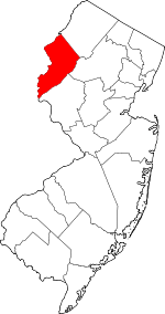 Map of New Jersey highlighting Warren County | |
| Towns | ||
| Townships | ||
| CDPs |
| |
| Other unincorporated communities | ||
Places adjacent to Mansfield Township, Warren County, New Jersey | |
|---|---|