Pohatcong Township, New Jersey
Pohatcong Township is a township in Warren County, New Jersey, United States.[17] As of the 2010 United States Census, the township's population was 3,339,[7][8][9] reflecting a decline of 77 (-2.3%) from the 3,416 counted in the 2000 Census, which had in turn declined by 175 (-4.9%) from the 3,591 counted in the 1990 Census.[18] The name Pohatcong is said to be from the Lenni Lenape Native American term meaning "stream between split hills".[19]
Pohatcong Township, New Jersey | |
|---|---|
| Township of Pohatcong | |
.jpg) Savannah Sparrow near Carpentersville | |
 Map of Pohatcong Township in Warren County. Inset: Location of Warren County highlighted in the State of New Jersey. | |
 Census Bureau map of Pohatcong Township, New Jersey. | |
| Coordinates: 40.636483°N 75.174906°W[1] | |
| Country | |
| State | |
| County | Warren |
| Incorporated | January 1, 1882 |
| Government | |
| • Type | Faulkner Act |
| • Body | Township Council |
| • Mayor | David S. Slack (term ends December 31, 2023)[3][4] |
| • Municipal clerk | Wanda L. Kutzman[5] |
| Area | |
| • Total | 13.712 sq mi (35.514 km2) |
| • Land | 13.355 sq mi (34.590 km2) |
| • Water | 0.357 sq mi (0.924 km2) 2.60% |
| Area rank | 179th of 566 in state 13th of 22 in county[1] |
| Elevation | 253 ft (77 m) |
| Population | |
| • Total | 3,339 |
| • Estimate (2019)[10] | 3,175 |
| • Rank | 438th of 566 in state 12th of 22 in county[11] |
| • Density | 250.0/sq mi (96.5/km2) |
| • Density rank | 491st of 566 in state 13th of 22 in county[11] |
| Time zone | UTC−05:00 (Eastern (EST)) |
| • Summer (DST) | UTC−04:00 (Eastern (EDT)) |
| ZIP Code | |
| Area code | 908[14] |
| FIPS code | 34-59820[1][15][16] |
| GNIS feature ID | 882254[1][6] |
| Website | www |
Pohatcong Township was officially established in 1881. On March 24, 1881 Chapter 145 of the Acts of the New Jersey General Assembly was published defining and creating Pohatcong Township. The act to form Pohatcong had been introduced by Assemblyman William Fritts and, once law, was to take effect January 1 of the following year.[20] Pohatcong was incorporated on January 1, 1882.[21] It was divided off of Greenwich Township. Pohatcong township's name comes from Lenape Native Americans, who called the area "split hills stream outlet". The industrialized center of the township was separated to form Alpha borough, on April 27, 1911.[22]
Geography
According to the United States Census Bureau, the township had a total area of 13.712 square miles (35.514 km2), including 13.355 square miles (34.590 km2) of land and 0.357 square miles (0.924 km2) of water (2.60%).[1][23]
Finesville (with a 2010 Census population of 175[24]) and Upper Pohatcong (2010 population of 1,781[25]) are unincorporated communities and census-designated places (CDPs) located within the township.[26][27][28] Other unincorporated communities, localities and place names located partially or completely within the township include Carpentersville, Hughesville, Huntington, Kennedys, Riegelsville, Springtown, Warren and Warren Glen.[29]
Pohatcong Township borders the municipalities of Greenwich Township, Lopatcong Township and Phillipsburg in Warren County; and Bethlehem Township, Bloomsbury and Holland Township in Hunterdon County.[30][31] The borough of Alpha is completely surrounded by Pohatcong Township, making it part of 21 pairs of "doughnut towns" in the state, where one municipality entirely surrounds another.[32]
Demographics
| Historical population | |||
|---|---|---|---|
| Census | Pop. | %± | |
| 1890 | 1,483 | — | |
| 1900 | 2,215 | 49.4% | |
| 1910 | 3,202 | 44.6% | |
| 1920 | 1,559 | * | −51.3% |
| 1930 | 1,974 | 26.6% | |
| 1940 | 2,029 | 2.8% | |
| 1950 | 2,540 | 25.2% | |
| 1960 | 3,543 | 39.5% | |
| 1970 | 3,924 | 10.8% | |
| 1980 | 3,856 | −1.7% | |
| 1990 | 3,591 | −6.9% | |
| 2000 | 3,416 | −4.9% | |
| 2010 | 3,339 | −2.3% | |
| Est. 2019 | 3,175 | [10][33] | −4.9% |
| Population sources: 1890-1920[34] 1890[35] 1890-1910[36] 1910-1930[37] 1930-1990[38] 2000[39][40] 2010[7][8][9] * = Lost territory in previous decade[22] | |||
Census 2010
The 2010 United States Census counted 3,339 people, 1,310 households, and 941.890 families in the township. The population density was 250.0 per square mile (96.5/km2). There were 1,420 housing units at an average density of 106.3 per square mile (41.0/km2). The racial makeup was 95.24% (3,180) White, 1.59% (53) Black or African American, 0.03% (1) Native American, 0.90% (30) Asian, 0.00% (0) Pacific Islander, 0.69% (23) from other races, and 1.56% (52) from two or more races. Hispanic or Latino of any race were 3.47% (116) of the population.[7]
Of the 1,310 households, 29.8% had children under the age of 18; 58.8% were married couples living together; 8.6% had a female householder with no husband present and 28.1% were non-families. Of all households, 23.4% were made up of individuals and 10.8% had someone living alone who was 65 years of age or older. The average household size was 2.55 and the average family size was 3.01.[7]
22.6% of the population were under the age of 18, 6.6% from 18 to 24, 24.3% from 25 to 44, 31.6% from 45 to 64, and 14.9% who were 65 years of age or older. The median age was 42.8 years. For every 100 females, the population had 100.2 males. For every 100 females ages 18 and older there were 97.3 males.[7] The Census Bureau's 2006-2010 American Community Survey showed that (in 2010 inflation-adjusted dollars) median household income was $84,318 (with a margin of error of +/- $14,047) and the median family income was $95,982 (+/- $2,028). Males had a median income of $56,705 (+/- $13,134) versus $35,481 (+/- $1,974) for females. The per capita income for the borough was $34,781 (+/- $7,346). About 3.9% of families and 4.9% of the population were below the poverty line, including 2.2% of those under age 18 and 3.9% of those age 65 or over.[41]
Census 2000
As of the 2000 United States Census[15] there were 3,416 people, 1,341 households, and 989 families residing in the township. The population density was 256.3 people per square mile (98.9/km2). There were 1,411 housing units at an average density of 105.9 per square mile (40.9/km2). The racial makeup of the township was 98.01% White, 0.44% African American, 0.03% Native American, 0.29% Asian, 0.64% from other races, and 0.59% from two or more races. Hispanic or Latino of any race were 2.02% of the population.[39][40]
There were 1,341 households, out of which 30.2% had children under the age of 18 living with them, 62.6% were married couples living together, 8.6% had a female householder with no husband present, and 26.2% were non-families. 22.0% of all households were made up of individuals, and 10.5% had someone living alone who was 65 years of age or older. The average household size was 2.54 and the average family size was 2.99.[39][40]
In the township the population was spread out, with 23.3% under the age of 18, 5.6% from 18 to 24, 30.5% from 25 to 44, 24.6% from 45 to 64, and 16.0% who were 65 years of age or older. The median age was 40 years. For every 100 females, there were 98.3 males. For every 100 females age 18 and over, there were 93.1 males.[39][40]
The median income for a household in the township was $52,188, and the median income for a family was $60,208. Males had a median income of $44,327 versus $32,316 for females. The per capita income for the township was $24,754. About 3.4% of families and 4.3% of the population were below the poverty line, including 5.5% of those under age 18 and 6.2% of those age 65 or over.[39][40]
Economy
The Phillipsburg Mall is located on the border of Pohatcong and Lopatcong Township. 43 acres (17 ha) of the mall is located in Pohatcong, with the portion of the property in the township being assessed for $39.8 million, one of the highest valuations in the municipality.[42]
Government
Local government
Pohatcong Township is governed by the Faulkner Act (Small Municipality) form of government. The Faulkner Act, formally known as the Optional Municipal Charter Law, allows municipalities to adopt a Small Municipality form of government only for municipalities with a population of under 12,000. The government consists of a Mayor and a four-member Township Council, with all positions elected at-large in non-partisan elections. A Mayor is elected directly by the voters to a four-year term of office. Council members serve a term of three years, which are staggered so that either one or two seats come up for election each year as part of the November general election.[2] In May 2011 the township council submitted an ordinance to shift the non-partisan elections from May to November. The shift, which took effect in November 2012, was intended to save the municipality $8,000 a year in costs associated with conducting the election.[43]
As of 2020, the Mayor of Pohatcong Township is David S. Slack, whose term of office expires on December 31, 2023. Members of the Township Council are Council President Kevin J. Melvin (2022), Stephen Babinsky (2021), Ingrid Gray (2020; elected to serve an unexpired term) and John S. Stillo (2022).[3][44][45][46][47][48]
In September 2019, Ingrid Gray was appoimnted to fill the seat expiring in December 2020 that had been held by Anthony S. Vangeli until he left office.[49]
At 22 years of age when he was inaugurated on July 1, 2011, Kern became the youngest municipal executive serving in office in the State of New Jersey.[50][51]
Federal, state and county representation
Pohatcong Township is located in the 7th Congressional District[52] and is part of New Jersey's 23rd state legislative district.[8][53][54] Prior to the 2010 Census, Pohatcong Township had been part of the 5th Congressional District, a change made by the New Jersey Redistricting Commission that took effect in January 2013, based on the results of the November 2012 general elections.[55]
For the 116th United States Congress. New Jersey's Seventh Congressional District is represented by Tom Malinowski (D, Ringoes).[56] New Jersey is represented in the United States Senate by Democrats Cory Booker (Newark, term ends 2021)[57] and Bob Menendez (Paramus, term ends 2025).[58][59]
For the 2018–2019 session (Senate, General Assembly), the 23rd Legislative District of the New Jersey Legislature is represented in the State Senate by Michael J. Doherty (R, Washington Township, Warren County) and in the General Assembly by John DiMaio (R, Hackettstown) and Erik Peterson (R, Franklin Township, Hunterdon County).[60][61]
Warren County is governed by a Board of Chosen Freeholders whose three members are chosen at-large on a staggered basis in partisan elections with one seat coming up for election each year as part of the November general election. At an annual reorganization meeting held in the beginning of January, the board selects one of its members to serve as Freeholder Director and other as Deputy Director. As of 2014, Warren County's Freeholders are Freeholder Director Edward J. Smith (R, Asbury / Franklin Township, 2015), Freeholder Deputy Director Richard D. Gardner (R, Asbury / Franklin Township, 2014) and Freeholder Jason Sarnoski (R, Lopatcong Township, 2016).[62] Constitutional officers elected on a countywide basis are County Clerk Patricia J. Kolb (Blairstown Township),[63] Sheriff David Gallant (Blairstown Township) and Surrogate Kevin O'Neill (Hackettstown).[64][65] The County Administrator, Steve Marvin, is responsible for overseeing the day-to-day operation of the county and its departments.[66]
Politics
As of March 23, 2011, there were a total of 2,162 registered voters in Pohatcong Township, of which 583 (27.0% vs. 21.5% countywide) were registered as Democrats, 595 (27.5% vs. 35.3%) were registered as Republicans and 983 (45.5% vs. 43.1%) were registered as Unaffiliated. There was one voter registered to another party.[67] Among the township's 2010 Census population, 64.7% (vs. 62.3% in Warren County) were registered to vote, including 83.7% of those ages 18 and over (vs. 81.5% countywide).[67][68]
In the 2012 presidential election, Republican Mitt Romney received 802 votes (54.1% vs. 56.0% countywide), ahead of Democrat Barack Obama with 634 votes (42.8% vs. 40.8%) and other candidates with 22 votes (1.5% vs. 1.7%), among the 1,482 ballots cast by the township's 2,158 registered voters, for a turnout of 68.7% (vs. 66.7% in Warren County).[69][70] In the 2008 presidential election, Republican John McCain received 813 votes (51.5% vs. 55.2% countywide), ahead of Democrat Barack Obama with 707 votes (44.8% vs. 41.4%) and other candidates with 24 votes (1.5% vs. 1.6%), among the 1,578 ballots cast by the township's 2,178 registered voters, for a turnout of 72.5% (vs. 73.4% in Warren County).[71] In the 2004 presidential election, Republican George W. Bush received 863 votes (53.8% vs. 61.0% countywide), ahead of Democrat John Kerry with 712 votes (44.4% vs. 37.2%) and other candidates with 23 votes (1.4% vs. 1.3%), among the 1,605 ballots cast by the township's 2,141 registered voters, for a turnout of 75.0% (vs. 76.3% in the whole county).[72]
In the 2013 gubernatorial election, Republican Chris Christie received 69.7% of the vote (688 cast), ahead of Democrat Barbara Buono with 27.9% (275 votes), and other candidates with 2.4% (24 votes), among the 1,001 ballots cast by the township's 2,180 registered voters (14 ballots were spoiled), for a turnout of 45.9%.[73][74] In the 2009 gubernatorial election, Republican Chris Christie received 619 votes (57.9% vs. 61.3% countywide), ahead of Democrat Jon Corzine with 297 votes (27.8% vs. 25.7%), Independent Chris Daggett with 117 votes (10.9% vs. 9.8%) and other candidates with 14 votes (1.3% vs. 1.5%), among the 1,069 ballots cast by the township's 2,115 registered voters, yielding a 50.5% turnout (vs. 49.6% in the county).[75]
Education
The Pohatcong Township School District serves students in pre-kindergarten through eighth grade at Pohatcong Township Elementary School.[76] As of the 2018–19 school year, the district, comprised of one school, had an enrollment of 304 students and 30.3 classroom teachers (on an FTE basis), for a student–teacher ratio of 10.0:1.[77]
Public school students in ninth through twelfth grades attend Phillipsburg High School in Phillipsburg, which serves students from the Town of Phillipsburg as part of a sending/receiving relationship with the Phillipsburg School District. The high school also serves students from four other sending communities: Alpha, Bloomsbury (in Hunterdon County), Greenwich Township and Lopatcong Township.[78][79] As of the 2018–19 school year, the high school had an enrollment of 1,650 students and 126.5 classroom teachers (on an FTE basis), for a student–teacher ratio of 13.0:1.[80]
Students from the township and from all of Warren County are eligible to attend Ridge and Valley Charter School in Frelinghuysen Township (for grades K-8)[81] or Warren County Technical School in Washington borough (for 9-12),[82] with special education services provided by local districts supplemented throughout the county by the Warren County Special Services School District in Oxford Township (for PreK-12).[83][84]
Transportation
Roads and highways
_at_Exit_3_(U.S._Route_22%2C_New_Jersey_State_Route_122%2C_Phillipsburg%2C_Bloomsbury)_in_Pohatcong_Township%2C_Warren_County%2C_New_Jersey.jpg)
As of May 2010, the township had a total of 54.70 miles (88.03 km) of roadways, of which 36.13 miles (58.15 km) were maintained by the municipality, 12.81 miles (20.62 km) by Warren County, 3.20 miles (5.15 km) by the New Jersey Department of Transportation and 2.56 miles (4.12 km) by the Delaware River Joint Toll Bridge Commission.[85]
Interstate 78 is the most significant highway in Pohatcong. It passes through in the central region of the township. U.S. Route 22 runs along the eastern border before running concurrent with I-78. Route 122 passes through the northern portions of the township. The most significant county road in the township is CR 519.
The Riegelsville Bridge is a suspension bridge crossing the Delaware River connecting Pohatcong to Riegelsville, Pennsylvania, that is owned and operated by the Delaware River Joint Toll Bridge Commission.[86] The current bridge on the site opened in 1904.[87]
Public transportation
Trans-Bridge Lines operates the 890 and 891 bus routes, which connect Pohatcong Township with Easton, Pennsylvania.[88]
Rail- the Lehigh Line
The Norfolk Southern Railway's Lehigh Line (formerly the mainline of the Lehigh Valley Railroad), runs through Pohatcong Township on its way to Phillipsburg, New Jersey.
Surrounding communities
Places adjacent to Pohatcong Township, New Jersey | |
|---|---|
Pohatcong completely surrounds Alpha.
Historic sites
The Finesville-Seigletown Historic District was added to the National Register of Historic Places on November 10, 2010.[89]
Wineries
References
- 2010 Census Gazetteer Files: New Jersey County Subdivisions, United States Census Bureau. Accessed May 21, 2015.
- 2012 New Jersey Legislative District Data Book, Rutgers University Edward J. Bloustein School of Planning and Public Policy, March 2013, p. 103.
- Directory, Pohatcong Township. Accessed March 3, 2020.
- 2020 New Jersey Mayors Directory, New Jersey Department of Community Affairs. Accessed February 1, 2020.
- Municipal Clerk, Pohatcong Township. Accessed March 3, 2020.
- "Township of Pohatcong (Warren County, New Jersey)". Geographic Names Information System. United States Geological Survey. Retrieved May 15, 2014.
- DP-1 - Profile of General Population and Housing Characteristics: 2010 for Pohatcong township, Warren County, New Jersey Archived February 12, 2020, at Archive.today, United States Census Bureau. Accessed June 14, 2013.
- Municipalities Sorted by 2011-2020 Legislative District, New Jersey Department of State. Accessed February 1, 2020.
- Profile of General Demographic Characteristics: 2010 for Pohatcong township Archived May 17, 2014, at the Wayback Machine, New Jersey Department of Labor and Workforce Development. Accessed June 14, 2013.
- Annual Estimates of the Resident Population for Minor Civil Divisions in New Jersey: April 1, 2010 to July 1, 2019, United States Census Bureau. Accessed May 21, 2020.
- GCT-PH1 Population, Housing Units, Area, and Density: 2010 - State -- County Subdivision from the 2010 Census Summary File 1 for New Jersey Archived February 12, 2020, at Archive.today, United States Census Bureau. Accessed June 14, 2013.
- Look Up a ZIP Code for Bloomsbury, NJ, United States Postal Service. Accessed June 14, 2013.
- Look Up a ZIP Code for Phillipsburg, NJ, United States Postal Service. Accessed June 14, 2013.
- Area Code Lookup - NPA NXX for Phillipsburg, NJ, Area-Codes.com. Accessed October 20, 2014.
- U.S. Census website , United States Census Bureau. Accessed September 4, 2014.
- Geographic codes for New Jersey, Missouri Census Data Center. Accessed September 1, 2019.
- Lurie, M.N.; Siegel, M.; Mappen, M. (2004). Encyclopedia of New Jersey. Encyclopedia of New Jersey. Rutgers University Press. p. 646. ISBN 978-0-8135-3325-4. Retrieved July 4, 2019.
- Table 7. Population for the Counties and Municipalities in New Jersey: 1990, 2000 and 2010, New Jersey Department of Labor and Workforce Development, February 2011. Accessed June 14, 2013.
- About Archived September 27, 2012, at the Wayback Machine, Pohatcong Township. Accessed June 14, 2013. "Pohatcong Township whose Lenni Lenape name is said to mean 'stream between split hills' is located in the picturesque northwest New Jersey and is in the center of the Highlands Region spanning four states- New Jersey, Pennsylvania, New York and Connecticut."
- Leary, Frank (1981). Pohatcong: The Prologue. Pohatcong Heritage Commission.
- Hutchinson, Viola L. The Origin of New Jersey Place Names, New Jersey Public Library Commission, May 1945. Accessed September 20, 2015.
- Snyder, John P. The Story of New Jersey's Civil Boundaries: 1606-1968, Bureau of Geology and Topography; Trenton, New Jersey; 1969. p. 248. Accessed October 23, 2012.
- US Gazetteer files: 2010, 2000, and 1990, United States Census Bureau. Accessed September 4, 2014.
- DP-1 - Profile of General Population and Housing Characteristics: 2010 Demographic Profile Data for Finesville CDP, New Jersey Archived February 12, 2020, at Archive.today, United States Census Bureau. Accessed June 14, 2013.
- DP-1 - Profile of General Population and Housing Characteristics: 2010 Demographic Profile Data for Upper Pohatcong CDP, New Jersey Archived February 12, 2020, at Archive.today, United States Census Bureau. Accessed June 14, 2013.
- GCT-PH1 - Population, Housing Units, Area, and Density: 2010 - County -- County Subdivision and Place from the 2010 Census Summary File 1 for Warren County, New Jersey Archived February 12, 2020, at Archive.today, United States Census Bureau. Accessed June 14, 2013.
- 2006-2010 American Community Survey Geography for New Jersey, United States Census Bureau. Accessed June 14, 2013.
- New Jersey: 2010 - Population and Housing Unit Counts - 2010 Census of Population and Housing (CPH-2-32), United States Census Bureau, p. III-5, August 2012. Accessed June 14, 2013.
- Locality Search, State of New Jersey. Accessed December 18, 2014.
- Municipal Directory, Warren County, New Jersey. Accessed March 3, 2020.
- New Jersey Municipal Boundaries, New Jersey Department of Transportation. Accessed November 15, 2019.
- DeMarco, Megan. "Voters to decide whether to merge two Princetons into one", The Star-Ledger, November 3, 2011. Accessed January 8, 2017. "There are 22 sets of 'doughnut towns' in New Jersey, those where one town wraps around the other town". Note that following voter approval of the Princeton merger, 21 pairs of "doughnut towns" remain.
- Census Estimates for New Jersey April 1, 2010 to July 1, 2019, United States Census Bureau. Accessed May 21, 2020.
- Compendium of censuses 1726-1905: together with the tabulated returns of 1905, New Jersey Department of State, 1906. Accessed June 14, 2013.
- Porter, Robert Percival. Preliminary Results as Contained in the Eleventh Census Bulletins: Volume III - 51 to 75, p. 100. United States Census Bureau, 1890. Accessed June 14, 2013.
- Thirteenth Census of the United States, 1910: Population by Counties and Minor Civil Divisions, 1910, 1900, 1890, United States Census Bureau, p. 339. Accessed June 14, 2013.
- Fifteenth Census of the United States : 1930 - Population Volume I, United States Census Bureau, p. 719. Accessed June 14, 2013.
- Table 6. New Jersey Resident Population by Municipality: 1930 - 1990, New Jersey Department of Labor and Workforce Development. Accessed June 28, 2015.
- Census 2000 Profiles of Demographic / Social / Economic / Housing Characteristics for Pohatcong township, New Jersey Archived January 14, 2004, at the Wayback Machine, United States Census Bureau. Accessed June 14, 2013.
- DP-1: Profile of General Demographic Characteristics: 2000 - Census 2000 Summary File 1 (SF 1) 100-Percent Data for Pohatcong township, Warren County, New Jersey Archived February 12, 2020, at Archive.today, United States Census Bureau. Accessed June 14, 2013.
- DP03: Selected Economic Characteristics from the 2006-2010 American Community Survey 5-Year Estimates for Pohatcong township, Warren County, New Jersey Archived February 12, 2020, at Archive.today, United States Census Bureau. Accessed June 14, 2013.
- Wojcik, Sarah M. "Phillipsburg Mall appeals tax assessment, setting up battle with Lopatcong and Pohatcong townships", The Express-Times, November 9, 2010. Accessed August 15, 2011. "Lopatcong and Pohatcong townships are uniting to fight a tax appeal filed by the Phillipsburg Mall, one of the largest property owners in the two townships and a source of nearly $2 million in taxes this year.... About 32 acres of the mall property sit in Lopatcong Township, while the remaining 43 acres are part of Pohatcong Township.... In 2009, the Phillipsburg Mall was assessed at about $39.8 million in Pohatcong Township and about $25 million in Lopatcong Township..."
- Wojcik, Sarah M. "Pohatcong Township Council plans to move May elections to November", The Express-Times, May 5, 2011. Accessed June 14, 2013. "Township council voted Tuesday night to introduce an ordinance that would move the nonpartisan government elections from May to November. The move is expected to save the township about $8,000 in costs associated with putting on the May elections."
- 2019 Municipal User Friendly Budget, Pohatcong Township. Accessed March 3, 2020.
- 2019 Official Directory Warren County, New Jersey, Warren County, New Jersey. Accessed March 3, 2020.
- General Election November 5, 2019, Warren County Official Tally, Warren County, New Jersey, updated November 12, 2019. Accessed January 1, 2020.
- General Election November 6, 2018, Warren County Official Tally, Warren County, New Jersey, updated November 11, 2018. Accessed January 1, 2019.
- General Election November 7, 2017, Warren County Official Tally, Warren County, New Jersey, updated November 14, 2017. Accessed January 1, 2018.
- Meeting Minutes for September 17, 2019, Township of Pohatcong. Accessed March 3, 2020. "Motion: (To appoint Ingrid Gray to former Councilman Melvin' vacant seat (term of former Councilman Vangeli) through the November election at which time the winner of the election will be sworn in at the November meeting). Councilwoman Van Lieu moved to appoint Ingrid Gray to Melvin’s vacated seat through The General Election in November, Melvin seconded. The motion carried 3-0 (ayes: Melvin, Van Lieu and Slack, nays: none, absent: Babinsky)."
- Staff. "Twenty-somethings take N.J. political offices by storm", The Star-Ledger, July 15, 2011. Accessed August 15, 2011. "In mid-May, he uprooted wisdom, conventional and otherwise, and beat an experienced incumbent in a non-partisan election to become South Orange village president – and the state's youngest sitting municipal chief executive. He held that distinction for just a few weeks: On July 1, 22-year-old Jim Kern III was sworn in as mayor of Pohatcong, in Warren County."
- Wojcik, Sarah M. "James Kern III is Pohatcong Township's new mayor", The Express-Times, May 10, 2011. Accessed August 15, 2011. "In a landslide victory Tuesday, James Kern III edged out Frank Pagano to become what could be the youngest mayor in New Jersey, according to unofficial election results. Kern, 22, earned 63 percent of the vote while his opponent former township police sergeant Frank Pagano, 47, received only 34 percent.... Councilman Anthony 'Sal' Vangeli, who ran unopposed, was re-elected Tuesday with 73 percent of the vote. Both men will be sworn in during the July 1 reorganization meeting and a person will be selected to fill the remainder of Kern's council term."
- Plan Components Report, New Jersey Redistricting Commission, December 23, 2011. Accessed February 1, 2020.
- 2019 New Jersey Citizen's Guide to Government, New Jersey League of Women Voters. Accessed October 30, 2019.
- Districts by Number for 2011-2020, New Jersey Legislature. Accessed January 6, 2013.
- 2011 New Jersey Citizen's Guide to Government Archived June 4, 2013, at the Wayback Machine, p. 63, New Jersey League of Women Voters. Accessed May 22, 2015.
- Directory of Representatives: New Jersey, United States House of Representatives. Accessed June 1, 2020.
- About Cory Booker, United States Senate. Accessed January 26, 2015. "He now owns a home and lives in Newark's Central Ward community."
- Biography of Bob Menendez, United States Senate, January 26, 2015. "He currently lives in Paramus and has two children, Alicia and Robert."
- Senators of the 116th Congress from New Jersey. United States Senate. Accessed April 17, 2019. "Booker, Cory A. - (D - NJ) Class II; Menendez, Robert - (D - NJ) Class I"
- Legislative Roster 2018-2019 Session, New Jersey Legislature. Accessed January 22, 2018.
- District 23 Legislators, New Jersey Legislature. Accessed January 22, 2018.
- Board of Chosen Freeholders, Warren County, New Jersey. Accessed September 15, 2014.
- County Clerk's Office, Warren County, New Jersey. Accessed September 15, 2014.
- Message from Surrogate, Warren County, New Jersey. Accessed September 15, 2014.
- Constitutional Officers, Warren County, New Jersey. Accessed September 15, 2014.
- 2013 Official Directory, Warren County, New Jersey. Accessed September 15, 2014.
- Voter Registration Summary - Warren, New Jersey Department of State Division of Elections, March 23, 2011. Accessed June 14, 2013.
- GCT-P7: Selected Age Groups: 2010 - State -- County Subdivision; 2010 Census Summary File 1 for New Jersey Archived February 12, 2020, at Archive.today, United States Census Bureau. Accessed June 14, 2013.
- Presidential November 6, 2012 General Election Results - Warren County Archived January 18, 2014, at the Wayback Machine, New Jersey Department of State Division of Elections, March 15, 2013. Accessed June 14, 2013.
- Number of Registered Voters and Ballots Cast November 6, 2012 General Election Results - Warren County Archived January 18, 2014, at the Wayback Machine, New Jersey Department of State Division of Elections, March 15, 2013. Accessed June 14, 2013.
- 2008 Presidential General Election Results: Warren County, New Jersey Department of State Division of Elections, December 23, 2008. Accessed June 14, 2013.
- 2004 Presidential Election: Warren County, New Jersey Department of State Division of Elections, December 13, 2004. Accessed June 14, 2013.
- "Governor - Warren County" (PDF). New Jersey Department of Elections. January 29, 2014. Retrieved December 24, 2014.
- "Number of Registered Voters and Ballots Cast - November 5, 2013 - General Election Results - Warren County" (PDF). New Jersey Department of Elections. January 29, 2014. Retrieved December 24, 2014.
- 2009 Governor: Warren County Archived October 17, 2012, at the Wayback Machine, New Jersey Department of State Division of Elections, December 31, 2009. Accessed June 14, 2013.
- 2019-2020 Public School Directory, Warren County, New Jersey Department of Education. Accessed June 11, 2020.
- District information for Pohatcong Township School District, National Center for Education Statistics. Accessed April 1, 2020.
- Phillipsburg High School 2015 Report Card Narrative, New Jersey Department of Education. Accessed June 11, 2020. "At the secondary level, the district serves not only students from the town of Phillipsburg which makes up 37.6% of the high school population, but also students from the surrounding boroughs of Alpha and Bloomsbury, as well as the townships of Greenwich, Lopatcong, and Pohatcong."
- About PSD, Phillipsburg School District. Accessed June 11, 2020. "The district serves students from the Town of Phillipsburg and five sending communities at the secondary level: Alpha, Bloomsbury, Greenwich, Lopatcong and Pohatcong Townships. Phillipsburg is the largest community in Warren County."
- School data for Phillipsburg High School, National Center for Education Statistics. Accessed April 1, 2020.
- F.A.Q., Ridge and Valley Charter School. Accessed January 17, 2017. "Enrollment is open, on a space available basis, to all K-8 students residing in N.J. with priority given to students residing in the districts of Blairstown, Hardwick, Knowlton, Frelinghuysen, and North Warren Regional School."
- About Us Archived September 27, 2013, at the Wayback Machine, Warren County Technical School. Accessed September 16, 2013.
- Public School Directory 2016-2017, Warren County, New Jersey Department of Education. Accessed October 30, 2017.
- About Archived September 27, 2013, at the Wayback Machine, Warren County Special Services School District. Accessed September 16, 2013.
- Warren County Mileage by Municipality and Jurisdiction, New Jersey Department of Transportation, May 2010. Accessed July 18, 2014.
- Riegelsville Toll Supported Bridge Archived September 28, 2007, at the Wayback Machine, Delaware River Joint Toll Bridge Commission. Accessed June 20, 2013.
- Dale, Frank T., Bridges over the Delaware River: A History of Crossings, p. 103, ff., Rutgers University Press, 2003, ISBN 0-8135-3213-2. Accessed November 14, 2015.
- Novak, Stephen J. "NJ Transit bus service changes in Phillipsburg, Hackettstown will not go into effect with new fares Saturday", The Express-Times, April 30, 2010. Accessed August 15, 2011. "Phillipsburg's Wheels minibus routes, Nos. 890 and 891, will operate under reduced hours starting June 7. The program was initially slated to be cut completely when a transit plan was announced in March.... Phillipsburg's buses are run by Delaware River Coach, a subsidiary of Trans-Bridge Lines."
- Weekly List Of Actions Taken On Properties: 11/08/10 Through 11/12/10, National Register of Historic Places, November 19, 2010. Accessed August 15, 2011.
External links
| Wikimedia Commons has media related to Pohatcong Township, New Jersey. |
- Pohatcong Township Official website
- Warren County page for Pohatcong Township
- Pohatcong Township Elementary School
- Pohatcong Township Elementary School's 2015–16 School Report Card from the New Jersey Department of Education
- School Data for the Pohatcong Township Elementary School, National Center for Education Statistics
- Phillipsburg High School
Municipalities and communities of Warren County, New Jersey, United States | ||
|---|---|---|
| Boroughs | 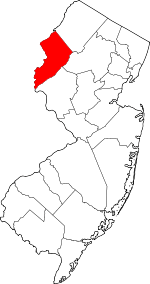 Map of New Jersey highlighting Warren County | |
| Towns | ||
| Townships | ||
| CDPs |
| |
| Other unincorporated communities | ||