List of United States cities by population
The following is a list of the most populous incorporated places of the United States. As defined by the United States Census Bureau, an "incorporated place" includes a variety of designations, including city, town, village, borough, and municipality.[lower-alpha 1] A few exceptional census-designated places (CDPs) are also included in the Census Bureau's listing of incorporated places.[lower-alpha 2] Consolidated city-counties represent a distinct type of government that includes the entire population of a county, or county equivalent. Some consolidated city-counties, however, include multiple incorporated places. This list presents only that portion (or "balance") of such consolidated city-counties that are not a part of another incorporated place.
This list refers only to the population of individual municipalities within their defined limits; the populations of other municipalities considered suburbs of a central city are listed separately, and unincorporated areas within urban agglomerations are not included. Therefore, a different ranking is evident when considering U.S. metropolitan area populations.
50 states and District of Columbia
The following table lists the 317 incorporated places in the United States (excluding the U.S. territories) with a population of at least 100,000 on July 1, 2019, as estimated by the United States Census Bureau. Five states—Delaware, Maine, Vermont, West Virginia and Wyoming—have no cities with populations of 100,000 or more. The table below contains the following information:
- The city rank by population as of July 1, 2019, as estimated by the United States Census Bureau[1]
- The city name[1]
- The name of the state in which the city lies[1]
- The city population as of July 1, 2019, as estimated by the United States Census Bureau[1]
- The city population as of April 1, 2010, as enumerated by the 2010 United States Census[1]
- The city percent population change from April 1, 2010, to July 1, 2019
- The city land area as of January 1, 2016[2]
- The city population density as of July 1, 2016 (residents per unit of land area)[2]
- The city latitude and longitude coordinates[2]
| State capital | |
| State largest city | |
| State capital and largest city | |
| Federal capital |
| 2019 rank |
City | State[lower-alpha 3] | 2019 estimate |
2010 Census |
Change | 2016 land area | 2016 population density | Location | ||
|---|---|---|---|---|---|---|---|---|---|---|
| 1 | New York[lower-alpha 4] | 8,336,817 | 8,175,133 | +1.98% | 301.5 sq mi | 780.9 km2 | 28,317/sq mi | 10,933/km2 | 40.6635°N 73.9387°W | |
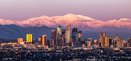
| 2 | Los Angeles | 3,979,576 | 3,792,621 | +4.93% | 468.7 sq mi | 1,213.9 km2 | 8,484/sq mi | 3,276/km2 | 34.0194°N 118.4108°W | |
| 3 | Chicago | 2,693,976 | 2,695,598 | −0.06% | 227.3 sq mi | 588.7 km2 | 11,900/sq mi | 4,600/km2 | 41.8376°N 87.6818°W | |
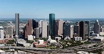
| 4 | Houston[3] | 2,320,268 | 2,100,263 | +10.48% | 637.5 sq mi | 1,651.1 km2 | 3,613/sq mi | 1,395/km2 | 29.7866°N 95.3909°W | |
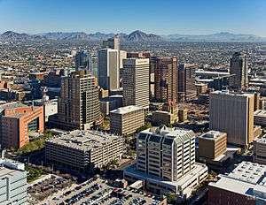
| 5 | Phoenix | 1,680,992 | 1,445,632 | +16.28% | 517.6 sq mi | 1,340.6 km2 | 3,120/sq mi | 1,200/km2 | 33.5722°N 112.0901°W | |
| 6 | Philadelphia[lower-alpha 5] | 1,584,064 | 1,526,006 | +3.80% | 134.2 sq mi | 347.6 km2 | 11,683/sq mi | 4,511/km2 | 40.0094°N 75.1333°W | |
| 7 | San Antonio | 1,547,253 | 1,327,407 | +16.56% | 461.0 sq mi | 1,194.0 km2 | 3,238/sq mi | 1,250/km2 | 29.4724°N 98.5251°W | |
| 8 | San Diego | 1,423,851 | 1,307,402 | +8.91% | 325.2 sq mi | 842.3 km2 | 4,325/sq mi | 1,670/km2 | 32.8153°N 117.1350°W | |
| 9 | Dallas | 1,343,573 | 1,197,816 | +12.17% | 340.9 sq mi | 882.9 km2 | 3,866/sq mi | 1,493/km2 | 32.7933°N 96.7665°W | |
| 10 | San Jose | 1,021,795 | 945,942 | +8.02% | 177.5 sq mi | 459.7 km2 | 5,777/sq mi | 2,231/km2 | 37.2967°N 121.8189°W | |
| 11 | Austin | 978,908 | 790,390 | +23.85% | 312.7 sq mi | 809.9 km2 | 3,031/sq mi | 1,170/km2 | 30.3039°N 97.7544°W | |
| 12 | Jacksonville[lower-alpha 6] | 911,507 | 821,784 | +10.92% | 747.4 sq mi | 1,935.8 km2 | 1,178/sq mi | 455/km2 | 30.3369°N 81.6616°W | |
| 13 | Fort Worth | 909,585 | 741,206 | +22.72% | 342.9 sq mi | 888.1 km2 | 2,491/sq mi | 962/km2 | 32.7815°N 97.3467°W | |
| 14 | Columbus | 898,553 | 787,033 | +14.17% | 218.5 sq mi | 565.9 km2 | 3,936/sq mi | 1,520/km2 | 39.9852°N 82.9848°W | |
| 15 | Charlotte | 885,708 | 731,424 | +21.09% | 305.4 sq mi | 791.0 km2 | 2,757/sq mi | 1,064/km2 | 35.2078°N 80.8310°W | |
| 16 | San Francisco[lower-alpha 7] | 881,549 | 805,235 | +9.48% | 46.9 sq mi | 121.5 km2 | 18,569/sq mi | 7,170/km2 | 37.7272°N 123.0322°W | |
| 17 | Indianapolis[lower-alpha 8] | 876,384 | 820,445 | +6.82% | 361.5 sq mi | 936.3 km2 | 2,366/sq mi | 914/km2 | 39.7767°N 86.1459°W | |
| 18 | Seattle | 753,675 | 608,660 | +23.83% | 83.8 sq mi | 217.0 km2 | 8,405/sq mi | 3,245/km2 | 47.6205°N 122.3509°W | |
| 19 | Denver[lower-alpha 9] | 727,211 | 600,158 | +21.17% | 153.3 sq mi | 397.0 km2 | 4,521/sq mi | 1,746/km2 | 39.7619°N 104.8811°W | |
| 20 | Washington[lower-alpha 10] | 705,749 | 601,723 | +17.29% | 61.1 sq mi | 158.2 km2 | 11,148/sq mi | 4,304/km2 | 38.9041°N 77.0172°W | |
| 21 | Boston | 692,600 | 617,594 | +12.14% | 48.3 sq mi | 125.1 km2 | 13,938/sq mi | 5,381/km2 | 42.3320°N 71.0202°W | |
| 22 | El Paso | 681,728 | 649,121 | +5.02% | 256.8 sq mi | 665.1 km2 | 2,660/sq mi | 1,030/km2 | 31.8484°N 106.4270°W | |
| 23 | Nashville[lower-alpha 11] | 670,820 | 601,222 | +11.58% | 475.9 sq mi | 1,232.6 km2 | 1,388/sq mi | 536/km2 | 36.1718°N 86.7850°W | |
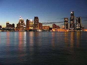
| 24 | Detroit | 670,031 | 713,777 | −6.13% | 138.8 sq mi | 359.5 km2 | 4,847/sq mi | 1,871/km2 | 42.3830°N 83.1022°W | |
| 25 | Oklahoma City | 655,057 | 579,999 | +12.94% | 606.3 sq mi | 1,570.3 km2 | 1,053/sq mi | 407/km2 | 35.4671°N 97.5137°W | |
| 26 | Portland | 654,741 | 583,776 | +12.16% | 133.5 sq mi | 345.8 km2 | 4,793/sq mi | 1,851/km2 | 45.5370°N 122.6500°W | |
| 27 | Las Vegas | 651,319 | 583,756 | +11.57% | 134.4 sq mi | 348.1 km2 | 4,709/sq mi | 1,818/km2 | 36.2292°N 115.2601°W | |
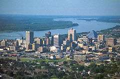
| 28 | Memphis | 651,073 | 646,889 | +0.65% | 317.4 sq mi | 822.1 km2 | 2,056/sq mi | 794/km2 | 35.1028°N 89.9774°W | |
| 29 | Louisville[lower-alpha 12] | 617,638 | 597,337 | +3.40% | 263.5 sq mi | 682.5 km2 | 2,339/sq mi | 903/km2 | 38.1654°N 85.6474°W | |
| 30 | Baltimore[lower-alpha 13] | 593,490 | 620,961 | −4.42% | 80.9 sq mi | 209.5 km2 | 7,598/sq mi | 2,934/km2 | 39.3000°N 76.6105°W | |
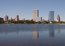
| 31 | Milwaukee | 590,157 | 594,833 | −0.79% | 96.2 sq mi | 249.2 km2 | 6,186/sq mi | 2,388/km2 | 43.0633°N 87.9667°W | |
| 32 | Albuquerque | 560,513 | 545,852 | +2.69% | 188.2 sq mi | 487.4 km2 | 2,972/sq mi | 1,147/km2 | 35.1056°N 106.6474°W | |
| 33 | Tucson | 548,073 | 520,116 | +5.38% | 230.8 sq mi | 597.8 km2 | 2,299/sq mi | 888/km2 | 32.1531°N 110.8706°W | |
| 34 | Fresno | 531,576 | 494,665 | +7.46% | 114.4 sq mi | 296.3 km2 | 4,563/sq mi | 1,762/km2 | 36.7836°N 119.7934°W | |
| 35 | Mesa | 518,012 | 439,041 | +17.99% | 137.9 sq mi | 357.2 km2 | 3,514/sq mi | 1,357/km2 | 33.4019°N 111.7174°W | |
| 36 | Sacramento | 513,624 | 466,488 | +10.10% | 97.9 sq mi | 253.6 km2 | 5,059/sq mi | 1,953/km2 | 38.5666°N 121.4686°W | |
| 37 | Atlanta | 506,811 | 420,003 | +20.67% | 133.5 sq mi | 345.8 km2 | 3,539/sq mi | 1,366/km2 | 33.7629°N 84.4227°W | |
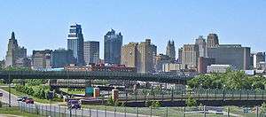
| 38 | Kansas City | 495,327 | 459,787 | +7.73% | 315.0 sq mi | 815.8 km2 | 1,528/sq mi | 590/km2 | 39.1251°N 94.5510°W | |
| 39 | Colorado Springs | 478,221 | 416,427 | +14.84% | 195.6 sq mi | 506.6 km2 | 2,378/sq mi | 918/km2 | 38.8673°N 104.7607°W | |
| 40 | Omaha | 478,192 | 408,958 | +16.93% | 133.2 sq mi | 345.0 km2 | 3,356/sq mi | 1,296/km2 | 41.2644°N 96.0451°W | |
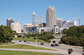
| 41 | Raleigh | 474,069 | 403,892 | +17.38% | 145.1 sq mi | 375.8 km2 | 3,163/sq mi | 1,221/km2 | 35.8306°N 78.6418°W | |
| 42 | Miami | 467,963 | 399,457 | +17.15% | 36.0 sq mi | 93.2 km2 | 12,599/sq mi | 4,865/km2 | 25.7752°N 80.2086°W | |
| 43 | Long Beach | 462,628 | 462,257 | +0.08% | 50.3 sq mi | 130.3 km2 | 9,347/sq mi | 3,609/km2 | 33.8092°N 118.1553°W | |
| 44 | Virginia Beach[lower-alpha 13] | 449,974 | 437,994 | +2.74% | 244.7 sq mi | 633.8 km2 | 1,850/sq mi | 710/km2 | 36.7800°N 76.0252°W | |
| 45 | Oakland | 433,031 | 390,724 | +10.83% | 55.9 sq mi | 144.8 km2 | 7,514/sq mi | 2,901/km2 | 37.7698°N 122.2257°W | |
| 46 | Minneapolis | 429,606 | 382,578 | +12.29% | 54.0 sq mi | 139.9 km2 | 7,660/sq mi | 2,960/km2 | 44.9633°N 93.2683°W | |
| 47 | Tulsa | 401,190 | 391,906 | +2.37% | 196.8 sq mi | 509.7 km2 | 2,048/sq mi | 791/km2 | 36.1279°N 95.9023°W | |
| 48 | Tampa | 399,700 | 335,709 | +19.06% | 113.4 sq mi | 293.7 km2 | 3,326/sq mi | 1,284/km2 | 27.9701°N 82.4797°W | |
| 49 | Arlington | 398,854 | 365,438 | +9.14% | 95.8 sq mi | 248.1 km2 | 4,100/sq mi | 1,600/km2 | 32.7007°N 97.1247°W | |
| 50 | New Orleans[lower-alpha 14] | 390,144 | 343,829 | +13.47% | 169.4 sq mi | 438.7 km2 | 2,311/sq mi | 892/km2 | 30.0534°N 89.9345°W | |
| 51 | Wichita | 389,938 | 382,368 | +1.98% | 160.4 sq mi | 415.4 km2 | 2,431/sq mi | 939/km2 | 37.6907°N 97.3459°W | |
| 52 | Bakersfield | 384,145 | 347,483 | +10.55% | 148.8 sq mi | 385.4 km2 | 2,529/sq mi | 976/km2 | 35.3212°N 119.0183°W | |
| 53 | Cleveland | 381,009 | 396,815 | −3.98% | 77.7 sq mi | 201.2 km2 | 4,965/sq mi | 1,917/km2 | 41.4785°N 81.6794°W | |
| 54 | Aurora | 379,289 | 325,078 | +16.68% | 153.5 sq mi | 397.6 km2 | 2,356/sq mi | 910/km2 | 39.6880°N 104.6897°W | |
| 55 | Anaheim | 350,365 | 336,265 | +4.19% | 50.0 sq mi | 129.5 km2 | 7,021/sq mi | 2,711/km2 | 33.8555°N 117.7601°W | |
| 56 | Honolulu[lower-alpha 2] | 345,064 | 337,256 | +2.32% | 60.5 sq mi | 156.7 km2 | 5,815/sq mi | 2,245/km2 | 21.3243°N 157.8476°W | |
| 57 | Santa Ana | 332,318 | 324,528 | +2.40% | 27.1 sq mi | 70.2 km2 | 12,333/sq mi | 4,762/km2 | 33.7363°N 117.8830°W | |
| 58 | Riverside | 331,360 | 303,871 | +9.05% | 81.2 sq mi | 210.3 km2 | 3,999/sq mi | 1,544/km2 | 33.9381°N 117.3932°W | |
| 59 | Corpus Christi | 326,586 | 305,215 | +7.00% | 174.6 sq mi | 452.2 km2 | 1,866/sq mi | 720/km2 | 27.7543°N 97.1734°W | |
| 60 | Lexington[lower-alpha 15] | 323,152 | 295,803 | +9.25% | 283.6 sq mi | 734.5 km2 | 1,123/sq mi | 434/km2 | 38.0407°N 84.4583°W | |
| 61 | Henderson | 320,189 | 257,729 | +24.23% | 104.7 sq mi | 271.2 km2 | 2,798/sq mi | 1,080/km2 | 36.0097°N 115.0357°W | |
| 62 | Stockton | 312,697 | 291,707 | +7.20% | 61.7 sq mi | 159.8 km2 | 4,977/sq mi | 1,922/km2 | 37.9763°N 121.3133°W | |
| 63 | Saint Paul | 308,096 | 285,068 | +8.08% | 52.0 sq mi | 134.7 km2 | 5,815/sq mi | 2,245/km2 | 44.9489°N 93.1041°W | |
| 64 | Cincinnati | 303,940 | 296,943 | +2.36% | 77.4 sq mi | 200.5 km2 | 3,860/sq mi | 1,490/km2 | 39.1402°N 84.5058°W | |
| 65 | St. Louis[lower-alpha 13] | 300,576 | 319,294 | −5.86% | 62.0 sq mi | 160.6 km2 | 5,023/sq mi | 1,939/km2 | 38.6357°N 90.2446°W | |
| 66 | Pittsburgh | 300,286 | 305,704 | −1.77% | 55.4 sq mi | 143.5 km2 | 5,481/sq mi | 2,116/km2 | 40.4398°N 79.9766°W | |
| 67 | Greensboro | 296,710 | 269,666 | +10.03% | 128.3 sq mi | 332.3 km2 | 2,237/sq mi | 864/km2 | 36.0951°N 79.8270°W | |
| 68 | Lincoln | 289,102 | 258,379 | +11.89% | 92.1 sq mi | 238.5 km2 | 3,044/sq mi | 1,175/km2 | 40.8105°N 96.6803°W | |
| 69 | Anchorage[lower-alpha 16] | 288,000 | 291,826 | −1.31% | 1,706.6 sq mi | 4,420.1 km2 | 175/sq mi | 68/km2 | 61.1743°N 149.2843°W | |
| 70 | Plano | 287,677 | 259,841 | +10.71% | 71.7 sq mi | 185.7 km2 | 3,990/sq mi | 1,540/km2 | 33.0508°N 96.7479°W | |
| 71 | Orlando | 287,442 | 238,300 | +20.62% | 105.2 sq mi | 272.5 km2 | 2,635/sq mi | 1,017/km2 | 28.4166°N 81.2736°W | |
| 72 | Irvine | 287,401 | 212,375 | +35.33% | 65.6 sq mi | 169.9 km2 | 4,057/sq mi | 1,566/km2 | 33.6784°N 117.7713°W | |
| 73 | Newark | 282,011 | 277,140 | +1.76% | 24.1 sq mi | 62.4 km2 | 11,691/sq mi | 4,514/km2 | 40.7242°N 74.1726°W | |
| 74 | Durham | 278,993 | 228,330 | +22.19% | 109.8 sq mi | 284.4 km2 | 2,395/sq mi | 925/km2 | 35.9811°N 78.9029°W | |
| 75 | Chula Vista | 274,492 | 243,916 | +12.54% | 49.6 sq mi | 128.5 km2 | 5,387/sq mi | 2,080/km2 | 32.6277°N 117.0152°W | |
| 76 | Toledo | 272,779 | 287,208 | −5.02% | 80.7 sq mi | 209.0 km2 | 3,451/sq mi | 1,332/km2 | 41.6641°N 83.5819°W | |
| 77 | Fort Wayne | 270,402 | 253,691 | +6.59% | 110.6 sq mi | 286.5 km2 | 2,391/sq mi | 923/km2 | 41.0882°N 85.1439°W | |
| 78 | St. Petersburg | 265,351 | 244,769 | +8.41% | 61.8 sq mi | 160.1 km2 | 4,223/sq mi | 1,631/km2 | 27.7620°N 82.6441°W | |
| 79 | Laredo | 262,491 | 236,091 | +11.18% | 101.1 sq mi | 261.8 km2 | 2,544/sq mi | 982/km2 | 27.5604°N 99.4892°W | |
| 80 | Jersey City | 262,075 | 247,597 | +5.85% | 14.8 sq mi | 38.3 km2 | 17,848/sq mi | 6,891/km2 | 40.7114°N 74.0648°W | |
| 81 | Chandler | 261,165 | 236,123 | +10.61% | 64.9 sq mi | 168.1 km2 | 3,813/sq mi | 1,472/km2 | 33.2829°N 111.8549°W | |
| 82 | Madison | 259,680 | 233,209 | +11.35% | 77.0 sq mi | 199.4 km2 | 3,280/sq mi | 1,270/km2 | 43.0878°N 89.4299°W | |
| 83 | Lubbock | 258,862 | 229,573 | +12.76% | 124.6 sq mi | 322.7 km2 | 2,027/sq mi | 783/km2 | 33.5656°N 101.8867°W | |
| 84 | Scottsdale | 258,069 | 217,385 | +18.72% | 183.9 sq mi | 476.3 km2 | 1,341/sq mi | 518/km2 | 33.6843°N 111.8611°W | |
| 85 | Reno | 255,601 | 225,221 | +13.49% | 107.3 sq mi | 277.9 km2 | 2,286/sq mi | 883/km2 | 39.5491°N 119.8499°W | |
| 86 | Buffalo | 255,284 | 261,310 | −2.31% | 40.4 sq mi | 104.6 km2 | 6,359/sq mi | 2,455/km2 | 42.8925°N 78.8597°W | |
| 87 | Gilbert[lower-alpha 17] | 254,114 | 208,453 | +21.90% | 68.0 sq mi | 176.1 km2 | 3,487/sq mi | 1,346/km2 | 33.3103°N 111.7431°W | |
| 88 | Glendale | 252,381 | 226,721 | +11.32% | 59.1 sq mi | 153.1 km2 | 4,161/sq mi | 1,607/km2 | 33.5331°N 112.1899°W | |
| 89 | North Las Vegas | 251,974 | 216,961 | +16.14% | 98.0 sq mi | 253.8 km2 | 2,436/sq mi | 941/km2 | 36.2857°N 115.0939°W | |
| 90 | Winston–Salem | 247,945 | 229,617 | +7.98% | 132.5 sq mi | 343.2 km2 | 1,828/sq mi | 706/km2 | 36.1027°N 80.2610°W | |
| 91 | Chesapeake[lower-alpha 13] | 244,835 | 222,209 | +10.18% | 338.5 sq mi | 876.7 km2 | 703/sq mi | 271/km2 | 36.6794°N 76.3018°W | |
| 92 | Norfolk[lower-alpha 13] | 242,742 | 242,803 | −0.03% | 53.3 sq mi | 138.0 km2 | 4,599/sq mi | 1,776/km2 | 36.9230°N 76.2446°W | |
| 93 | Fremont | 241,110 | 214,089 | +12.62% | 77.5 sq mi | 200.7 km2 | 3,008/sq mi | 1,161/km2 | 37.4945°N 121.9412°W | |
| 94 | Garland | 239,928 | 226,876 | +5.75% | 57.0 sq mi | 147.6 km2 | 4,122/sq mi | 1,592/km2 | 32.9098°N 96.6303°W | |
| 95 | Irving | 239,798 | 216,290 | +10.87% | 67.0 sq mi | 173.5 km2 | 3,557/sq mi | 1,373/km2 | 32.8577°N 96.9700°W | |
| 96 | Hialeah | 233,339 | 224,669 | +3.86% | 21.5 sq mi | 55.7 km2 | 10,995/sq mi | 4,245/km2 | 25.8699°N 80.3029°W | |
| 97 | Richmond[lower-alpha 13] | 230,436 | 204,214 | +12.84% | 59.8 sq mi | 154.9 km2 | 3,732/sq mi | 1,441/km2 | 37.5314°N 77.4760°W | |
| 98 | Boise[lower-alpha 18] | 228,959 | 205,671 | +11.32% | 82.1 sq mi | 212.6 km2 | 2,718/sq mi | 1,049/km2 | 43.6002°N 116.2317°W | |
| 99 | Spokane | 222,081 | 208,916 | +6.30% | 68.7 sq mi | 177.9 km2 | 3,144/sq mi | 1,214/km2 | 47.6669°N 117.4333°W | |
| 100 | Baton Rouge[lower-alpha 19] | 220,236 | 229,493 | −4.03% | 85.9 sq mi | 222.5 km2 | 2,651/sq mi | 1,024/km2 | 30.4422°N 91.1309°W | |
| 101 | Tacoma | 217,827 | 198,397 | +9.79% | 49.7 sq mi | 128.7 km2 | 4,251/sq mi | 1,641/km2 | 47.2522°N 122.4598°W | |
| 102 | San Bernardino | 215,784 | 209,924 | +2.79% | 61.5 sq mi | 159.3 km2 | 3,516/sq mi | 1,358/km2 | 34.1416°N 117.2936°W | |
| 103 | Modesto | 215,196 | 201,165 | +6.97% | 43.0 sq mi | 111.4 km2 | 4,934/sq mi | 1,905/km2 | 37.6375°N 121.0030°W | |
| 104 | Fontana | 214,547 | 196,069 | +9.42% | 43.0 sq mi | 111.4 km2 | 4,876/sq mi | 1,883/km2 | 34.1090°N 117.4629°W | |
| 105 | Des Moines | 214,237 | 203,433 | +5.31% | 88.9 sq mi | 230.2 km2 | 2,424/sq mi | 936/km2 | 41.5726°N 93.6102°W | |
| 106 | Moreno Valley | 213,055 | 193,365 | +10.18% | 51.3 sq mi | 132.9 km2 | 4,006/sq mi | 1,547/km2 | 33.9233°N 117.2057°W | |
| 107 | Santa Clarita | 212,979 | 176,320 | +20.79% | 52.8 sq mi | 136.8 km2 | 3,446/sq mi | 1,331/km2 | 34.4030°N 118.5042°W | |
| 108 | Fayetteville | 211,657 | 200,564 | +5.53% | 147.7 sq mi | 382.5 km2 | 1,386/sq mi | 535/km2 | 35.0828°N 78.9735°W | |
| 109 | Birmingham | 209,403 | 212,237 | −1.34% | 146.1 sq mi | 378.4 km2 | 1,452/sq mi | 561/km2 | 33.5274°N 86.7990°W | |
| 110 | Oxnard | 208,881 | 197,899 | +5.55% | 26.9 sq mi | 69.7 km2 | 7,729/sq mi | 2,984/km2 | 34.2023°N 119.2046°W | |
| 111 | Rochester | 205,695 | 210,565 | −2.31% | 35.8 sq mi | 92.7 km2 | 5,835/sq mi | 2,253/km2 | 43.1699°N 77.6169°W | |
| 112 | Port St. Lucie | 201,846 | 164,603 | +22.63% | 118.9 sq mi | 307.9 km2 | 1,557/sq mi | 601/km2 | 27.2806°N 80.3883°W | |
| 113 | Grand Rapids | 201,013 | 188,040 | +6.90% | 44.4 sq mi | 115.0 km2 | 4,424/sq mi | 1,708/km2 | 42.9612°N 85.6556°W | |
| 114 | Huntsville | 200,574 | 180,105 | +11.37% | 213.4 sq mi | 552.7 km2 | 905/sq mi | 349/km2 | 34.6990°N 86.6730°W | |
| 115 | Salt Lake City | 200,567 | 186,440 | +7.58% | 111.2 sq mi | 288.0 km2 | 1,742/sq mi | 673/km2 | 40.7769°N 111.9310°W | |
| 116 | Frisco | 200,490 | 116,989 | +71.38% | 67.7 sq mi | 175.3 km2 | 2,417/sq mi | 933/km2 | 33.1554°N 96.8226°W | |
| 117 | Yonkers | 200,370 | 195,976 | +2.24% | 18.0 sq mi | 46.6 km2 | 11,156/sq mi | 4,307/km2 | 40.9459°N 73.8674°W | |
| 118 | Amarillo | 199,371 | 190,695 | +4.55% | 101.4 sq mi | 262.6 km2 | 1,968/sq mi | 760/km2 | 35.1999°N 101.8302°W | |
| 119 | Glendale | 199,303 | 191,719 | +3.96% | 30.4 sq mi | 78.7 km2 | 6,606/sq mi | 2,551/km2 | 34.1814°N 118.2458°W | |
| 120 | Huntington Beach | 199,223 | 189,992 | +4.86% | 26.9 sq mi | 69.7 km2 | 7,459/sq mi | 2,880/km2 | 33.6906°N 118.0093°W | |
| 121 | McKinney | 199,177 | 131,117 | +51.91% | 63.0 sq mi | 163.2 km2 | 2,735/sq mi | 1,056/km2 | 33.1985°N 96.6680°W | |
| 122 | Montgomery | 198,525 | 205,764 | −3.52% | 159.8 sq mi | 413.9 km2 | 1,252/sq mi | 483/km2 | 32.3472°N 86.2661°W | |
| 123 | Augusta[lower-alpha 20] | 197,888 | 195,844 | +1.04% | 302.5 sq mi | 783.5 km2 | 652/sq mi | 252/km2 | 33.3655°N 82.0734°W | |
| 124 | Aurora | 197,757 | 197,899 | −0.07% | 44.9 sq mi | 116.3 km2 | 4,479/sq mi | 1,729/km2 | 41.7635°N 88.2901°W | |
| 125 | Akron | 197,597 | 199,110 | −0.76% | 62.0 sq mi | 160.6 km2 | 3,188/sq mi | 1,231/km2 | 41.0805°N 81.5214°W | |
| 126 | Little Rock | 197,312 | 193,524 | +1.96% | 118.7 sq mi | 307.4 km2 | 1,673/sq mi | 646/km2 | 34.7254°N 92.3586°W | |
| 127 | Tempe | 195,805 | 161,719 | +21.08% | 40.0 sq mi | 103.6 km2 | 4,562/sq mi | 1,761/km2 | 33.3884°N 111.9318°W | |
| 128 | Columbus[lower-alpha 21] | 195,769 | 189,885 | +3.10% | 216.4 sq mi | 560.5 km2 | 913/sq mi | 353/km2 | 32.5102°N 84.8749°W | |
| 129 | Overland Park | 195,494 | 173,372 | +12.76% | 75.1 sq mi | 194.5 km2 | 2,516/sq mi | 971/km2 | 38.8890°N 94.6906°W | |
| 130 | Grand Prairie | 194,543 | 175,396 | +10.92% | 72.3 sq mi | 187.3 km2 | 2,637/sq mi | 1,018/km2 | 32.6869°N 97.0211°W | |
| 131 | Tallahassee | 194,500 | 181,376 | +7.24% | 100.4 sq mi | 260.0 km2 | 1,901/sq mi | 734/km2 | 30.4551°N 84.2534°W | |
| 132 | Cape Coral | 194,495 | 154,305 | +26.05% | 105.6 sq mi | 273.5 km2 | 1,703/sq mi | 658/km2 | 26.6432°N 81.9974°W | |
| 133 | Mobile | 188,720 | 195,111 | −3.28% | 139.4 sq mi | 361.0 km2 | 1,384/sq mi | 534/km2 | 30.6684°N 88.1002°W | |
| 134 | Knoxville | 187,603 | 178,874 | +4.88% | 98.5 sq mi | 255.1 km2 | 1,891/sq mi | 730/km2 | 35.9707°N 83.9493°W | |
| 135 | Shreveport | 187,112 | 199,311 | −6.12% | 107.1 sq mi | 277.4 km2 | 1,820/sq mi | 700/km2 | 32.4669°N 93.7922°W | |
| 136 | Worcester | 185,428 | 181,045 | +2.42% | 37.4 sq mi | 96.9 km2 | 4,933/sq mi | 1,905/km2 | 42.2695°N 71.8078°W | |
| 137 | Ontario | 185,010 | 163,924 | +12.86% | 49.9 sq mi | 129.2 km2 | 3,471/sq mi | 1,340/km2 | 34.0394°N 117.6042°W | |
| 138 | Vancouver | 184,463 | 161,791 | +14.01% | 46.9 sq mi | 121.5 km2 | 3,728/sq mi | 1,439/km2 | 45.6349°N 122.5957°W | |
| 139 | Sioux Falls | 183,793 | 153,888 | +19.43% | 75.4 sq mi | 195.3 km2 | 2,312/sq mi | 893/km2 | 43.5383°N 96.7320°W | |
| 140 | Chattanooga | 182,799 | 167,674 | +9.02% | 143.1 sq mi | 370.6 km2 | 1,241/sq mi | 479/km2 | 35.0660°N 85.2484°W | |
| 141 | Brownsville | 182,781 | 175,023 | +4.43% | 132.5 sq mi | 343.2 km2 | 1,387/sq mi | 536/km2 | 25.9991°N 97.4550°W | |
| 142 | Fort Lauderdale | 182,437 | 165,521 | +10.22% | 34.6 sq mi | 89.6 km2 | 5,166/sq mi | 1,995/km2 | 26.1412°N 80.1467°W | |
| 143 | Providence | 179,883 | 178,042 | +1.03% | 18.4 sq mi | 47.7 km2 | 9,740/sq mi | 3,760/km2 | 41.8231°N 71.4188°W | |
| 144 | Newport News[lower-alpha 13] | 179,225 | 180,719 | −0.83% | 69.1 sq mi | 179.0 km2 | 2,631/sq mi | 1,016/km2 | 37.0762°N 76.5220°W | |
| 145 | Rancho Cucamonga | 177,603 | 165,269 | +7.46% | 40.0 sq mi | 103.6 km2 | 4,413/sq mi | 1,704/km2 | 34.1233°N 117.5642°W | |
| 146 | Santa Rosa | 176,753 | 167,815 | +5.33% | 41.3 sq mi | 107.0 km2 | 4,241/sq mi | 1,637/km2 | 38.4468°N 122.7061°W | |
| 147 | Peoria | 175,961 | 154,065 | +14.21% | 175.7 sq mi | 455.1 km2 | 934/sq mi | 361/km2 | 33.7862°N 112.3080°W | |
| 148 | Oceanside | 175,742 | 167,086 | +5.18% | 41.3 sq mi | 107.0 km2 | 4,249/sq mi | 1,641/km2 | 33.2245°N 117.3062°W | |
| 149 | Elk Grove | 174,775 | 153,015 | +14.22% | 42.2 sq mi | 109.3 km2 | 4,022/sq mi | 1,553/km2 | 38.4146°N 121.3850°W | |
| 150 | Salem | 174,365 | 154,637 | +12.76% | 48.6 sq mi | 125.9 km2 | 3,445/sq mi | 1,330/km2 | 44.9237°N 123.0232°W | |
| 151 | Pembroke Pines | 173,591 | 154,019 | +12.71% | 33.0 sq mi | 85.5 km2 | 5,109/sq mi | 1,973/km2 | 26.0210°N 80.3404°W | |
| 152 | Eugene | 172,622 | 156,185 | +10.52% | 44.1 sq mi | 114.2 km2 | 3,777/sq mi | 1,458/km2 | 44.0567°N 123.1162°W | |
| 153 | Garden Grove | 171,644 | 170,883 | +0.45% | 18.0 sq mi | 46.6 km2 | 9,714/sq mi | 3,751/km2 | 33.7788°N 117.9605°W | |
| 154 | Cary[lower-alpha 22] | 170,282 | 135,234 | +25.92% | 56.5 sq mi | 146.3 km2 | 2,873/sq mi | 1,109/km2 | 35.7809°N 78.8133°W | |
| 155 | Fort Collins | 170,243 | 143,986 | +18.24% | 55.8 sq mi | 144.5 km2 | 2,943/sq mi | 1,136/km2 | 40.5482°N 105.0648°W | |
| 156 | Corona | 169,868 | 152,374 | +11.48% | 39.5 sq mi | 102.3 km2 | 4,222/sq mi | 1,630/km2 | 33.8620°N 117.5655°W | |
| 157 | Springfield | 167,882 | 159,498 | +5.26% | 82.3 sq mi | 213.2 km2 | 2,033/sq mi | 785/km2 | 37.1942°N 93.2913°W | |
| 158 | Jackson | 160,628 | 173,514 | −7.43% | 111.0 sq mi | 287.5 km2 | 1,524/sq mi | 588/km2 | 32.3158°N 90.2128°W | |
| 159 | Alexandria[lower-alpha 13] | 159,428 | 139,966 | +13.90% | 15.0 sq mi | 38.8 km2 | 10,387/sq mi | 4,010/km2 | 38.8201°N 77.0841°W | |
| 160 | Hayward | 159,203 | 144,186 | +10.42% | 45.5 sq mi | 117.8 km2 | 3,493/sq mi | 1,349/km2 | 37.6287°N 122.1024°W | |
| 161 | Clarksville | 158,146 | 132,929 | +18.97% | 98.3 sq mi | 254.6 km2 | 1,529/sq mi | 590/km2 | 36.5664°N 87.3452°W | |
| 162 | Lakewood | 157,935 | 142,980 | +10.46% | 42.9 sq mi | 111.1 km2 | 3,599/sq mi | 1,390/km2 | 39.6989°N 105.1176°W | |
| 163 | Lancaster | 157,601 | 156,633 | +0.62% | 94.3 sq mi | 244.2 km2 | 1,698/sq mi | 656/km2 | 34.6936°N 118.1753°W | |
| 164 | Salinas | 155,465 | 150,441 | +3.34% | 23.6 sq mi | 61.1 km2 | 6,662/sq mi | 2,572/km2 | 36.6902°N 121.6337°W | |
| 165 | Palmdale | 155,079 | 152,750 | +1.52% | 106.0 sq mi | 274.5 km2 | 1,484/sq mi | 573/km2 | 34.5910°N 118.1054°W | |
| 166 | Hollywood | 154,817 | 140,768 | +9.98% | 27.3 sq mi | 70.7 km2 | 5,568/sq mi | 2,150/km2 | 26.0310°N 80.1646°W | |
| 167 | Springfield | 153,606 | 153,060 | +0.36% | 31.9 sq mi | 82.6 km2 | 4,830/sq mi | 1,860/km2 | 42.1155°N 72.5400°W | |
| 168 | Macon[lower-alpha 23] | 153,159 | 91,351 | +67.66% | 249.3 sq mi | 645.7 km2 | 612/sq mi | 236/km2 | 32.8088°N 83.6942°W | |
| 169 | Kansas City[lower-alpha 24] | 152,960 | 145,786 | +4.92% | 124.8 sq mi | 323.2 km2 | 1,216/sq mi | 470/km2 | 39.1225°N 94.7418°W | |
| 170 | Sunnyvale | 152,703 | 140,081 | +9.01% | 22.0 sq mi | 57.0 km2 | 6,944/sq mi | 2,681/km2 | 37.3858°N 122.0263°W | |
| 171 | Pomona | 151,691 | 149,058 | +1.77% | 23.0 sq mi | 59.6 km2 | 6,630/sq mi | 2,560/km2 | 34.0585°N 117.7611°W | |
| 172 | Killeen | 151,666 | 127,921 | +18.56% | 53.5 sq mi | 138.6 km2 | 2,680/sq mi | 1,030/km2 | 31.0777°N 97.7320°W | |
| 173 | Escondido | 151,625 | 143,911 | +5.36% | 37.1 sq mi | 96.1 km2 | 4,087/sq mi | 1,578/km2 | 33.1331°N 117.0740°W | |
| 174 | Pasadena | 151,227 | 149,043 | +1.47% | 43.5 sq mi | 112.7 km2 | 3,525/sq mi | 1,361/km2 | 29.6586°N 95.1506°W | |
| 175 | Naperville | 148,449 | 141,853 | +4.65% | 38.7 sq mi | 100.2 km2 | 3,802/sq mi | 1,468/km2 | 41.7492°N 88.1620°W | |
| 176 | Bellevue | 148,164 | 122,363 | +21.09% | 33.5 sq mi | 86.8 km2 | 4,221/sq mi | 1,630/km2 | 47.5979°N 122.1565°W | |
| 177 | Joliet | 147,344 | 147,433 | −0.06% | 64.4 sq mi | 166.8 km2 | 2,302/sq mi | 889/km2 | 41.5177°N 88.1488°W | |
| 178 | Murfreesboro | 146,900 | 108,755 | +35.07% | 55.9 sq mi | 144.8 km2 | 2,360/sq mi | 910/km2 | 35.8522°N 86.4160°W | |
| 179 | Midland | 146,038 | 111,147 | +31.39% | 74.4 sq mi | 192.7 km2 | 1,809/sq mi | 698/km2 | 32.0246°N 102.1135°W | |
| 180 | Rockford | 145,609 | 152,871 | −4.75% | 63.5 sq mi | 164.5 km2 | 2,325/sq mi | 898/km2 | 42.2588°N 89.0646°W | |
| 181 | Paterson | 145,233 | 146,199 | −0.66% | 8.4 sq mi | 21.8 km2 | 17,500/sq mi | 6,800/km2 | 40.9148°N 74.1628°W | |
| 182 | Savannah | 144,464 | 136,286 | +6.00% | 103.6 sq mi | 268.3 km2 | 1,417/sq mi | 547/km2 | 32.0025°N 81.1536°W | |
| 183 | Bridgeport | 144,399 | 144,229 | +0.12% | 16.1 sq mi | 41.7 km2 | 9,064/sq mi | 3,500/km2 | 41.1874°N 73.1958°W | |
| 184 | Torrance | 143,592 | 145,438 | −1.27% | 20.5 sq mi | 53.1 km2 | 7,180/sq mi | 2,770/km2 | 33.8350°N 118.3414°W | |
| 185 | McAllen | 143,268 | 129,877 | +10.31% | 58.4 sq mi | 151.3 km2 | 2,435/sq mi | 940/km2 | 26.2322°N 98.2464°W | |
| 186 | Syracuse | 142,327 | 145,170 | −1.96% | 25.0 sq mi | 64.7 km2 | 5,735/sq mi | 2,214/km2 | 43.0410°N 76.1436°W | |
| 187 | Surprise | 141,664 | 117,517 | +20.55% | 107.9 sq mi | 279.5 km2 | 1,230/sq mi | 470/km2 | 33.6706°N 112.4527°W | |
| 188 | Denton | 141,541 | 113,383 | +24.83% | 93.4 sq mi | 241.9 km2 | 1,433/sq mi | 553/km2 | 33.2166°N 97.1414°W | |
| 189 | Roseville | 141,500 | 118,788 | +19.12% | 43.0 sq mi | 111.4 km2 | 3,085/sq mi | 1,191/km2 | 38.7690°N 121.3189°W | |
| 190 | Thornton | 141,464 | 118,772 | +19.11% | 35.7 sq mi | 92.5 km2 | 3,829/sq mi | 1,478/km2 | 39.9194°N 104.9428°W | |
| 191 | Miramar | 141,191 | 122,041 | +15.69% | 29.4 sq mi | 76.1 km2 | 4,709/sq mi | 1,818/km2 | 25.9770°N 80.3358°W | |
| 192 | Pasadena | 141,029 | 137,122 | +2.85% | 23.0 sq mi | 59.6 km2 | 6,176/sq mi | 2,385/km2 | 34.1606°N 118.1396°W | |
| 193 | Mesquite | 140,937 | 139,824 | +0.80% | 47.2 sq mi | 122.2 km2 | 3,045/sq mi | 1,176/km2 | 32.7629°N 96.5888°W | |
| 194 | Olathe | 140,545 | 125,872 | +11.66% | 60.9 sq mi | 157.7 km2 | 2,225/sq mi | 859/km2 | 38.8843°N 94.8195°W | |
| 195 | Dayton | 140,407 | 141,527 | −0.79% | 55.7 sq mi | 144.3 km2 | 2,522/sq mi | 974/km2 | 39.7774°N 84.1996°W | |
| 196 | Carrollton | 139,248 | 119,097 | +16.92% | 36.3 sq mi | 94.0 km2 | 3,674/sq mi | 1,419/km2 | 32.9884°N 96.8998°W | |
| 197 | Waco | 139,236 | 124,805 | +11.56% | 89.0 sq mi | 230.5 km2 | 1,510/sq mi | 580/km2 | 31.5601°N 97.1860°W | |
| 198 | Orange | 138,669 | 136,416 | +1.65% | 25.4 sq mi | 65.8 km2 | 5,532/sq mi | 2,136/km2 | 33.7870°N 117.8613°W | |
| 199 | Fullerton | 138,632 | 135,161 | +2.57% | 22.4 sq mi | 58.0 km2 | 6,282/sq mi | 2,425/km2 | 33.8857°N 117.9280°W | |
| 200 | Charleston | 137,566 | 120,083 | +14.56% | 109.0 sq mi | 282.3 km2 | 1,233/sq mi | 476/km2 | 32.8179°N 79.9590°W | |
| 201 | West Valley City | 135,248 | 129,480 | +4.45% | 35.5 sq mi | 91.9 km2 | 3,847/sq mi | 1,485/km2 | 40.6885°N 112.0118°W | |
| 202 | Visalia | 134,605 | 124,442 | +8.17% | 37.5 sq mi | 97.1 km2 | 3,495/sq mi | 1,349/km2 | 36.3273°N 119.3289°W | |
| 203 | Hampton[lower-alpha 13] | 134,510 | 137,436 | −2.13% | 51.5 sq mi | 133.4 km2 | 2,629/sq mi | 1,015/km2 | 37.0480°N 76.2971°W | |
| 204 | Gainesville | 133,997 | 124,354 | +7.75% | 62.3 sq mi | 161.4 km2 | 2,112/sq mi | 815/km2 | 29.6788°N 82.3461°W | |
| 205 | Warren | 133,943 | 134,056 | −0.08% | 34.4 sq mi | 89.1 km2 | 3,928/sq mi | 1,517/km2 | 42.4929°N 83.0250°W | |
| 206 | Coral Springs | 133,759 | 121,096 | +10.46% | 23.8 sq mi | 61.6 km2 | 5,465/sq mi | 2,110/km2 | 26.2707°N 80.2593°W | |
| 207 | Cedar Rapids | 133,562 | 126,326 | +5.73% | 70.8 sq mi | 183.4 km2 | 1,852/sq mi | 715/km2 | 41.9670°N 91.6778°W | |
| 208 | Round Rock | 133,372 | 99,887 | +33.52% | 35.6 sq mi | 92.2 km2 | 3,396/sq mi | 1,311/km2 | 30.5252°N 97.6660°W | |
| 209 | Sterling Heights | 132,438 | 129,699 | +2.11% | 36.5 sq mi | 94.5 km2 | 3,628/sq mi | 1,401/km2 | 42.5812°N 83.0303°W | |
| 210 | Kent | 132,319 | 92,411 | +43.19% | 33.7 sq mi | 87.3 km2 | 3,784/sq mi | 1,461/km2 | 47.3880°N 122.2127°W | |
| 211 | Columbia | 131,674 | 129,272 | +1.86% | 133.5 sq mi | 345.8 km2 | 1,006/sq mi | 388/km2 | 34.0291°N 80.8980°W | |
| 212 | Santa Clara | 130,365 | 116,468 | +11.93% | 18.4 sq mi | 47.7 km2 | 6,845/sq mi | 2,643/km2 | 37.3646°N 121.9679°W | |
| 213 | New Haven | 130,250 | 129,779 | +0.36% | 18.7 sq mi | 48.4 km2 | 6,948/sq mi | 2,683/km2 | 41.3108°N 72.9250°W | |
| 214 | Stamford | 129,638 | 122,643 | +5.70% | 37.6 sq mi | 97.4 km2 | 3,434/sq mi | 1,326/km2 | 41.0799°N 73.5460°W | |
| 215 | Concord | 129,295 | 122,067 | +5.92% | 30.5 sq mi | 79.0 km2 | 4,221/sq mi | 1,630/km2 | 37.9722°N 122.0016°W | |
| 216 | Elizabeth | 129,216 | 124,969 | +3.40% | 12.3 sq mi | 31.9 km2 | 10,459/sq mi | 4,038/km2 | 40.6664°N 74.1935°W | |
| 217 | Athens[lower-alpha 25] | 126,913 | 115,452 | +9.93% | 116.4 sq mi | 301.5 km2 | 1,060/sq mi | 410/km2 | 33.9496°N 83.3701°W | |
| 218 | Thousand Oaks | 126,813 | 126,683 | +0.10% | 55.2 sq mi | 143.0 km2 | 2,335/sq mi | 902/km2 | 34.1933°N 118.8742°W | |
| 219 | Lafayette[lower-alpha 26] | 126,185 | 120,623 | +4.61% | 53.8 sq mi | 139.3 km2 | 2,372/sq mi | 916/km2 | 30.2074°N 92.0285°W | |
| 220 | Simi Valley | 125,613 | 124,237 | +1.11% | 41.5 sq mi | 107.5 km2 | 3,044/sq mi | 1,175/km2 | 34.2669°N 118.7485°W | |
| 221 | Topeka | 125,310 | 127,473 | −1.70% | 61.5 sq mi | 159.3 km2 | 2,062/sq mi | 796/km2 | 39.0347°N 95.6962°W | |
| 222 | Norman | 124,880 | 110,925 | +12.58% | 178.8 sq mi | 463.1 km2 | 683/sq mi | 264/km2 | 35.2406°N 97.3453°W | |
| 223 | Fargo | 124,662 | 105,549 | +18.11% | 49.3 sq mi | 127.7 km2 | 2,450/sq mi | 950/km2 | 46.8652°N 96.8290°W | |
| 224 | Wilmington | 123,744 | 106,476 | +16.22% | 51.6 sq mi | 133.6 km2 | 2,278/sq mi | 880/km2 | 34.2092°N 77.8858°W | |
| 225 | Abilene | 123,420 | 117,063 | +5.43% | 106.7 sq mi | 276.4 km2 | 1,146/sq mi | 442/km2 | 32.4545°N 99.7381°W | |
| 226 | Odessa | 123,334 | 99,940 | +23.41% | 45.2 sq mi | 117.1 km2 | 2,608/sq mi | 1,007/km2 | 31.8838°N 102.3411°W | |
| 227 | Columbia | 123,195 | 108,500 | +13.54% | 65.0 sq mi | 168.3 km2 | 1,856/sq mi | 717/km2 | 38.951561°N 92.328638°W | |
| 228 | Pearland | 122,460 | 91,252 | +34.20% | 46.3 sq mi | 119.9 km2 | 2,453/sq mi | 947/km2 | 29.5558°N 95.3231°W | |
| 229 | Victorville | 122,385 | 115,903 | +5.59% | 73.3 sq mi | 189.8 km2 | 1,668/sq mi | 644/km2 | 34.5277°N 117.3536°W | |
| 230 | Hartford | 122,105 | 124,775 | −2.14% | 17.4 sq mi | 45.1 km2 | 7,083/sq mi | 2,735/km2 | 41.7659°N 72.6816°W | |
| 231 | Vallejo | 121,692 | 115,942 | +4.96% | 30.7 sq mi | 79.5 km2 | 3,951/sq mi | 1,525/km2 | 38.1079°N 122.2640°W | |
| 232 | Allentown | 121,442 | 118,032 | +2.89% | 17.5 sq mi | 45.3 km2 | 6,882/sq mi | 2,657/km2 | 40.5936°N 75.4784°W | |
| 233 | Berkeley | 121,363 | 112,580 | +7.80% | 10.5 sq mi | 27.2 km2 | 11,547/sq mi | 4,458/km2 | 37.8670°N 122.2991°W | |
| 234 | Richardson | 121,323 | 99,223 | +22.27% | 28.6 sq mi | 74.1 km2 | 3,963/sq mi | 1,530/km2 | 32.9723°N 96.7081°W | |
| 235 | Arvada | 121,272 | 106,433 | +13.94% | 38.6 sq mi | 100.0 km2 | 3,043/sq mi | 1,175/km2 | 39.8337°N 105.1503°W | |
| 236 | Ann Arbor | 119,980 | 113,934 | +5.31% | 28.1 sq mi | 72.8 km2 | 4,298/sq mi | 1,659/km2 | 42.2761°N 83.7309°W | |
| 237 | Rochester | 118,935 | 106,769 | +11.39% | 54.6 sq mi | 141.4 km2 | 2,088/sq mi | 806/km2 | 44.0154°N 92.4772°W | |
| 238 | Cambridge | 118,927 | 105,162 | +13.09% | 6.4 sq mi | 16.6 km2 | 17,289/sq mi | 6,675/km2 | 42.3760°N 71.1187°W | |
| 239 | Sugar Land | 118,488 | 78,817 | +50.33% | 34.0 sq mi | 88.1 km2 | 3,488/sq mi | 1,347/km2 | 29.5994°N 95.6142°W | |
| 240 | Lansing | 118,210 | 114,297 | +3.42% | 39.1 sq mi | 101.3 km2 | 2,967/sq mi | 1,146/km2 | 42.7143°N 84.5593°W | |
| 241 | Evansville | 117,979 | 117,429 | +0.47% | 47.3 sq mi | 122.5 km2 | 2,526/sq mi | 975/km2 | 37.9877°N 87.5347°W | |
| 242 | College Station | 117,911 | 93,857 | +25.63% | 51.0 sq mi | 132.1 km2 | 2,199/sq mi | 849/km2 | 30.5852°N 96.2964°W | |
| 243 | Fairfield | 117,133 | 105,321 | +11.22% | 40.9 sq mi | 105.9 km2 | 2,806/sq mi | 1,083/km2 | 38.2593°N 122.0321°W | |
| 244 | Clearwater | 116,946 | 107,685 | +8.60% | 25.9 sq mi | 67.1 km2 | 4,415/sq mi | 1,705/km2 | 27.9789°N 82.7666°W | |
| 245 | Beaumont | 116,825 | 118,296 | −1.24% | 82.1 sq mi | 212.6 km2 | 1,441/sq mi | 556/km2 | 30.0849°N 94.1453°W | |
| 246 | Independence | 116,672 | 116,830 | −0.14% | 77.8 sq mi | 201.5 km2 | 1,504/sq mi | 581/km2 | 39.0855°N 94.3521°W | |
| 247 | Provo | 116,618 | 112,488 | +3.67% | 41.7 sq mi | 108.0 km2 | 2,803/sq mi | 1,082/km2 | 40.2453°N 111.6448°W | |
| 248 | West Jordan | 116,480 | 103,712 | +12.31% | 32.3 sq mi | 83.7 km2 | 3,520/sq mi | 1,360/km2 | 40.6024°N 112.0008°W | |
| 249 | Murrieta | 116,223 | 103,466 | +12.33% | 33.6 sq mi | 87.0 km2 | 3,324/sq mi | 1,283/km2 | 33.5721°N 117.1904°W | |
| 250 | Palm Bay | 115,552 | 103,190 | +11.98% | 65.7 sq mi | 170.2 km2 | 1,676/sq mi | 647/km2 | 27.9856°N 80.6626°W | |
| 251 | El Monte | 115,487 | 113,475 | +1.77% | 9.6 sq mi | 24.9 km2 | 12,063/sq mi | 4,658/km2 | 34.0746°N 118.0291°W | |
| 252 | Carlsbad | 115,382 | 105,328 | +9.55% | 37.7 sq mi | 97.6 km2 | 3,023/sq mi | 1,167/km2 | 33.1239°N 117.2828°W | |
| North Charleston | 115,382 | 97,471 | +18.38% | 73.7 sq mi | 190.9 km2 | 1,483/sq mi | 573/km2 | 32.9178°N 80.0650°W | ||
| 254 | Temecula | 114,761 | 100,097 | +14.65% | 37.3 sq mi | 96.6 km2 | 3,031/sq mi | 1,170/km2 | 33.4931°N 117.1317°W | |
| 255 | Clovis | 114,584 | 95,631 | +19.82% | 24.2 sq mi | 62.7 km2 | 4,404/sq mi | 1,700/km2 | 36.8282°N 119.6849°W | |
| 256 | Springfield | 114,230 | 116,250 | −1.74% | 60.1 sq mi | 155.7 km2 | 1,925/sq mi | 743/km2 | 39.7911°N 89.6446°W | |
| 257 | Meridian | 114,161 | 75,092 | +52.03% | 29.8 sq mi | 77.2 km2 | 3,584/sq mi | 1,384/km2 | 43.6142°N 116.3989°W | |
| 258 | Westminster | 113,166 | 106,114 | +6.65% | 31.7 sq mi | 82.1 km2 | 3,592/sq mi | 1,387/km2 | 39.8822°N 105.0644°W | |
| 259 | Costa Mesa | 113,003 | 109,960 | +2.77% | 15.7 sq mi | 40.7 km2 | 7,186/sq mi | 2,775/km2 | 33.6659°N 117.9123°W | |
| 260 | High Point | 112,791 | 104,371 | +8.07% | 55.2 sq mi | 143.0 km2 | 2,015/sq mi | 778/km2 | 35.9900°N 79.9905°W | |
| 261 | Manchester | 112,673 | 109,565 | +2.84% | 33.1 sq mi | 85.7 km2 | 3,339/sq mi | 1,289/km2 | 42.9849°N 71.4441°W | |
| 262 | Pueblo | 112,361 | 106,595 | +5.41% | 53.6 sq mi | 138.8 km2 | 2,058/sq mi | 795/km2 | 38.2699°N 104.6123°W | |
| 263 | Lakeland | 112,136 | 97,422 | +15.10% | 65.9 sq mi | 170.7 km2 | 1,615/sq mi | 624/km2 | 28.0555°N 81.9549°W | |
| 264 | Pompano Beach | 112,118 | 99,845 | +12.29% | 24.0 sq mi | 62.2 km2 | 4,558/sq mi | 1,760/km2 | 26.2416°N 80.1339°W | |
| 265 | West Palm Beach | 111,955 | 99,919 | +12.05% | 55.1 sq mi | 142.7 km2 | 1,963/sq mi | 758/km2 | 26.7464°N 80.1251°W | |
| 266 | Antioch | 111,502 | 102,372 | +8.92% | 29.4 sq mi | 76.1 km2 | 3,772/sq mi | 1,456/km2 | 37.9791°N 121.7962°W | |
| 267 | Everett | 111,475 | 103,019 | +8.21% | 33.3 sq mi | 86.2 km2 | 3,275/sq mi | 1,264/km2 | 47.9566°N 122.1914°W | |
| 268 | Downey | 111,126 | 111,772 | −0.58% | 12.4 sq mi | 32.1 km2 | 9,134/sq mi | 3,527/km2 | 33.9382°N 118.1309°W | |
| 269 | Lowell | 110,997 | 106,519 | +4.20% | 13.6 sq mi | 35.2 km2 | 8,129/sq mi | 3,139/km2 | 42.6390°N 71.3211°W | |
| 270 | Centennial | 110,937 | 100,377 | +10.52% | 29.5 sq mi | 76.4 km2 | 3,727/sq mi | 1,439/km2 | 39.5906°N 104.8691°W | |
| 271 | Elgin | 110,849 | 108,188 | +2.46% | 37.4 sq mi | 96.9 km2 | 2,998/sq mi | 1,158/km2 | 42.0396°N 88.3217°W | |
| 272 | Richmond | 110,567 | 103,701 | +6.62% | 30.1 sq mi | 78.0 km2 | 3,648/sq mi | 1,409/km2 | 37.9523°N 122.3606°W | |
| 273 | Peoria | 110,417 | 115,007 | −3.99% | 48.2 sq mi | 124.8 km2 | 2,371/sq mi | 915/km2 | 40.7515°N 89.6174°W | |
| 274 | Broken Arrow | 110,198 | 98,850 | +11.48% | 61.7 sq mi | 159.8 km2 | 1,741/sq mi | 672/km2 | 36.0365°N 95.7810°W | |
| 275 | Miami Gardens | 110,001 | 107,167 | +2.64% | 18.2 sq mi | 47.1 km2 | 6,212/sq mi | 2,398/km2 | 25.9489°N 80.2436°W | |
| 276 | Billings | 109,577 | 104,170 | +5.19% | 43.7 sq mi | 113.2 km2 | 2,525/sq mi | 975/km2 | 45.7885°N 108.5499°W | |
| 277 | Jurupa Valley | 109,527 | 0 | NA[lower-alpha 27] | 42.9 sq mi | 111.1 km2 | 2,414/sq mi | 932/km2 | 34.0026°N 117.4676°W | |
| 278 | Sandy Springs | 109,452 | 93,853 | +16.62% | 37.7 sq mi | 97.6 km2 | 2,804/sq mi | 1,083/km2 | 33.9315°N 84.3687°W | |
| 279 | Gresham | 109,381 | 105,594 | +3.59% | 23.3 sq mi | 60.3 km2 | 4,786/sq mi | 1,848/km2 | 45.5023°N 122.4416°W | |
| 280 | Lewisville | 109,212 | 95,290 | +14.61% | 36.7 sq mi | 95.1 km2 | 2,852/sq mi | 1,101/km2 | 33.0466°N 96.9818°W | |
| 281 | Hillsboro | 109,128 | 91,611 | +19.12% | 25.0 sq mi | 64.7 km2 | 4,207/sq mi | 1,624/km2 | 45.5280°N 122.9357°W | |
| 282 | Ventura[lower-alpha 28] | 109,106 | 106,433 | +2.51% | 21.8 sq mi | 56.5 km2 | 5,027/sq mi | 1,941/km2 | 34.2678°N 119.2542°W | |
| 283 | Greeley | 108,649 | 92,889 | +16.97% | 47.8 sq mi | 123.8 km2 | 2,176/sq mi | 840/km2 | 40.4153°N 104.7697°W | |
| 284 | Inglewood | 108,151 | 109,673 | −1.39% | 9.1 sq mi | 23.6 km2 | 12,160/sq mi | 4,700/km2 | 33.9561°N 118.3443°W | |
| 285 | Waterbury | 107,568 | 110,366 | −2.54% | 28.5 sq mi | 73.8 km2 | 3,799/sq mi | 1,467/km2 | 41.5585°N 73.0367°W | |
| 286 | League City | 107,536 | 83,560 | +28.69% | 51.2 sq mi | 132.6 km2 | 1,992/sq mi | 769/km2 | 29.4901°N 95.1091°W | |
| 287 | Santa Maria | 107,263 | 99,553 | +7.74% | 22.8 sq mi | 59.1 km2 | 4,662/sq mi | 1,800/km2 | 34.9332°N 120.4438°W | |
| 288 | Tyler | 106,985 | 96,900 | +10.41% | 56.6 sq mi | 146.6 km2 | 1,852/sq mi | 715/km2 | 32.3173°N 95.3059°W | |
| 289 | Davie[lower-alpha 29] | 106,306 | 91,992 | +15.56% | 34.9 sq mi | 90.4 km2 | 2,919/sq mi | 1,127/km2 | 26.0791°N 80.2850°W | |
| 290 | Lakewood[lower-alpha 30] | 106,300 | 92,843 | +14.49% | 24.7 sq mi | 64.0 km2 | 4,079/sq mi | 1,575/km2 | 40.0771°N 74.2004°W | |
| 291 | Daly City | 106,280 | 101,123 | +5.10% | 7.6 sq mi | 19.7 km2 | 14,009/sq mi | 5,409/km2 | 37.7009°N 122.4650°W | |
| 292 | Boulder | 105,673 | 97,385 | +8.51% | 24.8 sq mi | 64.2 km2 | 4,358/sq mi | 1,683/km2 | 40.0270°N 105.2519°W | |
| 293 | Allen | 105,623 | 84,246 | +25.37% | 27.1 sq mi | 70.2 km2 | 3,715/sq mi | 1,434/km2 | 33.0997°N 96.6631°W | |
| 294 | West Covina | 105,101 | 106,098 | −0.94% | 16.0 sq mi | 41.4 km2 | 6,740/sq mi | 2,600/km2 | 34.0559°N 117.9099°W | |
| 295 | Sparks | 105,006 | 90,264 | +16.33% | 35.9 sq mi | 93.0 km2 | 2,810/sq mi | 1,080/km2 | 39.5544°N 119.7356°W | |
| 296 | Wichita Falls | 104,683 | 104,553 | +0.12% | 72.2 sq mi | 187.0 km2 | 1,450/sq mi | 560/km2 | 33.9067°N 98.5259°W | |
| 297 | Green Bay | 104,578 | 104,057 | +0.50% | 45.4 sq mi | 117.6 km2 | 2,316/sq mi | 894/km2 | 44.5207°N 87.9842°W | |
| 298 | San Mateo | 104,430 | 97,207 | +7.43% | 12.1 sq mi | 31.3 km2 | 8,592/sq mi | 3,317/km2 | 37.5603°N 122.3106°W | |
| 299 | Norwalk | 103,949 | 105,549 | −1.52% | 9.7 sq mi | 25.1 km2 | 10,946/sq mi | 4,226/km2 | 33.9076°N 118.0835°W | |
| 300 | Rialto | 103,526 | 99,171 | +4.39% | 22.3 sq mi | 57.8 km2 | 4,633/sq mi | 1,789/km2 | 34.1118°N 117.3883°W | |
| 301 | Las Cruces | 103,432 | 97,618 | +5.96% | 76.9 sq mi | 199.2 km2 | 1,323/sq mi | 511/km2 | 32.3264°N 106.7897°W | |
| 302 | Chico | 103,301 | 86,187 | +19.86% | 33.3 sq mi | 86.2 km2 | 3,102/sq mi | 1,198/km2 | 39.7400°N 121.8356°W | |
| 303 | El Cajon | 102,708 | 99,478 | +3.25% | 14.5 sq mi | 37.6 km2 | 7,156/sq mi | 2,763/km2 | 32.8017°N 116.9604°W | |
| 304 | Burbank | 102,511 | 103,340 | −0.80% | 17.4 sq mi | 45.1 km2 | 6,003/sq mi | 2,318/km2 | 34.1901°N 118.3264°W | |
| 305 | South Bend | 102,026 | 101,168 | +0.85% | 41.4 sq mi | 107.2 km2 | 2,457/sq mi | 949/km2 | 41.6769°N 86.2690°W | |
| 306 | Renton | 101,751 | 90,927 | +11.90% | 23.4 sq mi | 60.6 km2 | 4,314/sq mi | 1,666/km2 | 47.4761°N 122.1920°W | |
| 307 | Vista | 101,638 | 93,834 | +8.32% | 18.7 sq mi | 48.4 km2 | 5,436/sq mi | 2,099/km2 | 33.1895°N 117.2386°W | |
| 308 | Davenport | 101,590 | 99,685 | +1.91% | 62.9 sq mi | 162.9 km2 | 1,631/sq mi | 630/km2 | 41.5541°N 90.6040°W | |
| 309 | Edinburg | 101,170 | 77,100 | +31.22% | 37.6 sq mi | 97.4 km2 | 2,691/sq mi | 1,039/km2 | 26.3042°N 98.1639°W | |
| 310 | Tuscaloosa | 101,129 | 90,468 | +11.78% | 71.7 sq mi | 185.7 km2 | 1,399/sq mi | 540/km2 | 33.2065°N 87.5346°W | |
| 311 | Carmel | 101,068 | 79,191 | +27.63% | 47.5 sq mi | 123.0 km2 | 2,128/sq mi | 822/km2 | 39.9667°N 86.1000°W | |
| 312 | Spokane Valley | 101,060 | 89,755 | +12.60% | 37.7 sq mi | 97.6 km2 | 2,681/sq mi | 1,035/km2 | 47.6733°N 117.2394°W | |
| 313 | San Angelo | 101,004 | 93,200 | +8.37% | 59.9 sq mi | 155.1 km2 | 1,681/sq mi | 649/km2 | 31.4411°N 100.4505°W | |
| 314 | Vacaville | 100,670 | 92,428 | +8.92% | 29.0 sq mi | 75.1 km2 | 3,449/sq mi | 1,332/km2 | 38.3539°N 121.9728°W | |
| 315 | Clinton[lower-alpha 31] | 100,471 | 96,796 | +3.80% | 28.1 sq mi | 72.8 km2 | 3,573/sq mi | 1,380/km2 | 42.5903°N 82.9170°W | |
| 316 | Bend | 100,421 | 76,639 | +31.03% | 33.1 sq mi | 85.7 km2 | 3,034/sq mi | 1,171/km2 | 44.0500°N 121.3000°W | |
| 317 | Woodbridge[lower-alpha 30] | 100,145 | 99,585 | +0.56% | 23.3 sq mi | 60.3 km2 | 4,351/sq mi | 1,680/km2 | 40.5607°N 74.2927°W | |
Distribution
For cities with populations of 100,000 or more, the following distributions hold. Smaller incorporated places are not included.
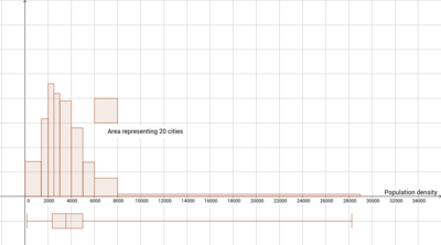
The mean density is 4,128.21 inhabitants per square mile (1,593.91/km2).
The median is 3,160.85 inhabitants per square mile (1,220.41/km2).
The total population (2019 estimate) of all cities over 100,000 is 95,467,976.
The total land area (2019 estimate) of all cities over 100,000 is 29,482 square miles (76,360 km2).
The overall density (total population divided by total land area [2019]) is 3,238 inhabitants per square mile (1,250/km2).
The mean city population is 301,160. The median city in population is number 185 (Syracuse) at 142,380.
| Population | Number of municipal governments[4] |
|---|---|
| 1,000,000+ | 10 |
| 300,000–999,999 | 56 |
| 200,000–299,999 | 51 |
| 100,000–199,999 | 200 |
| Total | 317 |
| State | Number of cities |
|---|---|
| CA | 75 |
| TX | 41 |
| FL | 22 |
| CO | 12 |
| AZ | 10 |
| NC, WA | 9 |
| IL | 8 |
| GA, MI, VA | 7 |
| NJ, OH, OR, TN | 6 |
| AL, CT, IN, KS, MA, MO, NV, NY | 5 |
| LA, OK, UT | 4 |
| IA, MN, PA, SC, WI | 3 |
| ID, KY, NE, NM | 2 |
| AK, AR, DC, HI, MD, MS, MT, ND, NH, RI, SD | 1 |
| DE, ME, VT, WV, WY | 0 |
Gallery


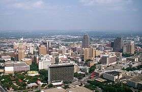 7. San Antonio, Texas
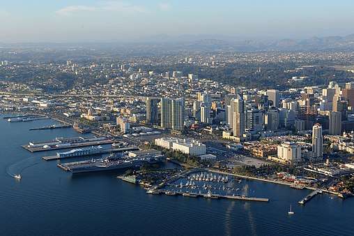 8. San Diego, California
 9. Dallas, Texas
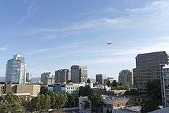 10. San Jose, California
 11. Austin, Texas
.jpg) 12. Jacksonville, Florida
12. Jacksonville, Florida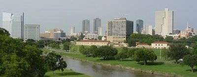 13. Fort Worth, Texas
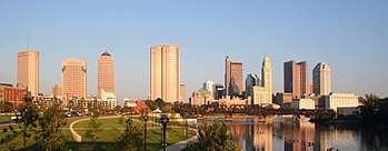
 15. Charlotte, North Carolina
 16. San Francisco, California
 17. Indianapolis, Indiana
 18. Seattle, Washington
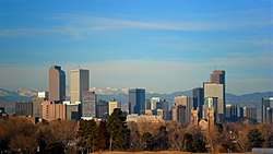

 21. Boston, Massachusetts
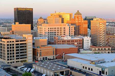 22. El Paso, Texas
 25. Oklahoma City, Oklahoma
 26. Portland, Oregon
 28. Memphis, Tennessee
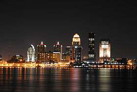 29. Louisville, Kentucky
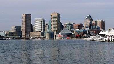
 32. Albuquerque, New Mexico
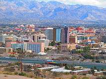 33. Tucson, Arizona
 34. Fresno, California
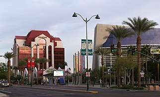 35. Mesa, Arizona
 36. Sacramento, California
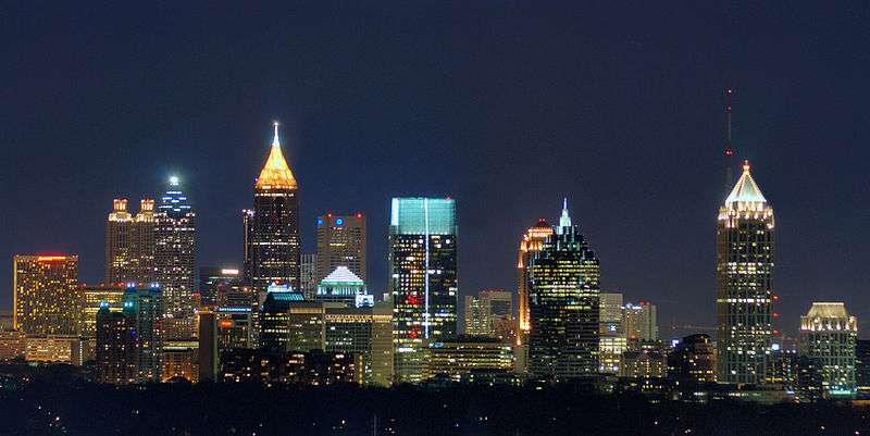
 38. Kansas City, Missouri
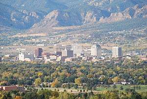 39. Colorado Springs, Colorado
 41. Raleigh, North Carolina
 42. Miami, Florida
 43. Long Beach, California
 44. Virginia Beach, Virginia
 45. Oakland, California
 46. Minneapolis, Minnesota
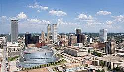 47. Tulsa, Oklahoma
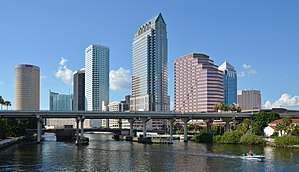 48. Tampa, Florida
 49. Arlington, Texas
 50. New Orleans, Louisiana
Puerto Rico
The following table lists the five municipalities (municipios) of Puerto Rico with a population greater than 100,000 on July 1, 2019, as estimated by the United States Census Bureau.
The table below contains the following information:
- The municipio rank by population as of July 1, 2019, as estimated by the United States Census Bureau[5]
- The municipio[5]
- The municipio population as of July 1, 2019, as estimated by the United States Census Bureau[5]
- The municipio population as of April 1, 2010, as enumerated by the 2010 United States Census[5]
- The municipio percent population change from April 1, 2010, to July 1, 2019
- The municipio land area as of January 1, 2016[2]
- The municipio population density as of July 1, 2019 (residents per land area)[2]
- The municipio latitude and longitude coordinates
| 2019 rank | Municipio | 2019 estimate | 2010 Census | Change | 2016 land area | 2019 population density | Location | ||
|---|---|---|---|---|---|---|---|---|---|
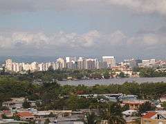
| 1 | San Juan | 318,441 | 395,326 | −19.45% | 39.5 sq mi | 102.3 km2 | 8,539/sq mi | 3,297/km2 | 18.4064°N 66.0640°W |
| 2 | Bayamón | 169,269 | 208,116 | −18.67% | 27.0 sq mi | 69.9 km2 | 6,651/sq mi | 2,568/km2 | 18.3801°N 66.1633°W |
| 3 | Carolina | 146,984 | 176,762 | −16.85% | 20.7 sq mi | 53.6 km2 | 7,463/sq mi | 2,881/km2 | 18.4120°N 65.9798°W |
| 4 | Ponce | 131,881 | 166,327 | −20.71% | 30.7 sq mi | 79.5 km2 | 4,588/sq mi | 1,771/km2 | 17.9874°N 66.6097°W |
| 5 | Caguas | 124,606 | 142,893 | −12.80% | 10.9 sq mi | 28.2 km2 | 11,890/sq mi | 4,590/km2 | 18.2321°N 66.0390°W |
Island Areas
The U.S. Census Bureau has a defined area called the "Island Areas" — it contains every major U.S. territory except Puerto Rico.[6] There are no cities in the Island Areas with more than 100,000 people. Below are the most populous cities in the Island Areas as of 2010.[7][8][9][10]
Sapian and Charlotte Amalie are capital cities, while Tafuna and Dededo are not.
| Territory | Largest city (2010) |
2010 population |
|---|---|---|
| American Samoa | Tafuna | 7,945 |
| Guam | Dededo | 44,943 |
| Northern Mariana Islands | Saipan | 48,220 |
| U.S. Virgin Islands | Charlotte Amalie | 18,481 |
Census-designated places
The following table lists U.S. census-designated places (CDPs) with populations of at least 100,000 according to the 2010 Census. A CDP is a concentration of population identified by the United States Census Bureau for statistical purposes. CDPs are delineated for each decennial census as the statistical counterparts of incorporated places such as cities, towns and villages. CDPs are populated areas that lack separate municipal government, but which otherwise physically resemble incorporated places. Unlike the incorporated cities in the main list, the US Census Bureau does not release annual population estimates for CDPs.
The table below contains the following information:
- The census-designated place
- The state
- The city population as of April 1, 2010, as enumerated by the 2010 United States Census
- The city population as of April 1, 2000, as enumerated by the 2010 United States Census
- The city percent population change from April 1, 2000, to April 1, 2010
- The city land area as of January 1, 2010[2]
- The city population density as of April 1, 2010 (residents per land area)[2]
- The city ANSI INCITS 446–2008 geographic code
- The city latitude and longitude coordinates
| City | State | 2010 Census | 2000 Census | Change | 2010 land area | 2010 population density | ANSI | Location | ||
|---|---|---|---|---|---|---|---|---|---|---|
| Paradise | Nevada | 223,167 | 186,070 | +19.94% | 46.717 sq mi | 120.996 km2 | 4,777/sq mi | 1,844/km2 | 02409023 | 36.08073°N 115.1368°W |
| Arlington | Virginia | 207,627 | 189,453 | +9.59% | 25.98 sq mi | 67.288 km2 | 7,992/sq mi | 3,086/km2 | 38.880°N 77.183°W | |
| Sunrise Manor | Nevada | 189,372 | 156,120 | +21.30% | 33.352 sq mi | 86.381 km2 | 5,678/sq mi | 2,192/km2 | 02410035 | 36.1785°N 115.0490°W |
| Spring Valley | Nevada | 178,395 | 117,390 | +51.97% | 33.226 sq mi | 86.055 km2 | 5,369/sq mi | 2,073/km2 | 02408797 | 36.0987°N 115.2619°W |
| Metairie | Louisiana | 138,481 | 146,136 | −5.24% | 23.222 sq mi | 60.145 km2 | 5,963/sq mi | 2,302/km2 | 02403282 | 29.9978°N 90.1779°W |
| East Los Angeles | California | 126,496 | 124,283 | +1.78% | 7.448 sq mi | 19.290 km2 | 16,984/sq mi | 6,558/km2 | 02408711 | 34.0315°N 118.1686°W |
| Enterprise | Nevada | 108,481 | 14,676 | +639.17% | 46.513 sq mi | 120.468 km2 | 2,332/sq mi | 900/km2 | 02408084 | 36.0182°N 115.2154°W |
| Brandon | Florida | 103,483 | 77,895 | +32.85% | 33.101 sq mi | 85.731 km2 | 3,126/sq mi | 1,207/km2 | 02402711 | 27.9360°N 82.2993°W |
Cities formerly over 100,000 people
The following table lists U.S. cities that, in past censuses, have had populations of at least 100,000 but have since decreased beneath this threshold or have been consolidated with or annexed into a neighboring city.
The table below contains the following information:
- Name of city
- Name of state
- The city population as of July 1, 2019, as estimated by the United States Census Bureau[1]
- The city's peak population based on highest official enumeration recorded by the Census (and the year of that particular Census)
- The numeric decline in population from its peak Census count to the most recent Census estimate in 2018.
- The percent decline in population from its peak Census count to the most recent Census estimate in 2018.
- Any additional notes of significant importance.
| City | State | 2019 estimated population | Peak population (year) | Numeric decline from peak population |
Percent decline from peak population |
Notes |
|---|---|---|---|---|---|---|
| Albany | New York | 96,460 | 134,995 (1950) | |||
| Allegheny | Pennsylvania | N/A[lower-alpha 32] | 129,896 (1900) | – | – | annexed by Pittsburgh in 1907 |
| Brooklyn | New York | N/A[lower-alpha 33] | 806,343 (1890) | – | – | consolidated with New York City in 1898 |
| Camden | New Jersey | 73,562 | 124,555 (1950) | |||
| Canton | Ohio | 70,447 | 116,912 (1950) | |||
| Dearborn | Michigan | 93,932 | 112,007 (1960) | |||
| Duluth | Minnesota | 85,618 | 107,312 (1960) | |||
| Edison[lower-alpha 30] | New Jersey | 99,758 | 100,693 (2018)* | *July 1, 2018 US Census Bureau estimate | ||
| Erie | Pennsylvania | 95,508 | 138,440 (1960) | |||
| Fall River | Massachusetts | 89,541 | 120,485 (1920) | |||
| Flint | Michigan | 95,538 | 196,940 (1960) | |||
| Gary | Indiana | 74,879 | 178,320 (1960) | |||
| Hammond | Indiana | 75,522 | 111,698 (1960) | |||
| Kenosha | Wisconsin | 99,944 | 100,164 (2018)* | *July 1, 2018 US Census Bureau estimate | ||
| Livonia | Michigan | 93,665 | 110,109 (1970) | |||
| Lynn | Massachusetts | 94,299 | 102,320 (1930) | |||
| New Bedford | Massachusetts | 95,363 | 121,217 (1920) | |||
| Niagara Falls | New York | 47,720 | 102,394 (1960) | |||
| Parma | Ohio | 78,103 | 100,216 (1970) | |||
| Portsmouth | Virginia | 94,398 | 114,773 (1960) | |||
| Reading | Pennsylvania | 88,375 | 111,171 (1930) | |||
| Roanoke | Virginia | 99,143 | 100,220 (1980) | |||
| Scranton | Pennsylvania | 76,653 | 143,333 (1930) | |||
| Somerville | Massachusetts | 81,360 | 103,908 (1930) | |||
| St. Joseph | Missouri | 74,875 | 102,979 (1900) | |||
| Trenton | New Jersey | 83,203 | 128,009 (1950) | |||
| Utica | New York | 59,750 | 101,740 (1930) | |||
| Wilmington | Delaware | 70,166 | 112,504 (1940) | |||
| Youngstown | Ohio | 65,469 | 170,002 (1930) |
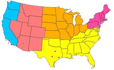
Locations of 50 most populous cities

See also
- Demographics of the United States
- United States Census Bureau
- List of U.S. states and territories by population
- List of metropolitan areas in the United States
- List of United States counties and county equivalents
- United States Office of Management and Budget
- The OMB has defined 1098 statistical areas comprising 388 MSAs, 541 μSAs, and 169 CSAs
- Primary statistical area – List of the 574 PSAs
- Combined Statistical Area – List of the 169 CSAs
- Core Based Statistical Area – List of the 929 CBSAs
- Metropolitan Statistical Area – List of the 388 MSAs
- Micropolitan Statistical Area – List of the 541 μSAs
- Primary statistical area – List of the 574 PSAs
- The OMB has defined 1098 statistical areas comprising 388 MSAs, 541 μSAs, and 169 CSAs
- United States Census Bureau
- Largest cities in the United States by population by decade
- List of U.S. states' largest cities by population
- List of cities proper by population (most populous cities in the world)
- List of United States cities by area
- List of United States cities by elevation
- List of United States cities by population density
- Lists of populated places in the United States
Notes
- Towns in New England, while incorporated on a level similar to cities in other states, are considered minor civil divisions by the Census Bureau and are not included in its list of incorporated places. A detailed discussion on this subject can be found at New England town#Census treatment of the New England town system.
- The State of Hawaiʻi has no incorporated municipalities other than the City and County of Honolulu, which comprises the entire Island of Oʻahu. In accordance with Hawaiian law, the United States Census Bureau defines the state's "cities" and "towns" as Census Designated Places (CDPs). The Census Bureau defines the Urban Honolulu CDP as the portion of the City and County of Honolulu that is coextensive with the Judicial District of Honolulu. The Urban Honolulu CDP is what is generally thought of as the "city" of Honolulu, and its population is used here and in other population comparisons. The Urban Honolulu CDP is currently the most populous Census Designated Place in the United States. The Honolulu, HI Metropolitan Statistical Area comprises the entire City and County of Honolulu.
- Or federal district in the case of Washington, D.C.
- Since 1898, the City of New York, New York, has comprised five boroughs with consolidated borough–county governments:
•The Borough of Brooklyn and Kings County
(pop. 2,559,903)
•The Borough of Queens and Queens County
(pop. 2,253,858)
•The Borough of Manhattan and New York County
(pop. 1,628,706)
•The Borough of the Bronx and Bronx County
(pop. 1,418,207)
•The Borough of Staten Island and Richmond County
(pop. 476,143) - The City of Philadelphia and Philadelphia County, are separate but coterminous entities with a single consolidated city–county government.
- The City of Jacksonville, Florida, and Duval County, Florida, are separate entities with a single consolidated city–county government. The City of Jacksonville comprises all of Duval County except the other incorporated municipalities within the county.
- The City and County of San Francisco, California has a consolidated city and county government.
- The City of Indianapolis, Indiana, and Marion County, Indiana, are separate entities with a single consolidated city–county government. The City of Indianapolis comprises all of Marion County except the other incorporated municipalities within the county. See Indianapolis (balance).
- The City and County of Denver, Colorado, has a consolidated city and county government.
- The City of Washington was consolidated with the District of Columbia in 1871.
- Nashville is a consolidated city-county. The population given is for the entire city-county, excluding other incorporated places lying within the city-county limits. (See Nashville-Davidson (balance), Tennessee). As of 2010, the population of the city-county including other incorporated places was 626,681.
- The City of Louisville, Kentucky, and Jefferson County, Kentucky, are separate entities with a single consolidated city–county government. The City of Louisville comprises all of Jefferson County except the other incorporated municipalities within the county. See Louisville/Jefferson County metro government (balance), Kentucky.
- This is an independent city that is not part of any county.
- The City of New Orleans, Louisiana, and Orleans Parish, Louisiana, are separate but coterminous entities with a single consolidated city–parish government.
- The City of Lexington, Kentucky, and Fayette County, Kentucky, are separate but coterminous entities with a single consolidated city–county government.
- The Municipality of Anchorage, Alaska, is a unified home rule municipality that functions as both a city and a borough.
- The Town of Gilbert, Arizona, is currently the most populous incorporated town in the United States.
- Officially listed in US Census Bureau records as Boise City
- The City of Baton Rouge, Louisiana, and East Baton Rouge Parish, Louisiana, are separate entities with a single consolidated city–parish government. The City of Baton Rouge has retained its own city limits within East Baton Rouge Parish.
- The City of Augusta, Georgia, and Richmond County, Georgia, are separate entities with a single consolidated city–county government. The City of Augusta comprises all of Richmond County except the two other incorporated municipalities within the county.
- The City of Columbus, Georgia, and Muscogee County, Georgia, are separate but coterminous entities with a single consolidated city–county government.
- The Town of Cary, North Carolina, is currently the second most populous incorporated town in the United States.
- After approval by local voters in a 2012 referendum, the City of Macon, Georgia merged with most of unincorporated Bibb County, Georgia on January 1, 2014. The new consolidated government is officially "Macon-Bibb County."
- Kansas City, Kansas, and Wyandotte County, Kansas, are separate entities with a single consolidated city–county government. Kansas City comprises all of Wyandotte County except the other incorporated municipalities within the county.
- The City of Athens, Georgia, and Clarke County, Georgia, are separate entities with a single consolidated city–county government. The City of Athens comprises all of Clarke County except the other incorporated municipalities within the county.
- The City of Lafayette, Louisiana, and Lafayette Parish, Louisiana, are separate entities with a single consolidated city–parish government. The City of Lafayette comprises all of Lafayette Parish except the other incorporated municipalities within the parish.
- Jurupa Valley was incorporated as a city on July 1, 2011, from various portions of unincorporated territory in Riverside County, California. Because of this, there is no official 2010 Census population.
- Official name is San Buenaventura
- The Town of Davie, Florida, is currently the third most populous incorporated town in the United States.
- In the state of New Jersey, townships are full-fledged municipalities on par with any town, city, borough, or village.
"City and Town Population Totals: 2010-2019". United States Census Bureau, Population Division. Retrieved May 21, 2020. - In the state of Michigan, charter townships are municipalities on par with any other incorporated city.
"City and Town Population Totals: 2010-2019". United States Census Bureau, Population Division. Retrieved May 21, 2020. - The population of all North Side neighborhoods of Pittsburgh (41,120), plus Census Tract 4270 Blocks 2 & 3, which are the sections of Millvale, Pennsylvania that were formally part of Allegheny City. (an additional 2,301), which totals to 43,421. All data from the 2010 Census.
- The population for Brooklyn in the 2010 Census was 2,504,700. However, since Brooklyn is now a borough of the City of New York and thus no longer its own separate city, for the purposes of this chart, its current population will be regarded as negligible.
References
- "City and Town Population Totals: 2010-2019". United States Census Bureau, Population Division. Retrieved May 21, 2020.
- "2016 U.S. Gazetteer Files". U.S. Gazetteer Files. United States Census Bureau. Retrieved August 22, 2017.
- City wins census appeal; count adjusted – Houston Chronicle. Chron.com (December 3, 2012). Retrieved on July 12, 2013.
- "Census of Governments" (PDF). Government Organization. U.S. Census Bureau. December 2002. Retrieved December 30, 2010.
- "Annual Estimates of the Resident Population: April 1, 2010 to July 1, 2019". 2019 Census Population Estimates. U.S. Census Bureau, Population Division. April 2020. Retrieved April 15, 2020.
- https://www.census.gov/prod/cen2010/cph-2-1.pdf United States Summary: 2010. Population and Housing Unit Counts. Issued September 2012. Page 1 (Page 49 of PDF). Retrieved July 25, 2020.
- https://factfinder.census.gov/faces/tableservices/jsf/pages/productview.xhtml?pid=DEC_10_DPAS_ASDP1&prodType=table Archived 2017-05-03 at the Wayback Machine American FactFinder. Profile of General Demographic Characteristics: 2010. 2010 American Samoa Demographic Profile Data [Geography set to "Tafuna village, American Samoa"]. Archived at: https://web.archive.org/web/20170503200517/https://factfinder.census.gov/faces/tableservices/jsf/pages/productview.xhtml?pid=DEC_10_DPAS_ASDP1&prodType=table
- https://web.archive.org/web/20140723215811/http://bsp.guam.gov/GU%20Statistical%20Yearbook_2010.pdf "2010 Guam Statistical Yearbook" (PDF). Archived from the original (PDF) on July 23, 2014.
- https://web.archive.org/web/20101223043232/http://www.oceandots.com/pacific/mariana/alamagan.php
"U.S. Census Bureau Releases 2010 Census Population Counts for the Northern Mariana Islands". Archived from the original on 2010-12-23. - https://archive.is/20130412034853/http://virginislandsdailynews.com/news/census-shows-v-i-s-population-down-2-1.1193325 ALDETH LEWIN (Daily News Staff) (August 25, 2011). "Census shows V.I.'s population down 2% - News". Virgin Islands Daily News. Archived from the original on April 12, 2013.