Hounslow
Hounslow (/ˈhaʊnzloʊ/) is a large suburban town, and the principal town of the London Borough of Hounslow in west London , England. Hounslow is identified as a major metropolitan centre in the London Plan. It is located near London Heathrow Airport and is about 10.7 miles (17.2 km) west-southwest of Charing Cross, 12 miles (19 km) south-east of Slough, 3 miles (4.8 km) south of Southall, 2 miles (3.2 km) north-west of Twickenham, and 6.5 miles (10.5 km) north-east of Staines-upon-Thames.
| Hounslow | |
|---|---|
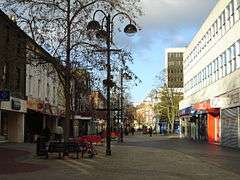 High Street | |
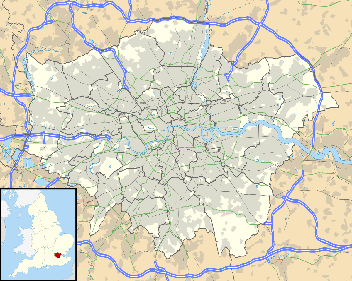 Hounslow Location within Greater London | |
| Population | 103,337 (2011 Census)[1] |
| OS grid reference | TQ140760 |
| • Charing Cross | 10.7 mi (17.2 km) ENE |
| London borough | |
| Ceremonial county | Greater London |
| Region | |
| Country | England |
| Sovereign state | United Kingdom |
| Post town | HOUNSLOW |
| Postcode district | TW3–TW6 |
| Dialling code | 020 |
| Police | Metropolitan |
| Fire | London |
| Ambulance | London |
| UK Parliament | |
| London Assembly | |
.jpg)
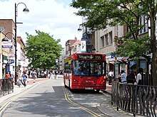
Hounslow has a large shopping centre, called the Treaty Centre, which adjoins its high street and many restaurants, cafés and small businesses, many of which are associated with product assembly, marketing, telecommunications and Heathrow Airport. It is connected to Central London by South Western Railway's Hounslow Loop Line and Hounslow station, and by the London Underground's Piccadilly line through three stations - Hounslow West, Hounslow Central and Hounslow East.
Etymology
The name Hounslow is spelt in old records as 'Hundeslow' and similar, pointing to Anglo-Saxon Hundes hlāw, meaning "the dog's mound" or "the mound of a man named or nicknamed Hound".
History
Hounslow Heath has strategic importance as routes from London to the west and southwest of Britain used to pass through it. Staines Road, the northern boundary of the present Heath, was the Roman Road, Trinobantes. There are several historic references to Roman camps on or close to the Heath. The military connection has continued with both Oliver Cromwell and James II using it as a military encampment and the construction in 1793 of the Cavalry Barracks. The barracks were extended with Beavers Lane Camp and from 1914-20 the Heath became Hounslow Heath Aerodrome. In 1902 the Hanworth Road drill hall (now the Treaty Lodge Hotel) was built for the 2nd Volunteer Battalion, The Middlesex Regiment.
The Heath has a continuous recorded history dating back to Norman times, where it gave its name to the former hamlet of Heathrow. Hounslow Heath was also known for the extremely high numbers of highwaymen and footpads in the area,[2] who mostly focused on targeting the wealthy and noble.[3]
Positioned on the Bath Road (where it forks to the Staines Road at the Bell Inn), Hounslow was centred around Holy Trinity Priory founded in 1211.[4] The priory developed what had been a small village into a town with regular markets and other facilities for travellers heading to and from London. Although the priory was dissolved in 1539 the town remained an important staging post on the Bath Road.
The building of the Great Western Railway line from London to Bristol from 1838 reduced long-distance travel along the Bath Road. By 1842 the local paper was reporting that the 'formerly flourishing village', which used to stable 2,000 horses, was suffering a 'general depreciation of property'.[5] The Hounslow Loop Line was constructed in 1850, prompting new development. Hounslow Hospital opened in 1876 and closed in 1978, despite being occupied in protest at the closure.
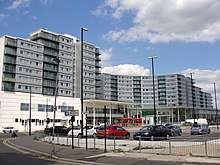
The construction of the Great West Road (a revival of an earlier name for the Bath Road as a by-pass for it around the north of Brentford, Isleworth and Hounslow centres) in the 1920s attracted the building of the factories and headquarters of large companies. The factories were a great local source of employment until a decline in the 1970s, attracting workers from a wide area and leading to a great deal of housing development. In the next two decades offices largely replaced factories on the Great West Road and further expansion in hotel and housing stock has taken place, an example being the Blenheim Centre, an image of which is in the gallery section below.
Governance
Historically part of Middlesex, since 1965 Hounslow has been part of the London Borough of Hounslow, with parts in the London Boroughs of Hillingdon, Richmond upon Thames, and Ealing. Prior to this, Hounslow was part of the Municipal Borough of Heston and Isleworth, from 1835 until 1965. Whitton was part of the Municipal Borough of Twickenham, while Cranford was part of the Hayes and Harlington Urban District and Feltham Urban District. Additionally, Norwood Green was part of the Municipal Borough of Southall.
Geography
Hounslow is located near London Heathrow Airport and is about 10.7 miles (17.2 km) west-southwest of Charing Cross, 15 miles (24 km) south-east of Slough, 3 miles (4.8 km) south of Southall, 2 miles (3.2 km) north-west of Twickenham, and 6.5 miles (10.5 km) north-east of Staines-upon-Thames.
Demography
The town of Hounslow, including its localities Cranford, Heston, Hounslow West and Lampton, was 103,337 in the 2011 census, whereas the wider borough had a population of 254,000.[6]
| Ward | Detached | Semi-detached | Terraced | Flats and apartments | Caravans/temporary/mobile homes | Shared between households[7] |
|---|---|---|---|---|---|---|
| Hounslow Central | 257 | 1,455 | 930 | 2,687 | 3 | 52 |
| Hounslow Heath | 285 | 1,522 | 1,128 | 1,886 | 7 | 87 |
| Hounslow South | 223 | 2,155 | 967 | 588 | 0 | 11 |
| Hounslow West | 248 | 1,526 | 799 | 1,344 | 5 | 23 |
| Ward | Population | Households | % Owned outright | % Owned with a loan | hectares[7] |
|---|---|---|---|---|---|
| Hounslow Central | 15,169 | 5,384 | 19 | 19 | 174 |
| Hounslow Heath | 14,727 | 4,915 | 17 | 27 | 279 |
| Hounslow South | 11,408 | 3,944 | 33 | 42 | 179 |
| Hounslow West | 12,658 | 3,945 | 23 | 24 | 162 |
Hounslow has a high degree of people who ethnically identify as BAME (Black, Asian and minority Ethnic), and it is the borough's most diverse town. In 7 of Hounslow's 8 electoral wards, the BAME proportion is above 70%.[8] The town has a large British Asian community.[9]
Economy
Hounslow is an economic hub within the west of the capital city, with it having a large shopping centre which adjoins its high street and many restaurants, cafés and small businesses,[10] many of which are associated with product assembly, marketing, telecommunications and Heathrow Airport, which has many businesses and public sector jobs in and around it to which the local population commute. The settlement is also partially employed in the Commuter Belt with access between 45 and 60 minutes from most of Central London.
DHL Air UK has its head office in the Orbital Park in Hounslow.[11]
Hounslow Town Centre is a busy predominantly retail centre, with a small number of commercial offices and civic buildings. There is a large shopping centre called the Treaty Centre which opened in 1987,[12] containing Debenhams, JD, Next, H&M and many large branches of chain stores found in British high streets. It includes a food court along with over 50 shops. There is a large ASDA superstore located within the Blenheim Centre complex (which was completed in 2006)[13] along with B&M, a Barnado's charity shop, a local health centre, a gym run by The Gym Group and Jungle V.I.P (a children's indoor play area).
A new retail area, the High Street Quarter, will be located near Hounslow High Street and is set to contain a 27-storey residential tower along with many shops, restaurants, and a ten-screen Cineworld cinema multiplex.[14][15]
Culture and community
Hounslow Heath is a large public open space and local nature reserve to the west of Hounslow, a London borough. It now covers about 200 acres (80 ha) and is only the residue of the historic Hounslow Heath that once covered over 4,000 acres (1,600 ha).[16]
Bell Square is an outdoor performance space next to the Bell pub. Hounslow Community Land Project was a community garden and sports area on a derelict piece of land on Hanworth Road.
Twinning
Hounslow is twinned with the following settlements around the world:
The London Borough of Hounslow also has a sister district agreement with Leningradsky District in Krasnodar Krai, Russia.[17]
Landmarks
One of the earliest surviving houses in the town is The Lawn, in front of the Civic Centre with its public tennis courts, in brown brick[18] with three double-hung sash windows set back in reveals with flat arches, roof with parapet and porch of fluted doric columns, pilasters, entablature and semi-circular traceried fanlight.[19] Nearby important landowners included those of Osterley House, Syon House, Hanworth Park House and Worton Hall.
Transport

Major roads
There are three major roads in Hounslow. The east-west roads, the A4 'Great West Road' and the 'Bath Road' that connects Hounslow to Central London and Slough, and the A30 'Great South West Road' that connects it to Staines-upon-Thames, which meet at Henlys Roundabout in Hounslow West. There is also the north-south road, the A312 'The Causeway' and 'The Parkway', which connects Hounslow to Hampton in the south and Harrow to the north.
Additionally, A and B roads in Hounslow include the A314 'Hanworth Road' that starts in Hounslow and finishes is Hanworth, Feltham. The historic A315 'London Road', 'Hounslow High Street', 'Hanworth Road', 'Grove Road' and 'Staines Road'; which starts in Central London down to Bedfont, Feltham. In doing this, it connects Hounslow to towns and districts such as Kensington, Hammersmith, Chiswick, Brentford and Isleworth.
East-west roads
The A4 Great West Road joins with the A3006 Bath Road (from the A315) before Henlys Roundabout, which is in Hounslow West, from which a WNW route passes Heathrow Airport, terminals 1 to 3 and terminal 5 as the Bath Road and a WSW route, the A30, passes terminal 4, bypasses Staines and reaches the M25; the remainder is a mostly-minor route to Land's End, Cornwall.
The M4 motorway is two miles north; its nearest junction, J3, being northwest along the A312.
The A315 is the historic WSW road out of London, on which Hounslow's High Street is placed. To the east, it bisects Isleworth, Brentford and Chiswick. To the west it bisects North Feltham and Bedfont before joining the A30.
North-south roads
The north-south A312, The Parkway, to the west of Hounslow leads south to Hampton or north to Harrow passing Waggoners' Roundabout (WNW of Henlys Roundabout in Hounslow West), Hayes, Yeading and Northolt.
Three minor roads converge on Heston from the A315 in parts of Hounslow, the A3063, A3005 and B363. The single road re-divides just north in Norwood Green into a northwest road to Southall (the A3005) and into the A4127 that passes by Hanwell, briefly using the A4020 west before bypassing Dormers Wells, passing Greenford to reach Sudbury, the town immediately to the west of Wembley and North Wembley.
For longer journeys north, the M4, A4 or A30 then M25 provides the best routes. For longer journeys south, Hanworth Road leads to the A316 that becomes the M3 motorway.
Trains and Underground
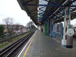
There are three main London Underground stations in the town; Hounslow East, Hounslow Central and Hounslow West, with all the stations being on the Piccadilly line. The District line used to operate now-discontinued services to Hounslow, and the town also has abandoned stations on the old line, such as Hounslow Town.
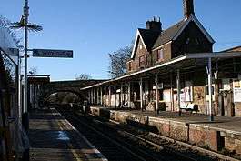
Hounslow railway station, operated by South Western Railway is on the railway line to London Waterloo, or westwards to Reading, Weybridge, Woking or Windsor. The railway line also offers services on the Hounslow Loop Line, opened 1850, further around the loop to Twickenham and Richmond.[21] It is situated a fair distance from the town centre and is used far less than the Underground stations.
Bus services
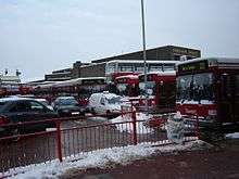
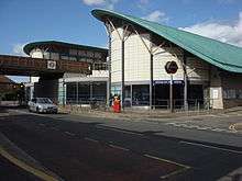
Hounslow bus garage, with an adjoining bus station close to the High Street. In 1962, as a result of the final stage of the London trolleybus programme of conversion to motor bus operation when Isleworth garage was closed, the staff from that depot (coded IH) were transferred to Hounslow. The property is owned by the RATP Group, which took it over with the purchase of London United from Transdev. In addition to its frequent and regular daytime services throughout the surrounding areas Hounslow figures on the N9 night service from Heathrow Airport to Central London.
Hounslow Heath Aerodrome was a grass airfield and was operational from 1910 to 1920. It was in the London borough of Hounslow, and in 1919 was the location from which the first scheduled daily international commercial air services took place.[22][23]
Education
St Mark's Roman Catholic School is on Bath Road. Lampton School was previously Spring Grove Grammar School, in the are of Lampton. Kingsley Academy was formerly known as Hounslow Manor School.
Religious sites
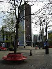
Churches include Holy Trinity church and St Michael & St Martin Catholic church.
Sport
A printed programme dated 7 July 1935 suggests that there may have been motor cycle speedway racing at a venue in Dockwell Lane branded as Hounslow Speedway. The best information suggests that more than one meeting was staged in conjunction with the Hounslow Motor Cycle and Car Club. The Irish Guards GAA club are based in Hounslow.
Hounslow Hockey Club was very successful at a national level in the late 20th century but has now merged with Barnes Hockey Club. Hounslow Heath Golf Centre on the west of the Heath closed in 2016.
Notable people
- Dave Cousins, singer and songwriter, leader of the Strawbs, was born in Hounslow.
- Mathangi "Maya" Arulpragasam, better known as M.I.A., English-Sri Lankan musician and visual artist, was born in Hounslow.
- Asim Chaudhry, actor and comedian.
- Phil Collins, singer-songwriter and Genesis drummer, was born and raised in Hounslow.
- Elvis Costello, singer-songwriter, attended Archbishop Myers' Secondary School (now St Mark's Catholic School).
- Cyril Cusack (1910–1993), actor, lived in Hounslow at the time of his death.
- Sophie Ellis-Bextor, singer-songwriter, model and occasional DJ, was born in Hounslow.
- Violet Englefield, actress and singer, was born in Hounslow.
- Mo Farah, Olympic 10,000 m and 5,000 m gold medalist, lived in Hounslow.[24]
- Ian Gillan, vocalist of rock band Deep Purple, was born in Hounslow.
- Gustavus Green (1865–1964), aircraft engine pioneer, was born in Hounslow.
- Charles Hawtrey (1914–1988), Carry On film legend, was born in Hounslow.
- Patsy Kensit, actress and singer, lived in Hounslow during her teenage years.
- Francis Maddison (1927–2006), historian, was born and educated in Hounslow.
- Bill Mason, Olympic rower and coach of Imperial College London rowing team, lives in Hounslow.
- Ian McLagan, keyboardist of the Small Faces and Faces, was born and raised in Hounslow.
- Dermot Morgan (1952–1998), Father Ted actor, lived in Hounslow at the time of his death.
- Kunal Nayyar, actor, was born in Hounslow but moved to India at a young age.
- Alistair Overeem, mixed martial arts champion, was born in Hounslow.
- Katherine Parkinson, actress, was born in Hounslow.
- Sir Alec Reed, founder of the REED employment agency, was born in Hounslow.
- Naomi Scott, singer and actress, was born and raised in Hounslow.
- Jay Sean, singer, was born in Hounslow.
- Cyril Vosper (1935–2004), adherent then critic of Scientology, was born in Hounslow.
- Maria Whittaker, 1980s Page Three girl, was born in Hounslow.
- Jack Wild (1952–2006), actor, Artful Dodger in the film Oliver! and star of H.R. Pufnstuf, grew up in Hounslow.
See also
References
- Notes
- Hounslow is made up of 8 wards in the London Borough of Hounslow: Cranford, Heston Central, Heston East, Heston West, Hounslow Central, Hounslow Heath, Hounslow South, and Hounslow West. "Archived copy". Archived from the original on 22 February 2014. Retrieved 9 June 2014.CS1 maint: archived copy as title (link)
- "Hounslow Heath - Highwaymen and Highway Robbery". www.stand-and-deliver.org.uk. Retrieved 6 May 2018.
- "When Hounslow Was The Most Dangerous Place In Britain". Londonist. 13 January 2017. Retrieved 6 May 2018.
- Daniel Lysons, 'Heston', The Environs of London: volume 3: County of Middlesex (1795:22–45): accessed 6 August 2010.
- Quoted in Acworth, WM 'The Railways in 1843' in Morgan, B (1963) Railway Lover's Companion, Eyre & Spottiswoode, P90
- Ali, Sorriya. "Census 2011". www.hounslow.gov.uk. Retrieved 6 May 2018.
- Key Statistics; Quick Statistics: Population Density 2011 census Office for National Statistics
- https://data.london.gov.uk/dataset/ward-profiles-and-atlas
- https://ukandeu.ac.uk/inside-the-british-asian-brexit-vote-and-why-it-contains-a-few-surprises/
- Restaurants guide Squaremeal.co.uk Retrieved 2013-12-24
- "Online Shipping." DHL Air UK. Retrieved on 23 April 2014. "DHL International (UK) Limited Registered Office: Orbital Park, 178-188 Great South West Road, Hounslow, Middlesex TW4 6JS"
- www.now-media.co.uk, Now Media. "Treaty Centre - Hounslow". Treaty Centre, Hounslow. Retrieved 6 May 2018.
- http://www.hwa.uk.com/site/wp-content/uploads/2016/02/HSQ-Final-Proof-Alistair-Parker42105264_1.pdf
- Patel, Salina (2 February 2018). "Hounslow High Street Quarter development takes major step forward". getwestlondon. Retrieved 6 May 2018.
- "High Street Quarter, Hounslow |". hounslowhighstreetquarter.com. Retrieved 6 May 2018.
- "Hounslow Heath - Hidden London". hidden-london.com. Retrieved 6 May 2018.
- Cumber, Robert (17 December 2010). "Council to revive links with Palestinian town". Hounslow, Heston & Whitton Chronicle. Archived from the original on 23 December 2010.
- Historic England. "Details from listed building database (1079602)". National Heritage List for England. Retrieved 24 June 2012. The similar example of 44–50 Bath Road: also in brown brick and as is sometimes seen, has been painted.
- Historic England. "Details from listed building database (1080312)". National Heritage List for England. Retrieved 24 June 2012. The Lawn
- "Myrtle Avenue, Hounslow". Google Maps. Retrieved 26 March 2013.
- Grid square map Ordnance survey website
- Cumber, Robert (6 April 2016). "How Hounslow's forgotten airports helped win the world wars". getwestlondon. Retrieved 6 May 2018.
- "Hounslow - Airfields of Britain Conservation Trust UK". www.abct.org.uk. Retrieved 6 May 2018.
- Turnbull, Simon (12 August 2012). "Magical Mo Farah races into land of legends during London 2012". Independent.co.uk. Retrieved 16 August 2012.
Further reading
- James Thorne (1876), "Hounslow", Handbook to the Environs of London, London: John Murray
External links
| Wikimedia Commons has media related to Hounslow (town). |
- Hounslow Online – www.hounslowtw3.net Hounslow's local community website
- Community Guide to Hounslow – www.activhounslow.com Hounslow's online guide
- History of Hounslow town
| Districts |
|  |
|---|---|---|
| Attractions | ||
| Parks and open spaces |
| |
| Constituencies | ||
| Bridges | ||
| Tube and rail stations | ||
| Places of worship |
| |
| Other topics | ||
| ||