Northolt
Northolt is an area in the London Borough of Ealing, London, England, and is 11 miles (17.7 km) west-northwest of Charing Cross.
| Northolt | |
|---|---|
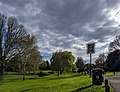
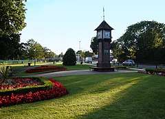 Northolt Green and the clock tower | |
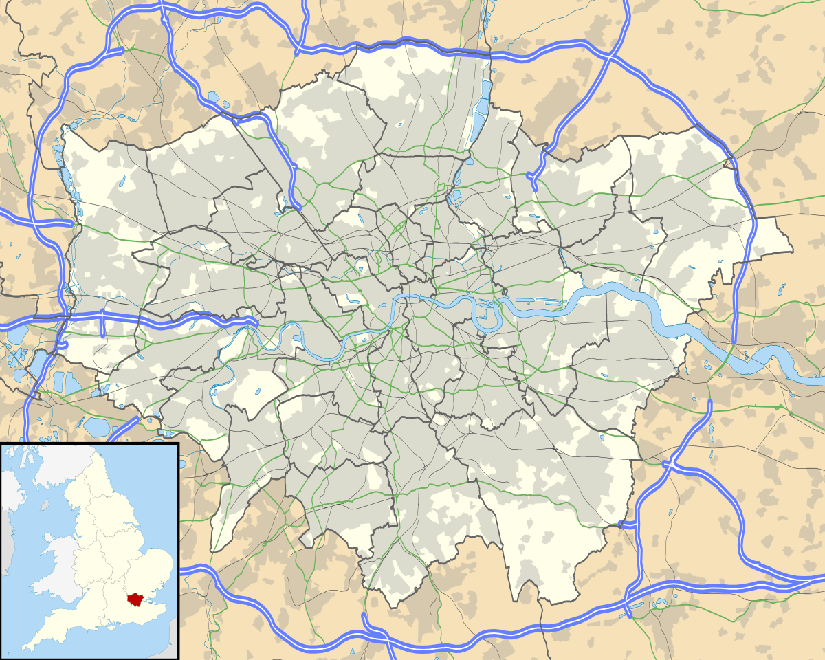 Northolt Location within Greater London | |
| Population | 30,304 (2011 Census)[1] |
| OS grid reference | TQ135845 |
| • Charing Cross | 11 mi (18 km) ESE |
| London borough | |
| Ceremonial county | Greater London |
| Region | |
| Country | England |
| Sovereign state | United Kingdom |
| Post town | NORTHOLT |
| Postcode district | UB5 |
| Dialling code | 020 |
| Police | Metropolitan |
| Fire | London |
| Ambulance | London |
| UK Parliament | |
| London Assembly | |
It had a population of 30,304 at the 2011 UK census.
History
The settlement of Northolt is located in the ancient county of Middlesex (now part of Greater London). It is mentioned in the Domesday Book as Northall (corresponding to "Southall") as being held by Geoffrey de Mandeville, and archaeological evidence suggests that there was a Saxon village at the location from the 8th century onwards. The medieval village had its origins in the Saxon period. Up to late Victorian times, the area was rural with predominantly arable crops being grown. The fourteenth century Northolt Manor existed behind the present Court Farm Road and was excavated from 1950 onwards. A barn constructed in the area in 1595 can now be seen in the Chiltern Open Air Museum. In the early part of the 18th century farmland was enclosed in order to provide hay for the City of London, alongside more traditional crops such as peas and beans.
Suburban development began in the 1920s. Most of the housing north of the Western Avenue was built in the 1920s–1930s, and is in the private housing sector. Most of the housing built to the south of the Western Avenue was built in the 1960s–1970s, and is in the social housing sectors, particularly along the Kensington and Ruislip Roads.
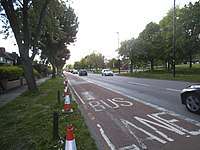
Two important transport links run through Northolt: the Grand Union Canal and the modern A40 road.
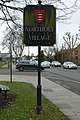
In the 21st century, a new large private housing development was built on the former site of the Taylor Woodrow company, adjacent to the Grand Union Canal. This development is known as "Grand Union Village" and incorporates a new canal boat marina.
Landmarks
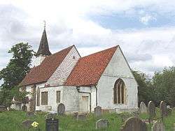
- St Mary the Virgin church (14th century) stands on the hill overlooking the old village. The Welsh poet Goronwy Owen was briefly a curate here. Bishop Samuel Lisle is buried here.
- In the centre of the village is a freestanding clock tower erected to commemorate the coronation of George VI in 1937.
- The White Hart public house is on the site of an old coaching inn. The roundabout immediately south of it is on the junction of the A312 (Church Road and Hayes Bypass) with the A4180 (Ruislip Road and West End Road). The Yeading Lane also joins the roundabout. (Now closed)
- Willow Cottages on the village green are said to have been built of bricks from the old manor house, which once stood behind the parish church.
- The two towers of the disused RAF radio station north of the town are situated in the Wood End wireless station recreation ground, which is bordered on all sides by housing (Bayshill Rise, Lancaster Road, Blenheim road). The location is now home to a National Air Traffic Control base.
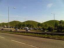
- Northala Fields is a large area alongside the A40 road which has been redeveloped as an extension to the Northolt and Greenford Country Park. The development consists of four large, man-made conical hills (built of rubble from the first Wembley Stadium), which act as a sound barrier to block traffic noise from the Western Avenue. Behind the mounds are new ponds and a visitor centre.
- The Larkspur Rovers F.C. clubhouse is in Rowdell Road, Northolt. It received funding from Ealing Council and an Olympic legacy grant of £50,000 from Sport England's Inspired Facilities Fund.[2]
- There is a village community centre building in Ealing Road, opposite St Mary's church, which incorporates an open-air miniature railway.
- A leisure centre, incorporating a pool, a fitness centre, a community hall and a library was built on the site of the former Swimarama swimming pool at the junction of Mandeville Road and Eastcote Lane North, and opened in 2010.[3]
- Down Barns Moated Site, a Scheduled Ancient Monument.[4]
Northolt Village
 Village sign with Middlesex coat of arms
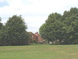
 Belvue Park
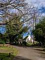 St Mary's Church
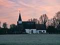 St Mary's Church
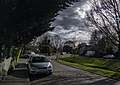
 Signage of The Crown pub
Geography
The centre of Northolt lies at an elevation of about 130 feet (40 m) above sea level. It is hillier in the north (up to about 200 feet (60 m)) whereas the south is lower, about 115 feet (35 m). The town is mainly suburban, with some industrial land to the east (by the Grand Union Canal), large green parts such as Lime Tree Park and Rectory Park, and semi-rural land to the west
Northolt is located 3.3 miles (5.3 km) from Hayes; 2.4 miles (3.9 km) from Southall; 1.4 miles (2.3 km) from Greenford; 3.1 miles (5.0 km) from Wembley; 2.7 miles (4.3 km) from Harrow; 2.8 miles (4.5 km) from Ruislip; and 4.5 miles (7.2 km) from Uxbridge.
Demography
Northolt is covered by two electoral wards of the London Borough of Ealing. Northolt Mandeville ward covers the main area of Northolt. Northolt West End ward covers the area south of the A40 road, including housing that is contiguous from Yeading directly to the south.
| Ward | Detached | Semi-detached | Terraced | Flats and apartments[5][6] |
|---|---|---|---|---|
| Northolt Mandeville | 3.7% | 29.6% | 25.3% | 40.8% |
| Northolt West End | 3.0% | 26.4% | 17.4% | 53.1% |
The median house price as of 2014 was £300,000 in Northolt Mandeville and £226,111 in Northolt West End. The population who are from BAME (Black, Asian and minority Ethnic) background was 51.7% and 55.1% respectively. The median age was 34 years and 32 years respectively.[7]
Population
While Northolt remained a rural, agricultural area in the 19th century, its population growth remained slow:
- 1801 – 336 inhabitants
- 1871 – 479
- 1921 – 904
- 1961 – 26,000[8]
- 1991 – 32,000
The rapid growth of the population in the mid-20th century can be explained by Northolt's growth as a dormitory town for nearby Ealing, and the construction in 1935 of the A40 road through the area. Modern family homes were built in the 1920s and 1930s. In the 1950s and 1960s, predominantly local authority rented housing was constructed. 3,423 council houses had been built in Northolt by 1963. Northolt tube station was opened in 1948 to serve the growing population of the area.
Crime
Anti-social behaviour has recently been the most common reported crime, followed by violent and sexual offences. Crime levels notably increased, by up to 50% between 2013 and 2014.[9]
RAF Northolt
The Royal Air Force station is situated in neighbouring South Ruislip in the London Borough of Hillingdon. Most early RAF airfields were named after the nearest railway station; in this case Northolt Junction, (now South Ruislip).
Pony racing
Northolt was famous for the pony racing which took place in Northolt Park. A one-and-a-half-mile (2.4 km) racecourse was constructed by Sir William Bass and Viscount Lascelles, and opened in 1929 by the Earl of Harewood and his wife the Princess Royal.
During the Second World War, the land was taken over and used as an army depot and prisoner of war camp. Despite numerous attempts to revive pony racing after the war the land was given over to housing construction. The Racecourse Estate was constructed between 1951 and 1955 in order to solve a severe housing shortage within the borough. The gates of the original racecourse remain in Petts Hill, and a section of the track can be observed as a long, flat stretch of land alongside Mandeville Road.
Education
|
|
Transport
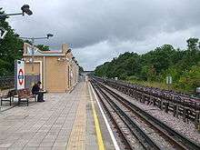

Northolt has two stations: Northolt on the London Underground Central line and Northolt Park, a Network Rail station served by Chiltern Railways. Numerous London Buses routes serve Northolt.
Political representation
The constituency of Ealing North is currently represented by Labour and Co-operative Party Member of Parliament James Murray, and has been since 2019 following the retirement of Stephen Pound.
Northolt is made up of two electoral wards (Northolt Mandeville and Northolt West End), as well as part of the electoral ward of North Greenford, which elect councillors to Ealing Council. As of 6 May 2010 the area is represented by five Labour councillors (three in West End and two in Mandeville) and one Conservative councillor.
At the same election Labour took control of Ealing Council from the Conservatives with a major swing against the Tories, which conflicted with the nationwide swing in the General Election.
Northolt comes under the London Assembly constituency of Ealing and Hillingdon which has one assembly member, currently Onkar Sahota (Labour), who was elected in May 2012.
Political status on Ealing Council:
- Labour: 53 seats
- Conservative: 12 seats
- Liberal Democrats: 4 seats
Nearest places
Nearest Settlements | ||||||||||
|---|---|---|---|---|---|---|---|---|---|---|
| ||||||||||
Notable people
- Jimmy Canning, IRA member, lived undercover in Northolt from 1991 to 1993; he had wooed local Audrey Lamb and moved into her house at 15 Islip Gardens, using it as a weapons and bomb storage depôt. He and Lamb were arrested in 1992 following police surveillance.[10]
- Michael Colclough, Canon Pastor at St Paul's Cathedral and Deputy Priest in Ordinary to The Queen, was Archdeacon of Northolt 1992-4.
- Alton Ellis (1938–2008), musician, "Godfather of Rocksteady", lived in Northolt.
- Paul Gardiner (1958–1984), musician, bass guitar player in Gary Numan's Tubeway Army, died in Northolt.
- Stanley Green (1915–1993), a human billboard, lived in Northolt.
- Paul Kidby, artist, known for his association with author Terry Pratchett's Discworld, was born in Northolt.
- Jerome Okimo, footballer with Stevenage FC, was born in Ealing and grew up in Northolt.
- Steve Perryman, footballer with Tottenham Hotspur, was born in Ealing and grew up in Northolt.
Northolt on television
- The popular BBC comedy series My Hero, produced between 2000 and 2006, and featuring Ardal O'Hanlon and Emily Joyce, was set in Northolt.
- An episode of the popular CBBC series Tracy Beaker had scenes filmed in the old Swimarama swimming pool.
- A faux documentary titled Ghostwatch, aired on Halloween in 1992, was filmed in Northolt. Ghostwatch, the tale of a single mother haunted in her Northolt home by a mysterious figure called "Pipes"
References
- Northolt is made up of 2 wards in the London Borough of Ealing: Northolt Mandeville, and Northolt West End. "Archived copy". Archived from the original on 22 February 2014. Retrieved 9 June 2014.CS1 maint: archived copy as title (link)
- http://www.ealing.gov.uk/news/article/431/playing_fields_secure_olympic_funding
- "Facility improvement projects". London Borough of Ealing. Retrieved 15 March 2009.
- Historic England. "Details from listed building database (1001978)". National Heritage List for England. Retrieved 28 September 2015.
- "Neighbourhood statistics". Office for National Statistics.
- Census Information Scheme (2012). "2011 Census Ward Population Estimates". Greater London Authority. Retrieved 30 January 2013.
- https://data.london.gov.uk/dataset/ward-profiles-and-atlas
- http://www.ealing.gov.uk/services/leisure/tourism/northolt/ ealing.gov
- http://www.police.uk/metropolitan/00AJGS/crime/stats/#crime_stats
- Harnden, Toby. Bandit Country: the IRA and South Armagh, pgs. 320-28.
External links
| Wikimedia Commons has media related to Northolt. |
| Districts |  | |
|---|---|---|
| Attractions | ||
| Parks and open spaces |
| |
| Constituencies | ||
| Tube and rail stations |
| |
| Places of worship |
| |
| Other topics | ||
| ||