Maplewood, Wisconsin
Maplewood is an unincorporated community in Door County, in the town of Forestville, Wisconsin, United States. The nearest city to Maplewood is Sturgeon Bay. Maplewood is located along Wisconsin Highway 42 approximately 3 miles (5 km) south of its junction with Wisconsin Highway 57.[2] A small county park in the center of Maplewood provides an eating area and restrooms for users of the Ahnapee State Trail.[3]
Maplewood, Wisconsin | |
|---|---|
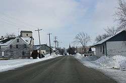 Looking east in Maplewood | |
 Maplewood Location within the state of Wisconsin | |
| Coordinates: 44°44′51″N 87°28′45″W | |
| Country | |
| State | |
| County | Door |
| Town | Forestville |
| Elevation | 214 m (702 ft) |
| Time zone | UTC-6 (Central (CST)) |
| • Summer (DST) | UTC-5 (CDT) |
| ZIP code | 54226 |
| Area code(s) | 920 |
| GNIS feature ID | 1569010[1] |
Images
 Looking east the main intersection in Maplewood
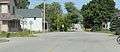
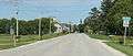 Looking east at the sign for Maplewood
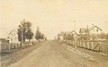 Looking west; postcard dated 1910
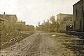 Looking east; postcard dated 1913
gollark: The avian carriers RFC was truly a masterpiece of its time. So sad that it's barely supported by ISPs.
gollark: This is explained by the strangely easy to establish morphism between you and apioform.
gollark: What is WITH your color coloring?
gollark: I could just use `clip-path` on profile pictures I guess.
gollark: Yes. This is the best way.
References
- U.S. Geological Survey Geographic Names Information System: Maplewood, Wisconsin
- 2001-2002 Official State Highway Map (Wisconsin)
- Interactive map showing how the trail goes through Maplewood. While the map is for the Ice Age Trail, Maplewood is one of the areas where the trails coincide.
Municipalities and communities of Door County, Wisconsin, United States | ||
|---|---|---|
| City |
| 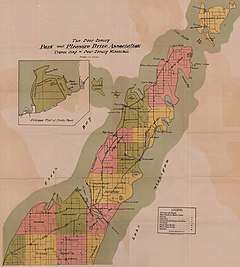 Towns in 1915; the borders remain the same today except for annexations by the City of Sturgeon Bay and the four villages. |
| Villages | ||
| Towns | ||
| CDPs | ||
| Unincorporated communities | ||
| Footnote | ‡Partially located in Kewaunee County | |
This article is issued from Wikipedia. The text is licensed under Creative Commons - Attribution - Sharealike. Additional terms may apply for the media files.