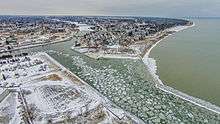
West Twin River (Wisconsin)
The West Twin River, formerly the Neshota River, is an 18.5-mile-long (29.8 km)[1] river in east-central Wisconsin that is a tributary to Lake Michigan. It merges with the East Twin River in the city of Two Rivers, Wisconsin, less than a mile from the lakeshore. The source of the river is in southeast Brown County, near Richard J. Drum Memorial Forest. It is formed by the confluence of the Devils River and the Neshota River.[2] On its course it passes through the unincorporated villages of Kingsbridge and Shoto.
| West Twin River | |
|---|---|
| Location | |
| Country | United States |
| Physical characteristics | |
| Source | |
| • location | Just south of Green Bay, Wisconsin |
| Mouth | |
• location | Confluence with the East Twin River at Two Rivers, Wisconsin |
• elevation | 177 feet (54 m) |
| Length | 18.5 miles (29.8 km) |
| Basin size | 176 square miles (460 km2) |
| Basin features | |
| Progression | South-southeast and east |
| River system | West Twin River |
About 6 miles (10 km) upstream from its mouth, the West Twin River is blocked by Shoto Dam, which divides the river into upper and lower reaches.[3] The river below Shoto Dam is broad, shallow, and slow and the water quality is poor, while above the dam it is narrow, deep, and fast-flowing with good to excellent water quality.[3] Shoto Dam creates a 55-acre (22 ha) reservoir known as Shoto Lake.[4]
Major tributaries
Major tributaries of the West Twin River include:[5]
- Black (Buck) Creek
- Devils River
- Francis Creek
- King Creek
- Kriwanek Creek
- Neshota River
- Twin Hill Creek
References
- U.S. Geological Survey. National Hydrography Dataset high-resolution flowline data. The National Map, accessed December 19, 2011
- Wisconsin Department of Natural Resources, West Twin River Watershed, June 2010, p. 4.
- Wisconsin Department of Natural Resources, West Twin River Watershed, June 2010, p. 5.
- Wisconsin Department of Natural Resources, West Twin River Watershed, June 2010, p. 7.
- Wisconsin Department of Natural Resources, West Twin River Watershed, June 2010, p. 5-7.