Wavertree
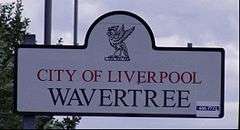
Wavertree is an area of Liverpool, on Merseyside, England, and is a Liverpool City Council ward. The population of the ward taken at the 2011 census was 14,772.[1] Historically in Lancashire, it is bordered by a number of districts to the south and east of Liverpool city centre from Toxteth, Edge Hill, Fairfield, Old Swan, Childwall and Mossley Hill.
| Wavertree | |
|---|---|
 | |
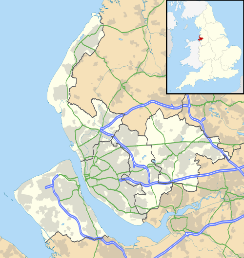
 Wavertree Location within Merseyside | |
| Population | 14,772 (2011) |
| OS grid reference | SJ3889 |
| Metropolitan borough | |
| Metropolitan county | |
| Region | |
| Country | England |
| Sovereign state | United Kingdom |
| Post town | LIVERPOOL |
| Postcode district | L15 |
| Dialling code | 0151 |
| Police | Merseyside |
| Fire | Merseyside |
| Ambulance | North West |
| UK Parliament | |
History

The name derives from the Old English words wæfre and treow, meaning "wavering tree", possibly in reference to aspen trees common locally.[2] It has also been variously described as "a clearing in a wood" or "the place by the common pond".[3] In the past the name has been spelt Watry, Wartre, Waurtree, Wavertre and Wavertree. The earliest settlement of Wavertree is attested to by the discovery of Bronze Age burial urns in Victoria Park in the mid −1860s [3][4] while digging the footings for houses, two of which were built for Patrick O Connor, patentee, ironmonger, merchant and Chair to the Wavertree Local Board of Health.[5] The Domesday Book reference is "Leving held Wauretreu. There are 2 carucates of land. It was worth 64 pence".
Wavertree was part of the parish of Childwall in the West Derby hundred.
Wavertree also boasts a village lock-up, commonly known as The Roundhouse, despite being octagonal in shape. Built in 1796, and later modified by prominent local resident and architect Sir James Picton, it was once used to detain local drunks. The lock-up was made a listed building in 1952.[6] A similar structure, Everton Lock-Up sometimes called Prince Rupert's Tower, survives in Everton. The village green, on which Wavertree's lock-up was built, is officially the only surviving piece of common land in Liverpool.[6]
Holy Trinity Church was built in 1794 and is situated on Church Road close to the famous Blue Coat School.
Wavertree Town Hall was built in 1872 as the headquarters of the Wavertree Local Board of Health. The motto on the town hall is sub umbra floresco or "I flourish in the shade". Rescued from demolition in 1979,[7] the town hall is now a pub.
In 1895, the village of Wavertree was incorporated into the city of Liverpool.
Description
Wavertree is one of the areas in south Liverpool populated by students of Liverpool's three universities, especially the Smithdown Road area. This road is known for "The Smithdown Ten" pub crawl, although the number of pubs in business varies year to year.[8]
It is also home to the annual Smithdown Road Festival, with local bars and cafes hosting almost 200 bands every year.
The community is ethnically diverse, with significant South Asian and black populations.
Governance
The elected councillors for Wavertree are Helen Casstles (Labour Party), Rosie Jolly (Labour Party) and Dave Cummings (Labour Party).
It is represented since 2019 by Paula Barker (Labour Party) in the parliamentary constituency of Liverpool Wavertree.
Education
There are a number of both primary and secondary schools in this densely populated area of Liverpool. King David which is situated in the area has a primary and senior school. The Liverpool Blue Coat School is also situated in Wavertree, having been built originally in 1708 for fifty poor boys. It is currently a mixed grammar school. Wavertree C of E which was renamed from Trinity District in the 1990s, is situated on Prince Alfred Road. The school celebrated its 140th Birthday in September 2007. There is another primary school on South Drive called Our Lady Of Good Help. This used to be located in Chestnut Grove next to our Lady`s Roman Catholic Church which is now facing re-development. St Clare's Roman Catholic Primary School is also situated off Smithdown Road
Wavertree Playground – "The Mystery"
The Mystery was one of the first purpose-built public playgrounds in the UK, opened in 1895. It is based on land donated to Liverpool Corporation by an anonymous donor, to be a venue for organised sports, and a place for children from the city's schools to run about in, not a park for 'promenading' in the Victorian tradition.[9] It is known locally as "The Mystery" because the donor remains a mystery.
The donor expressed the hope that the City Council "might approve of giving it a fair trial for this purpose ... before appropriating it for any other use". The land is currently home to a playground, Wavertree Athletics Centre, with many sports facilities including tennis courts, all-weather pitch, bowling green and athletic track with grandstand, and Liverpool Aquatics Centre, with two swimming pools, sports hall, and Lifestyles Fitness Centre. Liverpool Harriers & A.C. have based their headquarters at this centre since 1990.
Notable current or former residents
- Augustine Birrell, barrister, politician and writer
- Bill Kenwright
- Chelcee Grimes
- Cyril Edward Gourley
- George Harrison, musician
- Georgia May Foote
- Holly Johnson, singer
- James Valiant
- Joan Benesh, choreographer and dancer
- John Gregson, actor
- John Lennon, musician
- Kenneth Cope, actor
- Kim Cattrall, actress
- Leonard Rossiter, actor
- Norman Rossington
- Paul Dawber
- Paul Draper
- Ross Barkley, footballer
- Stewart Duckworth Headlam
- Tony Bellew, boxer
- Bertram Peel
- Denis Peel
Transport
- Train times and station information for Wavertree from National Rail
References
- "City of Liverpool Ward population 2011". Retrieved 12 January 2016.
- Placenames: Wavertree, National Museums Liverpool, retrieved 19 March 2008
- Wavertree History (PDF), Wavertree Cricket Club, ISBN 0-7524-3068-8, archived from the original (PDF) on 3 October 2011, retrieved 19 March 2008
- "Burial Urn".
- "Patrick O Connors Number 11 door spring".
- The Village Green and Lock-up, Discovering Historic Wavertree, archived from the original on 14 August 2007, retrieved 19 March 2008
- Wavertree Town Hall, Discovering Historic Wavertree, archived from the original on 14 August 2007, retrieved 19 March 2008
- Graves, Steve (30 July 2013). "Bell rings for last orders on 'Smithdown Ten' pub crawl". liverpoolecho.
- Wavertree Playground ('The Mystery'), Discovering Historic Wavertree, archived from the original on 14 August 2007, retrieved 19 March 2008
External links
| Wikimedia Commons has media related to Wavertree. |