Wahlrod
Wahlrod is an Ortsgemeinde – a community belonging to a Verbandsgemeinde – in the Westerwaldkreis in Rhineland-Palatinate, Germany.
Wahlrod | |
|---|---|
 Coat of arms | |
Location of Wahlrod within Westerwaldkreis district 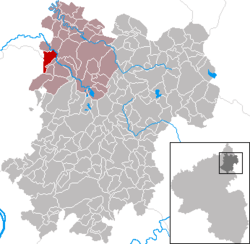 | |
 Wahlrod  Wahlrod | |
| Coordinates: 50°39′1″N 7°43′13″E | |
| Country | Germany |
| State | Rhineland-Palatinate |
| District | Westerwaldkreis |
| Municipal assoc. | Hachenburg |
| Government | |
| • Mayor | Eberhard Dineiger |
| Area | |
| • Total | 5.99 km2 (2.31 sq mi) |
| Elevation | 290 m (950 ft) |
| Population (2018-12-31)[1] | |
| • Total | 860 |
| • Density | 140/km2 (370/sq mi) |
| Time zone | CET/CEST (UTC+1/+2) |
| Postal codes | 57614 |
| Dialling codes | 02680 |
| Vehicle registration | WW |
| Website | www.wahlrod.de |
Geography
Location
The community lies in the northern Westerwaldkreis and borders on Altenkirchen district. Wahlrod belongs to the Verbandsgemeinde of Hachenburg, a kind of collective municipality. Its seat is in the like-named town.
History
In 1249, Wahlrod had its first documentary mention.
Politics
Community council
The council is made up of 13 council members, including the honorary mayor (Bürgermeister), who were elected in a majority vote in a municipal election on 13 June 2004.
Economy and infrastructure
Transport
Running right through the community is Bundesstraße 8, leading from Limburg an der Lahn to Siegburg. The nearest Autobahn interchanges are in Dierdorf and Neuwied on the A 3 (Cologne–Frankfurt), some 25 km away. The nearest InterCityExpress stop is the railway station at Montabaur on the Cologne-Frankfurt high-speed rail line.
References
- "Bevölkerungsstand 2018 - Gemeindeebene". Statistisches Landesamt Rheinland-Pfalz (in German). 2019.
External links
- Wahlrod (in German)
- Wahlrod in the collective municipality’s Web pages (in German)