Hardt, Westerwaldkreis
Hardt is an Ortsgemeinde – a community belonging to a Verbandsgemeinde – in the Westerwaldkreis in Rhineland-Palatinate, Germany.
Hardt | |
|---|---|
.svg.png) Coat of arms | |
Location of Hardt within Westerwaldkreis district 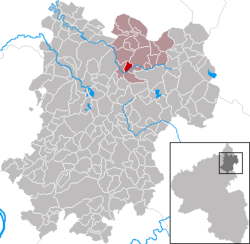 | |
 Hardt  Hardt | |
| Coordinates: 50°38′07″N 7°55′12″E | |
| Country | Germany |
| State | Rhineland-Palatinate |
| District | Westerwaldkreis |
| Municipal assoc. | Bad Marienberg (Westerwald) |
| Government | |
| • Mayor | Ursula Martain |
| Area | |
| • Total | 1.88 km2 (0.73 sq mi) |
| Elevation | 410 m (1,350 ft) |
| Population (2018-12-31)[1] | |
| • Total | 450 |
| • Density | 240/km2 (620/sq mi) |
| Time zone | CET/CEST (UTC+1/+2) |
| Postal codes | 56472 |
| Dialling codes | 02661 |
| Vehicle registration | WW |
| Website | www.bad-marienberg.de |
Geography
Location
The community lies in the Westerwald between Limburg and Siegen. The river, Nister, which is part of the Sieg drainage basin, flows east to west through the municipal area. Hardt belongs to the Verbandsgemeinde of Bad Marienberg, a kind of collective municipality. Its seat is in the like-named town.
Politics
Community council
The council is made up of 8 council members who were elected in a majority vote in a municipal election on 7 June 2009.
Economy and infrastructure
Transport
The nearest Autobahn interchanges are Montabaur on the A 3 (Cologne–Frankfurt), some 27 km away, and Haiger/Burbach on the A 45 (Dortmund–Hanau), some 25 km away. The nearest InterCityExpress stop is the railway station at Montabaur on the Cologne-Frankfurt high-speed rail line.
References
- "Bevölkerungsstand 2018 - Gemeindeebene". Statistisches Landesamt Rheinland-Pfalz (in German). 2019.
External links
- Hardt in the collective municipality’s Web pages (in German)
| Authority control |
|
|---|