Halbs
Halbs is an Ortsgemeinde – a community belonging to a Verbandsgemeinde – in the Westerwaldkreis in Rhineland-Palatinate, Germany.
Halbs | |
|---|---|
 Coat of arms | |
Location of Halbs within Westerwaldkreis district 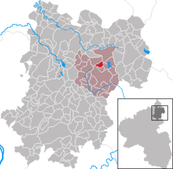 | |
 Halbs  Halbs | |
| Coordinates: 50°35′27″N 7°57′53″E | |
| Country | Germany |
| State | Rhineland-Palatinate |
| District | Westerwaldkreis |
| Municipal assoc. | Westerburg |
| Government | |
| • Mayor | Rudi Kessler |
| Area | |
| • Total | 2.12 km2 (0.82 sq mi) |
| Elevation | 450 m (1,480 ft) |
| Population (2018-12-31)[1] | |
| • Total | 359 |
| • Density | 170/km2 (440/sq mi) |
| Time zone | CET/CEST (UTC+1/+2) |
| Postal codes | 56457 |
| Dialling codes | 02663 |
| Vehicle registration | WW |
| Website | www.westerburger-land.de |
Geography
Location
Halbs lies 3 km north of Westerburg on a bank in the middle of a wooded and field area. Since 1972 it has belonged to what was then the newly founded Verbandsgemeinde of Westerburg, a kind of collective municipality.
Neighbouring communities
Bordering on Halbs are Ailertchen, Hergenroth and Stahlhofen am Wiesensee.
Politics
Community council
The council is made up of 9 council members, including the extraofficial mayor (Bürgermeister), who were elected in a majority vote in a municipal election on 7 June 2009.
Economy and infrastructure
Transport
North of the community runs Bundesstraße 255, leading from Montabaur to Herborn. The nearest Autobahn interchange is Diez on the A 3 (Cologne–Frankfurt). The nearest InterCityExpress stop is the railway station at Montabaur on the Cologne-Frankfurt high-speed rail line.
References
- "Bevölkerungsstand 2018 - Gemeindeebene". Statistisches Landesamt Rheinland-Pfalz (in German). 2019.
External links
- Halbs in the collective municipality’s Web pages (in German)
| Authority control |
|
|---|