Vals-le-Chastel
Vals-le-Chastel is a commune in the Haute-Loire department in south-central France.
Vals-le-Chastel | |
|---|---|
Commune | |
 | |
Location of Vals-le-Chastel 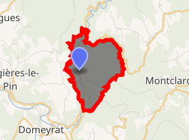
| |
 Vals-le-Chastel  Vals-le-Chastel | |
| Coordinates: 45°16′18″N 3°31′19″E | |
| Country | France |
| Region | Auvergne-Rhône-Alpes |
| Department | Haute-Loire |
| Arrondissement | Brioude |
| Canton | Pays de Lafayette |
| Government | |
| • Mayor (2014–2020) | Corinne Boyer |
| Area 1 | 3.99 km2 (1.54 sq mi) |
| Population (2017-01-01)[1] | 44 |
| • Density | 11/km2 (29/sq mi) |
| Time zone | UTC+01:00 (CET) |
| • Summer (DST) | UTC+02:00 (CEST) |
| INSEE/Postal code | 43250 /43230 |
| Elevation | 507–777 m (1,663–2,549 ft) (avg. 530 m or 1,740 ft) |
| 1 French Land Register data, which excludes lakes, ponds, glaciers > 1 km2 (0.386 sq mi or 247 acres) and river estuaries. | |
Population
| Year | Pop. | ±% |
|---|---|---|
| 1793 | 228 | — |
| 1806 | 241 | +5.7% |
| 1821 | 239 | −0.8% |
| 1831 | 231 | −3.3% |
| 1841 | 304 | +31.6% |
| 1851 | 229 | −24.7% |
| 1861 | 178 | −22.3% |
| 1872 | 196 | +10.1% |
| 1881 | 201 | +2.6% |
| 1891 | 176 | −12.4% |
| 1901 | 141 | −19.9% |
| 1911 | 134 | −5.0% |
| 1921 | 132 | −1.5% |
| 1931 | 110 | −16.7% |
| 1946 | 86 | −21.8% |
| 1954 | 71 | −17.4% |
| 1962 | 66 | −7.0% |
| 1968 | 63 | −4.5% |
| 1975 | 62 | −1.6% |
| 1982 | 46 | −25.8% |
| 1990 | 44 | −4.3% |
| 1999 | 46 | +4.5% |
| 2009 | 46 | +0.0% |
| 2017 | 44 | −4.3% |
gollark: ↓ apio
gollark: Do not attempt to resist.
gollark: You are to be told thing.
gollark: ++remind 0.06Gs bee you.
gollark: Besides, maybe your months are bad.
See also
| Wikimedia Commons has media related to Vals-le-Chastel. |
| Authority control |
|
|---|
- "Populations légales 2017". INSEE. Retrieved 6 January 2020.
This article is issued from Wikipedia. The text is licensed under Creative Commons - Attribution - Sharealike. Additional terms may apply for the media files.