Le Vernet, Haute-Loire
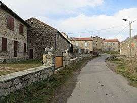
Le Vernet is a commune in the Haute-Loire department in south-central France.
Le Vernet | |
|---|---|
Commune | |
 | |
Location of Le Vernet 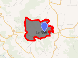
| |
 Le Vernet  Le Vernet | |
| Coordinates: 45°02′15″N 3°40′21″E | |
| Country | France |
| Region | Auvergne-Rhône-Alpes |
| Department | Haute-Loire |
| Arrondissement | Le Puy-en-Velay |
| Canton | Saint-Paulien |
| Government | |
| • Mayor (2014–2020) | Alain Lioutaud |
| Area 1 | 3.82 km2 (1.47 sq mi) |
| Population (2017-01-01)[1] | 24 |
| • Density | 6.3/km2 (16/sq mi) |
| Time zone | UTC+01:00 (CET) |
| • Summer (DST) | UTC+02:00 (CEST) |
| INSEE/Postal code | 43260 /43320 |
| Elevation | 1,070–1,301 m (3,510–4,268 ft) (avg. 1,120 m or 3,670 ft) |
| 1 French Land Register data, which excludes lakes, ponds, glaciers > 1 km2 (0.386 sq mi or 247 acres) and river estuaries. | |
Population
| Year | Pop. | ±% |
|---|---|---|
| 1793 | 141 | — |
| 1806 | 127 | −9.9% |
| 1821 | 147 | +15.7% |
| 1831 | 159 | +8.2% |
| 1841 | 175 | +10.1% |
| 1851 | 159 | −9.1% |
| 1861 | 151 | −5.0% |
| 1872 | 162 | +7.3% |
| 1881 | 185 | +14.2% |
| 1891 | 152 | −17.8% |
| 1901 | 157 | +3.3% |
| 1911 | 154 | −1.9% |
| 1921 | 134 | −13.0% |
| 1931 | 121 | −9.7% |
| 1946 | 115 | −5.0% |
| 1954 | 81 | −29.6% |
| 1962 | 88 | +8.6% |
| 1968 | 79 | −10.2% |
| 1975 | 67 | −15.2% |
| 1982 | 67 | +0.0% |
| 1990 | 52 | −22.4% |
| 1999 | 40 | −23.1% |
| 2007 | 37 | −7.5% |
| 2017 | 24 | −35.1% |
gollark: Plus you get much more of them.
gollark: Hmm. Perhaps.
gollark: Potential to do what, lose money?
gollark: He could just buy gold, which would make *some* sense.
gollark: Apparently this person has no understanding of economics whatsoever.
See also
| Wikimedia Commons has media related to Le Vernet (Haute-Loire). |
| Authority control |
|
|---|
- "Populations légales 2017". INSEE. Retrieved 6 January 2020.
This article is issued from Wikipedia. The text is licensed under Creative Commons - Attribution - Sharealike. Additional terms may apply for the media files.