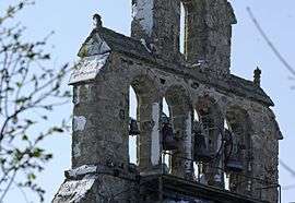
Chastel, Haute-Loire
Chastel is a commune in the Haute-Loire department in south-central France.
Chastel | |
|---|---|
Commune | |
 | |
Location of Chastel 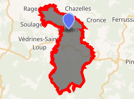
| |
 Chastel  Chastel | |
| Coordinates: 45°05′03″N 3°19′25″E | |
| Country | France |
| Region | Auvergne-Rhône-Alpes |
| Department | Haute-Loire |
| Arrondissement | Brioude |
| Canton | Pays de Lafayette |
| Government | |
| • Mayor (2014–2020) | René Haelvoert |
| Area 1 | 27.69 km2 (10.69 sq mi) |
| Population (2017-01-01)[1] | 129 |
| • Density | 4.7/km2 (12/sq mi) |
| Time zone | UTC+01:00 (CET) |
| • Summer (DST) | UTC+02:00 (CEST) |
| INSEE/Postal code | 43065 /43300 |
| Elevation | 711–1,359 m (2,333–4,459 ft) (avg. 900 m or 3,000 ft) |
| 1 French Land Register data, which excludes lakes, ponds, glaciers > 1 km2 (0.386 sq mi or 247 acres) and river estuaries. | |
Population
| Year | Pop. | ±% |
|---|---|---|
| 1793 | 753 | — |
| 1806 | 792 | +5.2% |
| 1821 | 744 | −6.1% |
| 1831 | 742 | −0.3% |
| 1841 | 690 | −7.0% |
| 1851 | 715 | +3.6% |
| 1861 | 653 | −8.7% |
| 1872 | 599 | −8.3% |
| 1881 | 629 | +5.0% |
| 1891 | 608 | −3.3% |
| 1901 | 560 | −7.9% |
| 1911 | 606 | +8.2% |
| 1921 | 538 | −11.2% |
| 1931 | 521 | −3.2% |
| 1946 | 378 | −27.4% |
| 1954 | 351 | −7.1% |
| 1962 | 345 | −1.7% |
| 1968 | 347 | +0.6% |
| 1975 | 320 | −7.8% |
| 1982 | 274 | −14.4% |
| 1990 | 216 | −21.2% |
| 1999 | 162 | −25.0% |
| 2009 | 147 | −9.3% |
| 2017 | 129 | −12.2% |
gollark: F-strings bad.
gollark: It is [DATA EXPUNGED].
gollark: Or ${new Date().getFullYear()} if you like.
gollark: Yes, it is $CURRENT_YEAR.
gollark: gnu-nobody is also somewhat bees.
See also
| Wikimedia Commons has media related to Chastel (Haute-Loire). |
| Authority control |
|
|---|
- "Populations légales 2017". INSEE. Retrieved 6 January 2020.
This article is issued from Wikipedia. The text is licensed under Creative Commons - Attribution - Sharealike. Additional terms may apply for the media files.