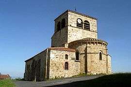
Saint-Hilaire, Haute-Loire
Saint-Hilaire is a commune in the Haute-Loire department in south-central France.
Saint-Hilaire | |
|---|---|
Commune | |
 | |
.svg.png) Coat of arms | |
Location of Saint-Hilaire 
| |
 Saint-Hilaire  Saint-Hilaire | |
| Coordinates: 45°22′54″N 3°26′18″E | |
| Country | France |
| Region | Auvergne-Rhône-Alpes |
| Department | Haute-Loire |
| Arrondissement | Brioude |
| Canton | Sainte-Florine |
| Government | |
| • Mayor (2014–2020) | Dominique Ceres |
| Area 1 | 14.64 km2 (5.65 sq mi) |
| Population (2017-01-01)[1] | 158 |
| • Density | 11/km2 (28/sq mi) |
| Time zone | UTC+01:00 (CET) |
| • Summer (DST) | UTC+02:00 (CEST) |
| INSEE/Postal code | 43193 /43390 |
| Elevation | 519–884 m (1,703–2,900 ft) (avg. 750 m or 2,460 ft) |
| 1 French Land Register data, which excludes lakes, ponds, glaciers > 1 km2 (0.386 sq mi or 247 acres) and river estuaries. | |
Population
| Year | Pop. | ±% |
|---|---|---|
| 1793 | 763 | — |
| 1806 | 880 | +15.3% |
| 1821 | 872 | −0.9% |
| 1831 | 875 | +0.3% |
| 1841 | 839 | −4.1% |
| 1851 | 917 | +9.3% |
| 1861 | 863 | −5.9% |
| 1872 | 701 | −18.8% |
| 1881 | 752 | +7.3% |
| 1891 | 676 | −10.1% |
| 1901 | 606 | −10.4% |
| 1911 | 496 | −18.2% |
| 1921 | 423 | −14.7% |
| 1931 | 370 | −12.5% |
| 1946 | 316 | −14.6% |
| 1954 | 285 | −9.8% |
| 1962 | 251 | −11.9% |
| 1968 | 217 | −13.5% |
| 1975 | 200 | −7.8% |
| 1982 | 205 | +2.5% |
| 1990 | 197 | −3.9% |
| 1999 | 190 | −3.6% |
| 2007 | 192 | +1.1% |
| 2017 | 158 | −17.7% |
gollark: Obviously the best way is to take MIT and add a "tell me if my software becomes embedded in secretish hardware backdoors in CPUs" clause.
gollark: And I think the hippocratic one has a worrying arbitration thing in it.
gollark: The anticapitalist one seems to be somewhat beeoidal and only permit use by ridiculously specific types of organization.
gollark: Mine are all just MIT because I doubt people will ever actually use them, but I want to make it as hassle-free as possible.
gollark: > nginx 1.14
References
- "Populations légales 2017". INSEE. Retrieved 6 January 2020.
| Wikimedia Commons has media related to Saint-Hilaire (Haute-Loire). |
| Authority control |
|
|---|
This article is issued from Wikipedia. The text is licensed under Creative Commons - Attribution - Sharealike. Additional terms may apply for the media files.