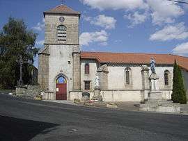
Sembadel
Sembadel (Auvergnat: Sant Badèu) is a commune in the Haute-Loire department in south-central France.
Sembadel | |
|---|---|
Commune | |
 | |
Location of Sembadel 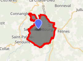
| |
 Sembadel  Sembadel | |
| Coordinates: 45°16′32″N 3°41′15″E | |
| Country | France |
| Region | Auvergne-Rhône-Alpes |
| Department | Haute-Loire |
| Arrondissement | Brioude |
| Canton | Plateau du Haut-Velay granitique |
| Government | |
| • Mayor (2014–2020) | Roland Gobet |
| Area 1 | 18.59 km2 (7.18 sq mi) |
| Population (2017-01-01)[1] | 229 |
| • Density | 12/km2 (32/sq mi) |
| Time zone | UTC+01:00 (CET) |
| • Summer (DST) | UTC+02:00 (CEST) |
| INSEE/Postal code | 43237 /43160 |
| Elevation | 849–1,128 m (2,785–3,701 ft) |
| 1 French Land Register data, which excludes lakes, ponds, glaciers > 1 km2 (0.386 sq mi or 247 acres) and river estuaries. | |
Geography
The Senouire has its source in the commune.
Population
| Year | Pop. | ±% |
|---|---|---|
| 1793 | 619 | — |
| 1806 | 652 | +5.3% |
| 1821 | 601 | −7.8% |
| 1831 | 706 | +17.5% |
| 1841 | 891 | +26.2% |
| 1851 | 875 | −1.8% |
| 1861 | 770 | −12.0% |
| 1872 | 738 | −4.2% |
| 1881 | 732 | −0.8% |
| 1891 | 775 | +5.9% |
| 1901 | 818 | +5.5% |
| 1911 | 933 | +14.1% |
| 1921 | 865 | −7.3% |
| 1931 | 765 | −11.6% |
| 1946 | 615 | −19.6% |
| 1954 | 575 | −6.5% |
| 1962 | 524 | −8.9% |
| 1968 | 422 | −19.5% |
| 1975 | 328 | −22.3% |
| 1982 | 263 | −19.8% |
| 1990 | 238 | −9.5% |
| 1999 | 250 | +5.0% |
| 2012 | 239 | −4.4% |
| 2017 | 229 | −4.2% |
gollark: How?
gollark: As planned.
gollark: `extern` should probably have errored.
gollark: Oh, I forgot to wget it, how foolish.
gollark: Hmm.
See also
| Wikimedia Commons has media related to Sembadel. |
| Authority control |
|
|---|
- "Populations légales 2017". INSEE. Retrieved 6 January 2020.
This article is issued from Wikipedia. The text is licensed under Creative Commons - Attribution - Sharealike. Additional terms may apply for the media files.