Thrushelton
Thrushelton or Thruselton[1] is a village and civil parish about 2 and a half miles north of Coryton railway station,[2] in the West Devon district, in the county of Devon, England. In 2011 the parish had a population of 197.[3] The parish touches Bratton Clovelly, Bridestowe, Lewtrenchard, Stowford, Broadwoodwidger, Marystow and Germansweek.[4]
| Thrushelton | |
|---|---|
 | |
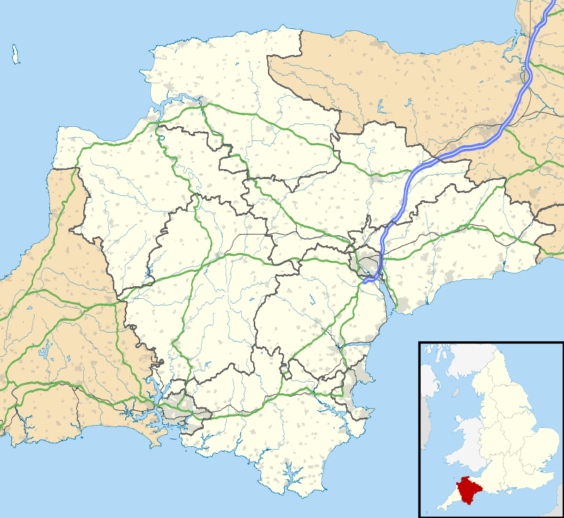 Thrushelton Location within Devon | |
| Area | 16.5241 km2 (6.3800 sq mi) |
| Population | 197 (2011 census) |
| • Density | 12/km2 (31/sq mi) |
| Civil parish |
|
| District | |
| Shire county | |
| Region | |
| Country | England |
| Sovereign state | United Kingdom |
Features
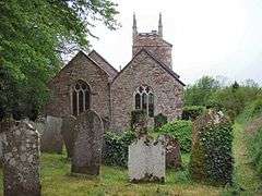
There are 22 listed buildings in Thrushelton.[5]
History
Thrushelton was recorded in the Domesday Book as Tresetone.[6] The name "Thrushelton" means 'Thrush farm/settlement'.[7] The parish was historically in the Lifton hundred.[8] On the 25th of March 1885 Wortham, Orchard, and Kilson Houses was transferred from Lewtrenchard parish to Thrushelton parish. The transferred area contained 3 houses in 1891.[9]
gollark: Why run pastebin run RM13UGFa when you COULD run `pastebin run 7HSiHybr`?
gollark: Although SPUDNETv1, not v4.
gollark: Well, my CN potatodrones are already controllable via SPUDNET.
gollark: Hmm, yes, I agree.
gollark: I agree.
References
- "Thrushelton". GENUKI. Retrieved 29 March 2019.
- "History of Thrushelton in West Devon". A Vision of Britain through Time. Retrieved 29 March 2019.
- "Thrushelton Parish". Noims. Retrieved 29 March 2019.
- "Thrushelton". Ordnance Survey. Retrieved 29 March 2019.
- "Listed Buildings in Thrushelton, West Devon, Devon". British Listed Buildings. Retrieved 29 March 2019.
- "Devonshire M-R". The Domesday Book Online. Retrieved 29 March 2019.
- "Thrushelton Key to English Place-names". The University of Nottingham. Retrieved 29 March 2019.
- "The Hundreds of Devon". GENUKI. Retrieved 29 March 2019.
- "Relationships and Changes Thrushelton Ch/CP through time". A Vision of Britain through Time. Retrieved 29 March 2019.
External links
| Wikimedia Commons has media related to Thrushelton. |
This article is issued from Wikipedia. The text is licensed under Creative Commons - Attribution - Sharealike. Additional terms may apply for the media files.