Tamu, Myanmar
Tamu or Tat Mu is a town in Sagaing Region in north-west Burma near the border with the eastern Indian state of Manipur. It is the administrative seat for Tamu Township.
Tamu တမူး Tuimu | |
|---|---|
Town | |
 Tamu Location in Burma | |
| Coordinates: 24°13′10.1″N 94°18′31.3″E | |
| Country | |
| Region | |
| District | Tamu District |
| Township | Tamu Township |
| Elevation | 180 m (590 ft) |
| Population | 43,737 |
| Time zone | UTC+6.30 (MST) |
Transport
Tamu is something of a transport hub for cross-border traffic to India, being just across the border from Moreh. It is on the alignment of a proposed railway connecting the two countries.[1] Tamu is an important commercial town serving the Indian border town of Moreh. It is also a hub for smuggled goods from Thailand and China which are transported to India. The town is mainly populated by the Burmese, Chin ethnic people, and many others from throughout the country.
Climate
| Climate data for Tamu, Myanmar (1981–2010) | |||||||||||||
|---|---|---|---|---|---|---|---|---|---|---|---|---|---|
| Month | Jan | Feb | Mar | Apr | May | Jun | Jul | Aug | Sep | Oct | Nov | Dec | Year |
| Average high °C (°F) | 26.0 (78.8) |
28.8 (83.8) |
32.9 (91.2) |
34.7 (94.5) |
34.3 (93.7) |
32.5 (90.5) |
31.5 (88.7) |
32.0 (89.6) |
31.8 (89.2) |
31.3 (88.3) |
29.3 (84.7) |
26.3 (79.3) |
31.0 (87.8) |
| Average low °C (°F) | 7.6 (45.7) |
9.9 (49.8) |
14.1 (57.4) |
18.1 (64.6) |
20.4 (68.7) |
22.1 (71.8) |
22.1 (71.8) |
21.8 (71.2) |
21.3 (70.3) |
18.7 (65.7) |
14.3 (57.7) |
9.1 (48.4) |
16.6 (61.9) |
| Average rainfall mm (inches) | 5.0 (0.20) |
14.5 (0.57) |
34.3 (1.35) |
65.7 (2.59) |
189.9 (7.48) |
403.1 (15.87) |
461.2 (18.16) |
411.8 (16.21) |
368.0 (14.49) |
202.8 (7.98) |
38.6 (1.52) |
10.2 (0.40) |
2,205.1 (86.81) |
| Source: Norwegian Meteorological Institute[3] | |||||||||||||
gollark: I can manually *link* that, at least.
gollark: What do you want me to do, make ++tel hangup work as a stack?
gollark: ++tel graph
gollark: And yet the following has been proven:
gollark: ++tel graph
References
- Verma, Kumod (2008-12-31). "Pact on TARN to connect 28 nations through rail link". The Times of India. Retrieved 2016-06-20.
- Samrat (2012-03-13). "In India's Northeast, Peace and Foreign Ties Quietly Spread". India Ink. Retrieved 2016-06-20.
- "Myanmar Climate Report" (PDF). Norwegian Meteorological Institute. pp. 23–36. Archived from the original (PDF) on 8 October 2018. Retrieved 1 December 2018.
External links
- "Tamu Map — Satellite Images of Tamu" Maplandia
- http://www.thehindubusinessline.com/todays-paper/tp-others/tp-states/border-woes/article2099469.ece
- http://e-pao.net/epPageExtractor.asp?src=features.Indo-Myanmar_relationship_on_bilateral_and_economic_cooperation.html..
- http://www.akshardhool.com/2012/12/a-precursor-of-things-to-come.html
- http://www2.irrawaddy.org/article.php?art_id=21159
- http://www.forbes.com/sites/morganhartley/2013/03/26/burmas-second-chance-for-trade-with-india/
- http://www.irrawaddy.org/india/burma-indo-border-market-threatened-by-indian-insurgents.html
Capital: Sagaing | ||
| Hkamti District |
| .svg.png) 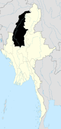 |
| Kanbalu District |
| |
| Kale District | ||
| Katha District | ||
| Mawlaik District | ||
| Monywa District | ||
| Sagaing District | ||
| Shwebo District | ||
| Tamu District |
| |
| Yinmabin District |
| |
| Naga Self-Administered Zone |
| |
| India |
| ||||
|---|---|---|---|---|---|
| Thailand |
| ||||
This article is issued from Wikipedia. The text is licensed under Creative Commons - Attribution - Sharealike. Additional terms may apply for the media files.