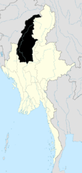
Pinlebu
Pinlebu is a town in Katha District, Sagaing Division of Myanmar on the Mu River. It is the administrative seat of Pinlebu Township. The town is connected by road to Phaungbyin, Kawlin, and Bamauk.[1] Its inhabitants include the Kadu and Kanan ethnic minorities, and the region has witnessed fighting between the Communists and the government troops.[2]
Pinlebu ပင်လယ်ဘူး | |
|---|---|
Town | |
 Pinlebu Location in Burma | |
| Coordinates: 24°04′53″N 95°22′13″E | |
| Country | |
| Region | |
| District | Katha |
| Township | Pinlebu Township |
| Elevation | 266 m (875 ft) |
| Time zone | UTC+6.30 (MST) |
Notes
- "General Maung Aye on tour of Sagaing Division". The New Light of Myanmar 7 March 2000. Archived from the original on 20 November 2008. Retrieved 20 November 2008.
- "Hmankin Range, native land of Kadu and Kanan nationals". The New Light of Myanmar 12 June 2003. Retrieved 20 November 2008.
gollark: Yes.
gollark: I'm beginning to wonder if this is some kind of sick joke by #8's authorm ,em.
gollark: Oh, never mind.
gollark: Wait, `openssl enc`? Is AES-256-CBC symmetric like that?
gollark: Obviously? How else would I do Solomnoff induction?
External links
- Map of Sagaing Division Asterism
- "Pinlebu Map — Satellite Images of Pinlebu" Maplandia.com
This article is issued from Wikipedia. The text is licensed under Creative Commons - Attribution - Sharealike. Additional terms may apply for the media files.
.svg.png)
