Htigyaing Township
Htigyaing Township or Tigyaing Township (Shan: ၸႄႈဝဵင်းတီႈၶင်ႉ ; Burmese: ထီးချိုင့်မြို့နယ်) is a township of Katha District in eastern Sagaing Division, in northern Burma (Myanmar). It lies on the border with the Shan State of Burma. The administrative seat is at Htigyaing.
Htigyaing Township | |
|---|---|
Township | |
 Htigyaing Township Location in Burma | |
| Coordinates: 23°46′0″N 96°8′0″E | |
| Country | |
| Region | Sagaing Region |
| District | Katha District |
| Capital | Htigyaing |
| Time zone | UTC+6.30 (MST) |
The Shweli River is a tributary of the Irrawaddy and forms part of the northern boundary with Katha Township and part of the eastern boundary with the Shan State.[1] The Indaung Reserved Forest and the Kyauktaung Reserved Forest are located in the eastern part of the township.[1]
Among the towns and villages in Tigyaing Township are: Aledaw, Datwin, Daungbin, Htidawgaing, Myadaung, Tawma and Wundingon.
Notes
- Army Map Service, Corps of Engineers, United States Army (1954) "Mong Mit, Burma" topographic map NF 47-1, Series U542
gollark: It could reasonably be argued that even if I just look at a thing and perfectly understand it enough to predict all its future conditions, I didn't cause it.
gollark: And again, God *set up the entire thing*.
gollark: Foreknowledge plus causing is... causing.
gollark: As repeatedly previously stated, God also caused those conditions, if they are omnipotent and/or created the universe.
gollark: I approximately preempted your joke by several decaseconds, actually.
External links
- Township 211 on "Myanmar States/Divisions & Townships Overview Map" Myanmar Information Management Unit (MIMU)
- "Tigyaing Google Satellite Map" Maplandia.com
Capital: Htigyaing | |
|
Capital: Sagaing | ||
| Hkamti District |
| .svg.png) 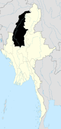 |
| Kanbalu District |
| |
| Kale District | ||
| Katha District | ||
| Mawlaik District | ||
| Monywa District | ||
| Sagaing District | ||
| Shwebo District | ||
| Tamu District |
| |
| Yinmabin District |
| |
| Naga Self-Administered Zone |
| |
This article is issued from Wikipedia. The text is licensed under Creative Commons - Attribution - Sharealike. Additional terms may apply for the media files.