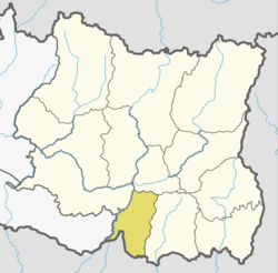
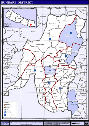
Sunsari District
Sunsari District (Nepali: सुनसरी जिल्ला![]()
Sunsari District सुनसरी जिल्ला | |
|---|---|
District | |
 | |
| Country | |
| Province | Province No. 1 |
| Established | 1962 |
| Administrative Headquarter | Inaruwa |
| Government | |
| • Type | Coordination committee |
| • Body | DCC, Sunsari |
| Area | |
| • Total | 1,257 km2 (485 sq mi) |
| Population (2011)[1] | |
| • Total | 763,497 |
| • Density | 610/km2 (1,600/sq mi) |
| Time zone | UTC+05:45 (NPT) |
| Website | www |
According to the 2011 Nepal census, the population was 763,487.[1] The district headquarters is located in Inaruwa.
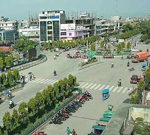
The area was originally part of Morang District but became its own district in 1962 when Nepal was divided into 14 zones and 75 districts. Major cities in Sunsari district are Inaruwa, Itahari, Jhumka and Dharan, and Duhabi. Some religious places of this district are Budha Subba Temple, Ramdhuni, Chataradham, Baraha Kshetra, Bishnupaduka, Dantakali, and Pindeshor Babadham.
Geography and climate
| Climate Zone[2] | Elevation Range | % of Area |
|---|---|---|
| Lower Tropical | below 300 meters (1,000 ft) | 86.6% |
| Upper Tropical | 300 to 1,000 meters 1,000 to 3,300 ft. |
7.8% |
| Subtropical | 1,000 to 2,000 meters 3,300 to 6,600 ft. |
2.0% |
Demographics
At the time of the 2011 Nepal census, Sunsari District had a population of 763,487. Of these, 29.1% spoke Nepali, 28.3% Maithili, 11.6% Tharu, 9.6% Urdu, 2.8% Uranw/Urau, 2.7% Limbu, 2.1% Newari, 1.8% Tamang, 1.6% Bantawa, 1.3% Magar, 0.7% Chamling, 0.6% Bhojpuri, 0.6% Bengali and 0.6% Gurung as their first language.
45.2% of the population in the district spoke Nepali, 5.9% Maithili, 2.1% Hindi and 1.6% Tharu as their second language.[3]
Administration
The district consists of two Sub-metropolitan Cities, four urban municipalities and six rural municipalities.[4] These are as follows:[5]
- Itahari Sub Metropolitan City
- Dharan Sub Metropolitan City
- Inaruwa Municipality
- Duhabi Municipality
- Ramdhuni Municipality
- Barahachhetra Municipality
- Koshi Rural Municipality
- Gadhi Rural Municipality
- Barju Rural Municipality
- Bhokraha Narashingh Rural Municipality
- Harinagara Rural Municipality
- Dewanganj Rural Municipality
Former Village Development Committees (VDCs) and Municipalities
- Amaduwa
- Amahibelha
- Aurabarni(Now Gadhi Gaupalika
- Bakalauri
- Barahachhetra
- Basantapur
- Bhadgaun Sinawari (now Ramdhuni-Bhasi Municipality)
- Bhaluwa (now Duhabi-Bhaluwa Municipality)
- Bharoul
- Bhokraha
- Bishnupaduka (now Dharan Municipality)
- Chadbela
- Chhitaha
- Chimdi
- Dewanganj
- Dharan Municipality
- Duhabi-Bhaluwa Municipality
- Dumaraha
- Gautampur
- Ghuski
- Harinagar
- Haripur
- Inaruwa Municipality
- Itahari Municipality
- Jalpapur
- Kaptanganj
- Laukahi
- Madheli
- Madhesa
- Madhuwan
- Madhyeharsahi
- Mahendranagar
- Narshinhatappu
- Panchakanya (now Dharan Municipality)
- Paschim Kasuha
- Prakashpur
- Purbakushaha
- Ramdhuni-Bhasi Municipality
- Ramganj Belgachhi
- Ramganj Senuwari
- Ramnagar Bhutaha
- Sahebganj
- Satterjhora
- Simariya
- Singiya (now Ramdhuni-Bhasi Municipality)
- Sonapur
- Sripurjabdi
- Tanamuna
See also
- Zones of Nepal
References
- Central Bureau of Statistics (2012). National Population and Housing Census 2011 (PDF). Kathmandu: Government of Nepal.
- The Map of Potential Vegetation of Nepal - a forestry/agroecological/biodiversity classification system (PDF), . Forest & Landscape Development and Environment Series 2-2005 and CFC-TIS Document Series No.110., 2005, ISBN 87-7903-210-9, retrieved Nov 22, 2013
- 2011 Nepal Census, Social Characteristics Tables
- "स्थानिय तह". 103.69.124.141. Retrieved 2018-12-04.
- "स्थानिय तह". 103.69.124.141. Retrieved 2018-12-06.
External links
| Wikimedia Commons has media related to Sunsari District. |
Places adjacent to Sunsari District | ||||||||||
|---|---|---|---|---|---|---|---|---|---|---|
| ||||||||||
Headquarter: Inaruwa | ||
| Rural Municipalities |
| |
| Municipalities |
| |
| Sub-metropolitan Cities | ||