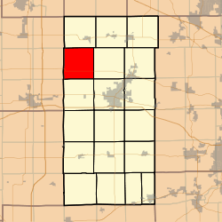
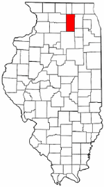
South Grove Township, DeKalb County, Illinois
South Grove Township is one of nineteen townships in DeKalb County, Illinois, USA. As of the 2010 census, its population was 512 and it contained 209 housing units.[2] South Grove Township was renamed from Vernon Township on November 20, 1850.
South Grove Township | |
|---|---|
 Location in DeKalb County | |
 DeKalb County's location in Illinois | |
| Coordinates: 42°01′24″N 88°53′19″W | |
| Country | |
| State | |
| County | DeKalb |
| Established | November 20, 1850 |
| Area | |
| • Total | 34.48 sq mi (89.3 km2) |
| • Land | 34.41 sq mi (89.1 km2) |
| • Water | 0.07 sq mi (0.2 km2) 0.20% |
| Elevation | 912 ft (278 m) |
| Population (2010) | |
| • Total | 512 |
| • Estimate (2016)[1] | 513 |
| • Density | 14.9/sq mi (5.8/km2) |
| Time zone | UTC-6 (CST) |
| • Summer (DST) | UTC-5 (CDT) |
| ZIP codes | 60111, 60129, 60146, 60150 |
| FIPS code | 17-037-70837 |
Geography
According to the 2010 census, the township has a total area of 34.48 square miles (89.3 km2), of which 34.41 square miles (89.1 km2) (or 99.80%) is land and 0.07 square miles (0.18 km2) (or 0.20%) is water.[2]
Unincorporated towns
Cemeteries
- Greenview
- South Grove
Airports and landing strips
- Vodden Airport
School districts
- DeKalb Community Unit School District 428
- Hiawatha Community Unit School District 426
- Sycamore Community Unit School District 427
Political districts
- Illinois's 16th congressional district
- State House District 70
- State Senate District 35
gollark: They are*!
gollark: As planned.
gollark: Python packaging is currently beyond comprehension.
gollark: I expect any sufficiently smart language to automatically find closed forms for any recurrence relations it sees.
gollark: A GOOD one would optimize it to the triangular number formula.
References
- "South Grove Township, DeKalb County, Illinois". Geographic Names Information System. United States Geological Survey. Retrieved 4 July 2010.
- US Census Bureau 2009 TIGER/Line Shapefiles
- US National Atlas
- "Population and Housing Unit Estimates". Retrieved June 9, 2017.
- "Population, Housing Units, Area, and Density: 2010 - County". US Census Bureau. Archived from the original on 12 February 2020. Retrieved 28 May 2013.
- "Census of Population and Housing". Census.gov. Retrieved June 4, 2016.
External links
This article is issued from Wikipedia. The text is licensed under Creative Commons - Attribution - Sharealike. Additional terms may apply for the media files.