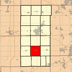
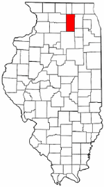
Clinton Township, DeKalb County, Illinois
Clinton Township is one of nineteen townships in DeKalb County, Illinois, USA. As of the 2010 census, its population was 1,868 and it contained 758 housing units.[2]
Clinton Township | |
|---|---|
 Location in DeKalb County | |
 DeKalb County's location in Illinois | |
| Coordinates: 41°45′49″N 88°46′34″W | |
| Country | |
| State | |
| County | DeKalb |
| Established | November 6, 1849 |
| Government | |
| • Supervisor | Janice Knudsen |
| • Town Clerk | Jeanne Tyne |
| • Assessor | Robert Knudsen |
| • Commissioner | Scott Hunt |
| • Trustee | Jerald Hipple James Wassmann Kip Anderson Charles George |
| Area | |
| • Total | 35.3 sq mi (91 km2) |
| • Land | 35.24 sq mi (91.3 km2) |
| • Water | 0.06 sq mi (0.2 km2) 0.17% |
| Elevation | 810 ft (247 m) |
| Population (2010) | |
| • Total | 1,868 |
| • Estimate (2016)[1] | 1,855 |
| • Density | 53/sq mi (20/km2) |
| Time zone | UTC-6 (CST) |
| • Summer (DST) | UTC-5 (CDT) |
| ZIP codes | 60518, 60520, 60550, 60552, 60556 |
| FIPS code | 17-037-14988 |
Geography
According to the 2010 census, the township has a total area of 35.3 square miles (91 km2), of which 35.24 square miles (91.3 km2) (or 99.83%) is land and 0.06 square miles (0.16 km2) (or 0.17%) is water.[2]
Cities, towns, villages
Cemeteries
- Johnson Grove
- North Clinton
Airports and landing strips
- Wade Airport
School districts
- Indian Creek Community Unit District 425
Political districts
- Illinois's 14th congressional district
- State House District 70
- State Senate District 35
gollark: Their colours and magic changed; not that significant.
gollark: Wyrms, based on extrapolation from the lore thread, only got mana-transformed a bit.
gollark: Zyus actually have completely different colour-dependent body types!
gollark: One must consider that in some ways zyu colours are much more different than xeno varieties.
gollark: It makes a bit of sense, since they're quite distinct, I guess.
References
- "Clinton Township, DeKalb County, Illinois". Geographic Names Information System. United States Geological Survey. Retrieved 4 July 2010.
- US Census Bureau 2009 TIGER/Line Shapefiles
- US National Atlas
- "Population and Housing Unit Estimates". Retrieved June 9, 2017.
- "Population, Housing Units, Area, and Density: 2010 - County". US Census Bureau. Archived from the original on 12 February 2020. Retrieved 28 May 2013.
- "Census of Population and Housing". Census.gov. Retrieved June 4, 2016.
External links
This article is issued from Wikipedia. The text is licensed under Creative Commons - Attribution - Sharealike. Additional terms may apply for the media files.