Somonauk Township, DeKalb County, Illinois
Somonauk Township is one of nineteen townships in DeKalb County, Illinois, USA. As of the 2010 census, its population was 2,101 and it contained 831 housing units.[2]
Somonauk Township | |
|---|---|
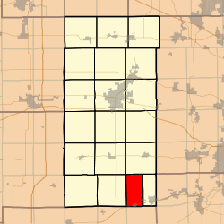 Location in DeKalb County | |
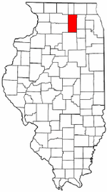 DeKalb County's location in Illinois | |
| Coordinates: 41°40′19″N 88°41′07″W | |
| Country | |
| State | |
| County | DeKalb |
| Established | November 6, 1849 |
| Area | |
| • Total | 19.33 sq mi (50.1 km2) |
| • Land | 19.25 sq mi (49.9 km2) |
| • Water | 0.08 sq mi (0.2 km2) 0.41% |
| Elevation | 715 ft (218 m) |
| Population (2010) | |
| • Total | 2,101 |
| • Estimate (2016)[1] | 2,091 |
| • Density | 109.2/sq mi (42.2/km2) |
| Time zone | UTC-6 (CST) |
| • Summer (DST) | UTC-5 (CDT) |
| ZIP codes | 60548, 60552 |
| FIPS code | 17-037-70473 |
Geography
According to the 2010 census, the township has a total area of 19.33 square miles (50.1 km2), of which 19.25 square miles (49.9 km2) (or 99.59%) is land and 0.08 square miles (0.21 km2) (or 0.41%) is water.[2]
Unincorporated towns
Cemeteries
- Oak Mound
- Oakridge
- Van Olindas
Airports and landing strips
- George Airport
- Warren Landing Strip
Lakes
- Buck Lake
School districts
- Sandwich Community Unit School District 430
- Somonauk Community Unit School District 432
Political districts
- Illinois's 14th congressional district
- State House District 70
- State Senate District 35
gollark: £60 or so now, probably.
gollark: You probably mostly want a generic non-awful FHD monitor.
gollark: Actually, the i5s don't have E-cores, so it might be there but disabled mostly.
gollark: Ironically, ADL doesn't even have it.
gollark: Also, everything since I think Kaby Lake is DDR4 only (well, LPDDR4 too, and DDR5 on ADL).
References
- "Somonauk Township, DeKalb County, Illinois". Geographic Names Information System. United States Geological Survey. Retrieved 4 July 2010.
- US Census Bureau 2009 TIGER/Line Shapefiles
- US National Atlas
- "Population and Housing Unit Estimates". Retrieved June 9, 2017.
- "Population, Housing Units, Area, and Density: 2010 - County". US Census Bureau. Archived from the original on 12 February 2020. Retrieved 28 May 2013.
- "Census of Population and Housing". Census.gov. Retrieved June 4, 2016.
External links
Places adjacent to Somonauk Township, DeKalb County, Illinois | |
|---|---|
Municipalities and communities of DeKalb County, Illinois, United States | ||
|---|---|---|
| Cities | Map of Illinois highlighting DeKalb County | |
| Town | ||
| Villages | ||
| Townships | ||
| Unincorporated communities | ||
| Ghost towns | ||
| Footnotes | ‡This populated place also has portions in an adjacent county or counties | |
This article is issued from Wikipedia. The text is licensed under Creative Commons - Attribution - Sharealike. Additional terms may apply for the media files.