South Carolina Highway 59
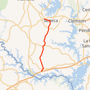
South Carolina Highway 59 (SC 59) is a 15.6-mile-long (25.1 km) state highway in the northwestern part of the U.S. state of South Carolina. The highway travels in a south-north orientation from just southwest of Fair Play north and then northeast to Seneca, completely within Oconee County.
| ||||
|---|---|---|---|---|
| ||||
| Route information | ||||
| Maintained by SCDOT | ||||
| Length | 15.6 mi[1] (25.1 km) | |||
| Existed | 1942–present | |||
| Major junctions | ||||
| South end | ||||
| North end | ||||
| Location | ||||
| Counties | Oconee | |||
| Highway system | ||||
| ||||

Route description
SC 59 begins at an interchange with Interstate 85 (I-85) just southwest of Fair Play. The route heads northeast into town, and intersects SC 182/SC 243. After leaving town, SC 59 heads northwest and turns to the northwest to intersect SC 24. The road heads on its northeast trajectory until it meets its northern terminus, an intersection with U.S. Route 76 (US 76), US 123, SC 28 in Seneca.[1]
History
Established in 1942 as a renumbering of SC 181 and part of SC 182, SC 59 traversed from the Georgia state line to Fair Play, then north to Seneca ending at US 76/SC 13/SC 28. By 1963, SC 59 was truncated at I-85 due to Lake Hartwell submerging the route to Georgia. The portion south of I-85 that was not submerged were downgraded to secondary road Lakeshore Drive (S-37-11). In 2000, SC 59 was extended northwest along West North 1st Street in Seneca, to its current northern terminus with US 76/US 123/SC 28.
Historically, there was one previous SC 59 between 1930-1942; it ran from SC 55 near Clover to SC 58/SC 163 near Lake Wylie. In 1942, the highway was renumbered as SC 557.
Junction list
The entire route is in Oconee County.
| Location | mi[1] | km | Destinations | Notes | |
|---|---|---|---|---|---|
| | 0.0 | 0.0 | Exit 2 (I-85) | ||
| Fair Play | 1.1 | 1.8 | Eastern terminus of SC 182; western terminus of SC 243 | ||
| | 7.1 | 11.4 | Southern end of SC 24 concurrency | ||
| | 7.3 | 11.7 | Northern end of SC 24 concurrency | ||
| Seneca | 14.1 | 22.7 | Southern terminus of SC 130 | ||
| 15.6 | 25.1 | ||||
1.000 mi = 1.609 km; 1.000 km = 0.621 mi
| |||||
See also


References
- Google (February 4, 2013). "Route of SC 59" (Map). Google Maps. Google. Retrieved February 4, 2013.
External links

- Mapmikey's South Carolina Highways Page: SC50-59