Slievemaan
Slievemaan (Irish: Sliabh Meáin, meaning "Middle mountain")[2] at 759 metres (2,490 ft), is the 54th–highest peak in Ireland on the Arderin scale,[3] and the 70th–highest peak on the Vandeleur-Lynam scale.[4][5] Slievemaan is situated in the southwen sector of the Wicklow Mountains range, and is part of the large massif of Lugnaquilla 925 metres (3,035 ft), Wicklow's highest mountain.[6] Slievemaan lies at the southern end of the Glen of Imaal.[6][7]
| Slievemaan | |
|---|---|
| Sliabh Meáin | |
 | |
| Highest point | |
| Elevation | 759 m (2,490 ft) [1] |
| Prominence | 54 m (177 ft) [1] |
| Listing | Hewitt, Arderin, Simm, Vandeleur-Lynam |
| Coordinates | 52.958821°N 6.486565°W |
| Geography | |
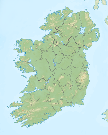 Slievemaan Location in Ireland | |
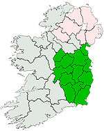
| Location | Wicklow, Ireland |
| Parent range | Wicklow Mountains |
| OSI/OSNI grid | T017918[1] |
| Topo map | OSi Discovery 56 |
| Geology | |
| Mountain type | Dark slate-schist, quartzite & coticule[1] |
To the west of Slievemaan is the subsidiary peak of Ballineddan Mountain 652 metres (2,139 ft), whose prominence of 27 metres (89 ft) qualifies it as a Vandeleur-Lynam.[5]
Slievemann is sometimes confused with the other Wicklow mountain of Slieve Maan which is lower at 548 metres (1,798 ft).[2]
Bibliography
- Fairbairn, Helen (2014). Dublin & Wicklow: A Walking Guide. Collins Press. ISBN 978-1848892019.
- MountainViews Online Database (Simon Stewart) (2013). A Guide to Ireland's Mountain Summits: The Vandeleur-Lynams & the Arderins. Collins Books. ISBN 978-1-84889-164-7.
- Dillion, Paddy (1993). The Mountains of Ireland: A Guide to Walking the Summits. Cicerone. ISBN 978-1852841102.
See also
References
- "Slievemaan". MountainViews Online Database. Retrieved 8 February 2019.
- Paul Tempan (February 2012). "Irish Hill and Mountain Names" (PDF). MountainViews.ie.
- Simon Stewart (October 2018). "Arderins: Irish mountains of 500+m with a prominence of 30m". MountainViews Online Database.
- Simon Stewart (October 2018). "Vandeleur-Lynams: Irish mountains of 600+m with a prominence of 15m". MountainViews Online Database.
- Mountainviews, (September 2013), "A Guide to Ireland's Mountain Summits: The Vandeleur-Lynams & the Arderins", Collins Books, Cork, ISBN 978-1-84889-164-7
- Dillion, Paddy (1993). The Mountains of Ireland: A Guide to Walking the Summits. Cicerone. ISBN 978-1852841102.
Walk 10: Ballineddan Mountain, Slievemaan, Lugnaquillia, Camenabologue East Top, Camenabologue
- Fairbairn, Helen (2014). Dublin & Wicklow: A Walking Guide. Collins Press. ISBN 978-1848892019.
External links
- MountainViews: The Irish Mountain Website, Slievemaan
- MountainViews: Irish Online Mountain Database
- The Database of British and Irish Hills , the largest database of British Isles mountains ("DoBIH")
- Hill Bagging UK & Ireland, the searchable interface for the DoBIH
| British Isles | 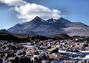 | |
|---|---|---|
| Scotland | ||
| Outside Scotland | ||
| England | ||
| Ireland | ||
| County tops | ||
.jpg)