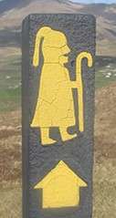
Monaghan Way
The Monaghan Way (Irish: Slí Mhuineacháin)[3] is a long-distance trail in County Monaghan, Ireland. It is 65-kilometre (40-mile) long and begins in Monaghan Town and ends in Inniskeen. It is typically completed in three days.[1] It is designated as a National Waymarked Trail by the National Trails Office of the Irish Sports Council and is managed by Monaghan County Council and the Monaghan Way Committee.[4]
| Monaghan Way | |
|---|---|
| Length | 65 km (40 mi)[1] |
| Location | County Monaghan, Ireland |
| Designation | National Waymarked Trail[1] |
| Trailheads | Monaghan Town, Inniskeen |
| Use | Hiking |
| Elevation | |
| Highest point | Mullyash (317 m (1,040 ft)[2] |
| Hiking details | |
| Trail difficulty | Moderate[1] |
| Season | Any |
The trail begins in Monaghan Town and travels east towards Castleblayney, via Castleshane and Clontibret.[5] From Castleblayney the route passes Lough Muckno and Lough Ross before following the alignment of a disused railway line along the River Fane to reach the end at Iniskeen.[6][1]
References
Notes
- "Monaghan Way". IrishTrails. Irish Sports Council. Retrieved 3 August 2011.
- Monaghan Tourism, 2007 & p-14.
- Monaghan Tourism 2007, p. 1.
- National Trails Office 2010, p. 40.
- Monaghan Tourism 2007, p. 15.
- Monaghan Tourism 2007, p. 17.
Bibliography
- Monaghan Tourism (2007). "Monaghan Way" (PDF). Monaghan Tourism. Archived from the original (pdf) on 5 August 2011. Retrieved 3 August 2011.CS1 maint: ref=harv (link)
- National Trails Office (2010). "Setting New Directions. A review of National Waymarked Ways in Ireland" (PDF). Dublin: Irish Sports Council. Archived from the original (pdf) on 31 May 2011. Retrieved 1 August 2011.CS1 maint: ref=harv (link)
External links
- Monaghan Way (pdf) at Monaghan Tourism
- Monaghan Way at IrishTrails.ie
This article is issued from Wikipedia. The text is licensed under Creative Commons - Attribution - Sharealike. Additional terms may apply for the media files.
.jpg)
