Saulon-la-Rue
Saulon-la-Rue is a commune in the Côte-d'Or department in eastern France.
Saulon-la-Rue | |
|---|---|
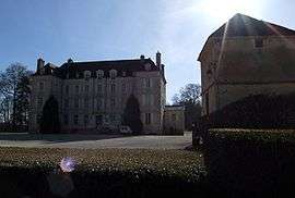 Chateau | |
.svg.png) Coat of arms | |
Location of Saulon-la-Rue 
| |
 Saulon-la-Rue  Saulon-la-Rue | |
| Coordinates: 47°13′21″N 5°03′52″E | |
| Country | France |
| Region | Bourgogne-Franche-Comté |
| Department | Côte-d'Or |
| Arrondissement | Beaune |
| Canton | Nuits-Saint-Georges |
| Intercommunality | Sud Dijonnais |
| Government | |
| • Mayor (2008–2014) | Alexandre Garneret |
| Area 1 | 4.53 km2 (1.75 sq mi) |
| Population (2017-01-01)[1] | 703 |
| • Density | 160/km2 (400/sq mi) |
| Time zone | UTC+01:00 (CET) |
| • Summer (DST) | UTC+02:00 (CEST) |
| INSEE/Postal code | 21586 /21910 |
| Elevation | 211–233 m (692–764 ft) |
| 1 French Land Register data, which excludes lakes, ponds, glaciers > 1 km2 (0.386 sq mi or 247 acres) and river estuaries. | |
Population
| Year | Pop. | ±% |
|---|---|---|
| 1962 | 237 | — |
| 1968 | 238 | +0.4% |
| 1975 | 326 | +37.0% |
| 1982 | 378 | +16.0% |
| 1990 | 451 | +19.3% |
| 1999 | 526 | +16.6% |
| 2008 | 571 | +8.6% |
gollark: It has A72s, so bad.
gollark: I'm not sure what Rockchip said.
gollark: I'm hoping Rockchip actually release it because I really want one.
gollark: This is quite cool!
gollark: This (alleged) upcoming Rockchip SoC is apparently performance-competitive with my old x86 server!
See also
References
- "Populations légales 2017". INSEE. Retrieved 6 January 2020.
| Wikimedia Commons has media related to Saulon-la-Rue. |
| Authority control |
|
|---|
This article is issued from Wikipedia. The text is licensed under Creative Commons - Attribution - Sharealike. Additional terms may apply for the media files.