Fain-lès-Montbard
Fain-lès-Montbard is a commune in the Côte-d'Or department in eastern France.
Fain-lès-Montbard | |
|---|---|
Location of Fain-lès-Montbard 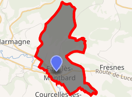
| |
 Fain-lès-Montbard  Fain-lès-Montbard | |
| Coordinates: 47°36′29″N 4°24′00″E | |
| Country | France |
| Region | Bourgogne-Franche-Comté |
| Department | Côte-d'Or |
| Arrondissement | Montbard |
| Canton | Montbard |
| Intercommunality | Montbardois |
| Government | |
| • Mayor (2014-2020) | Bernard Pernet |
| Area 1 | 7.48 km2 (2.89 sq mi) |
| Population (2017-01-01)[1] | 300 |
| • Density | 40/km2 (100/sq mi) |
| Time zone | UTC+01:00 (CET) |
| • Summer (DST) | UTC+02:00 (CEST) |
| INSEE/Postal code | 21259 /21500 |
| Elevation | 213–362 m (699–1,188 ft) (avg. 225 m or 738 ft) |
| 1 French Land Register data, which excludes lakes, ponds, glaciers > 1 km2 (0.386 sq mi or 247 acres) and river estuaries. | |
Population
| Year | Pop. | ±% |
|---|---|---|
| 2005 | 278 | — |
| 2006 | 274 | −1.4% |
| 2007 | 274 | +0.0% |
| 2008 | 283 | +3.3% |
| 2009 | 292 | +3.2% |
| 2010 | 301 | +3.1% |
| 2011 | 301 | +0.0% |
| 2012 | 309 | +2.7% |
| 2013 | 307 | −0.6% |
| 2014 | 304 | −1.0% |
| 2015 | 301 | −1.0% |
| 2016 | 300 | −0.3% |
gollark: At what now?
gollark: Or third-party ones, really.
gollark: Why would mobile do the LEAST? It has access to more device APIs. It's almost certainly web.
gollark: chessbut hyperbolic geometry somehow?
gollark: EW*Q*?
See also
References
- "Populations légales 2017". INSEE. Retrieved 6 January 2020.
| Wikimedia Commons has media related to Fain-lès-Montbard. |
This article is issued from Wikipedia. The text is licensed under Creative Commons - Attribution - Sharealike. Additional terms may apply for the media files.