Drambon
Drambon is a commune in the Côte-d'Or department in eastern France.
Drambon | |
|---|---|
The confluence of the Bèze and Alban rivers in Drambon | |
.svg.png) Coat of arms | |
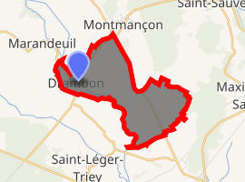
Location of Drambon 
| |
 Drambon  Drambon | |
| Coordinates: 47°20′16″N 5°21′43″E | |
| Country | France |
| Region | Bourgogne-Franche-Comté |
| Department | Côte-d'Or |
| Arrondissement | Dijon |
| Canton | Auxonne |
| Government | |
| • Mayor (2008–2014) | Jean-Pierre Chaume |
| Area 1 | 4.77 km2 (1.84 sq mi) |
| Population (2017-01-01)[1] | 186 |
| • Density | 39/km2 (100/sq mi) |
| Time zone | UTC+01:00 (CET) |
| • Summer (DST) | UTC+02:00 (CEST) |
| INSEE/Postal code | 21233 /21270 |
| Elevation | 186–207 m (610–679 ft) (avg. 192 m or 630 ft) |
| 1 French Land Register data, which excludes lakes, ponds, glaciers > 1 km2 (0.386 sq mi or 247 acres) and river estuaries. | |
Population
| Year | Pop. | ±% |
|---|---|---|
| 1962 | 98 | — |
| 1968 | 104 | +6.1% |
| 1975 | 80 | −23.1% |
| 1982 | 79 | −1.2% |
| 1990 | 112 | +41.8% |
| 1999 | 139 | +24.1% |
| 2008 | 165 | +18.7% |
gollark: It is perhaps one of the biggest franchises of the 21st century CE/0th century EWT.
gollark: <@!330678593904443393> Emu War is not a *joke*.
gollark: Wait, you mean the *Australian* Emu War in... er, before 2000... or the Emu *Canon* War?
gollark: Emu War: Achievement Unlocked, as opposed to Emu War Advanced Ultra, right?
gollark: You can actually get it through browser caching on some versions.
See also
References
- "Populations légales 2017". INSEE. Retrieved 6 January 2020.
| Wikimedia Commons has media related to Drambon. |
This article is issued from Wikipedia. The text is licensed under Creative Commons - Attribution - Sharealike. Additional terms may apply for the media files.