Queenzieburn
Queenzieburn (Scots: Queenieburn)[1] is a small settlement in North Lanarkshire, Scotland. Its estimated population is 520.[2] It is located near the town of Kilsyth and has a small industrial estate. The village has one school called Chapelgreen Primary. Senior pupils usually attend Kilsyth Academy.
Queenzieburn
| |
|---|---|
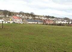 Queenzieburn viewed from the west | |
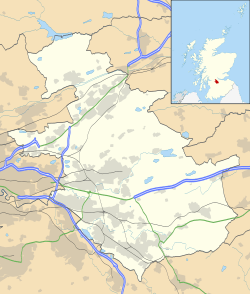 Queenzieburn Location within North Lanarkshire | |
| Population | 520 |
| Council area | |
| Lieutenancy area | |
| Country | Scotland |
| Sovereign state | United Kingdom |
| Post town | Glasgow |
| Postcode district | G65 |
| Police | Scotland |
| Fire | Scottish |
| Ambulance | Scottish |
| UK Parliament | |
Etymology
Queenzieburn is pronounced /kwiːnibɜːrn/. This is due to the original Scots spelling, Queenȝieburn, containing the letter yogh, which was later erroneously confused with the tailed z. The meaning may be ‘stream, of the wedge place’.[3]
Notable residents
Entertainer Janette Tough who, along with her husband Ian, make up the comedy duo the Krankies grew up in Queenzieburn.[4]
.jpg)
Queenzieburn and Kilsyth from the air. The four main vertical lines looking roughly eastwards at the bottom of the picture are: Glasgow Road through Queenzieburn and Kilsyth, the line of the old Kelvin Valley Railway Line near Gavell Station,[5] the River Kelvin, and the Forth and Clyde Canal
gollark: As a fallback fallback, it will find channels in the same server to post in.
gollark: As a fallback, it will DM you.
gollark: It will attempt to send the reminder in the original channel it was sent in.
gollark: No.
gollark: It could be made to send reminders when they're actually due. It just doesn't, out of spite.
References
- "The Online Scots Dictionary". Scots Online. Retrieved 30 June 2017.
- "Estimated population of localities by broad age groups, mid-2012" (PDF). Retrieved 3 January 2018.
- Drummond, Peter, John (2014). An analysis of toponyms and toponymic patterns in eight parishes of the upper Kelvin basin (PDF). Glasgow: Glasgow University. p. 278. Retrieved 3 July 2017.
- https://www.cumbernauld-news.co.uk/news/get-well-soon-wee-jimmy-1-356368
- "25 inch O.S. Map with Bing slider". N.L.S. Ordnance Survey. Retrieved 13 February 2018.
External links
| Wikimedia Commons has media related to Queenzieburn. |

This article is issued from Wikipedia. The text is licensed under Creative Commons - Attribution - Sharealike. Additional terms may apply for the media files.