Stand, North Lanarkshire
Stand is a hamlet in North Lanarkshire, Scotland situated on the A73 near Airdrie.[1] Its Ordnance Survey grid reference is NS7668.[2]
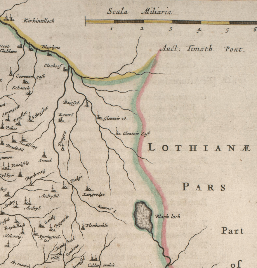
The village appeared on a map by Timothy Pont, published in 1596.[3] It is near the top right of the map near the Black Loch.
Stand is also shown on another map by Roy c1754.[4] The etymology of the name is uncertain although a horse stop or stabling point has been suggested.[5] It is between the Fleming estates at Biggar and Cumbernauld.[6]
Facilities
There is a bed and breakfast in Stand. For more facilities, residents can travel to nearby towns such as Airdrie, Coatbridge and Cumbernauld, along with the nearby cities of Glasgow and Stirling.

Stand from Blaeu's Map based on Pont's
gollark: Bees are genetically scanned in the machines.
gollark: We condense excess unwanted bees into singularities.
gollark: It's an SSD (rack mount).
gollark: Look up server self destructors.
gollark: There are.
References
- "OS 25 inch, 1892-1905". National Library of Scotland. Ordnance Survey. Retrieved 9 June 2017.
- "O.S. Map with zoom and Bing overlay". National Library of Scotland. Ordnance Survey. Retrieved 30 December 2017.
- "Glasgow and the county of Lanark - Pont 34". Maps of Scotland. Timothy Pont (16th century). Retrieved 31 December 2017.
- "Roy's map of the Lowlands". National Library of Scotland. Retrieved 3 January 2018.
- Drummond, Peter, John (2014). An analysis of toponyms and toponymic patterns in eight parishes of the upper Kelvin basin (PDF). Glasgow: Glasgow University. p. 366. Retrieved 3 July 2017.
- Hawes, Claire. "The Flemings of Biggar and Cumbernauld". St Andrews Institute of Scottish Historical Research. Retrieved 3 January 2018.
This article is issued from Wikipedia. The text is licensed under Creative Commons - Attribution - Sharealike. Additional terms may apply for the media files.
