Pine Township, Benton County, Indiana
Pine Township is one of eleven townships in Benton County, Indiana. As of the 2010 census, its population was 330 and it contained 115 housing units.[3] Pine Township was one of the original three created by county commissioners in July 1840, and is named for Big Pine Creek which flows south through the township.[4]
Pine Township | |
|---|---|
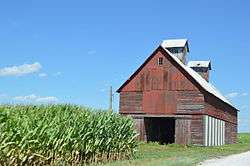 Cornfield and grain crib on E100N | |
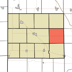 Location of Pine Township in Benton County | |
| Coordinates: 40°35′56″N 87°09′03″W | |
| Country | United States |
| State | Indiana |
| County | Benton |
| Organized | July 1840 |
| Government | |
| • Type | Indiana township |
| Area | |
| • Total | 35.66 sq mi (92.4 km2) |
| • Land | 35.66 sq mi (92.4 km2) |
| • Water | 0 sq mi (0 km2) |
| Elevation | 735 ft (224 m) |
| Population (2010) | |
| • Total | 330 |
| • Density | 9.3/sq mi (3.6/km2) |
| Time zone | UTC-5 (EST) |
| • Summer (DST) | UTC-4 (EDT) |
| FIPS code | 18-59886[2] |
| GNIS feature ID | 453738 |
Geography
According to the 2010 census, the township has a total area of 35.66 square miles (92.4 km2), all land.[3]
Adjacent townships
- Bolivar (south)
- Center (west)
- Gilboa (north)
- Oak Grove (southwest)
- Union (northwest)
- Round Grove Township, White County (east)
- Shelby Township, Tippecanoe County (southeast)
- West Point Township, White County (northeast)
Major highways
gollark: The new version comes with teapot detection which I think is neat.
gollark: Amazing.
gollark: I don't know if I actually use any 1.4.2 features.
gollark: You should be able to just change the nim version it asks for.
gollark: It has to store historical uptime data for things.
References
- "US Board on Geographic Names". United States Geological Survey. 2007-10-25. Retrieved 2008-01-31.
- "U.S. Census website". United States Census Bureau. Retrieved 2008-01-31.
- "Population, Housing Units, Area, and Density: 2010 - County -- County Subdivision and Place -- 2010 Census Summary File 1". United States Census. Archived from the original on 2020-02-12. Retrieved 2013-05-10.
- Birch, Jesse Setlington (1942) [1928]. History of Benton County and Historic Oxford. Oxford, Indiana: Craw & Craw, Inc. p. 21.
External links
Municipalities and communities of Benton County, Indiana, United States | ||
|---|---|---|
| Towns | Map of Indiana highlighting Benton County | |
| Townships | ||
| Unincorporated communities | ||
| Ghost towns | ||
| Footnotes | ‡This populated place also has portions in an adjacent county or counties | |
This article is issued from Wikipedia. The text is licensed under Creative Commons - Attribution - Sharealike. Additional terms may apply for the media files.