Lochiel, Indiana
Lochiel is an unincorporated community in Union Township, Benton County, in the U.S. state of Indiana.[2]
Lochiel, Indiana | |
|---|---|
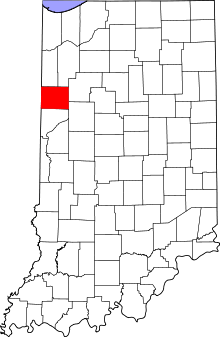 Benton County's location in Indiana | |
 Lochiel Lochiel's location in Benton County | |
| Coordinates: 40°39′51″N 087°16′26″W | |
| Country | United States |
| State | Indiana |
| County | Benton County |
| Township | Union Township |
| Elevation | 797 ft (243 m) |
| Time zone | UTC-5 (Eastern (EST)) |
| • Summer (DST) | UTC-4 (EDT) |
| ZIP code | 47944 |
| Area code(s) | 765 |
| GNIS feature ID | 438196 |
History
A post office at Lochiel was established in 1883, and remained in operation until it was discontinued in 1907.[3] The community was named after Clan Cameron, also known as Lochiel.[4]
Geography
Lochiel is located at 40°39′51″N 087°16′26″W at an elevation of 797 feet.
gollark: At least use an actual fridge thing and not thermoelectric cooling!
gollark: It would do that anyway, something something convergent instrumental goals.
gollark: Well, okay, not literally the worst, but a bad one.
gollark: Isn't that basically the worst way to get water?
gollark: No, do NOT launch your ideology everywhere without beta testing!
References
- "US Board on Geographic Names". United States Geological Survey. 2007-10-25. Retrieved 2008-01-31.
- "Lochiel, Indiana". Geographic Names Information System. United States Geological Survey. Retrieved February 29, 2020.
- "Benton County". Jim Forte Postal History. Retrieved 26 August 2014.
- Baker, Ronald L. (October 1995). From Needmore to Prosperity: Hoosier Place Names in Folklore and History. Indiana University Press. p. 200. ISBN 978-0-253-32866-3.
Lochiel is the title of the Camerons.
Municipalities and communities of Benton County, Indiana, United States | ||
|---|---|---|
| Towns | Map of Indiana highlighting Benton County | |
| Townships | ||
| Unincorporated communities | ||
| Ghost towns | ||
| Footnotes | ‡This populated place also has portions in an adjacent county or counties | |
This article is issued from Wikipedia. The text is licensed under Creative Commons - Attribution - Sharealike. Additional terms may apply for the media files.