Freeland Park, Indiana
Freeland Park is an unincorporated community in Parish Grove Township, Benton County, in the U.S. state of Indiana.[3] It is part of the Lafayette, Indiana Metropolitan Statistical Area.
Freeland Park, Indiana | |
|---|---|
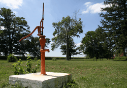 A water pump in the town park | |
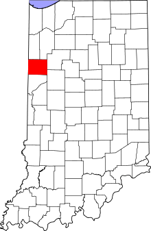 Benton County's location in Indiana | |
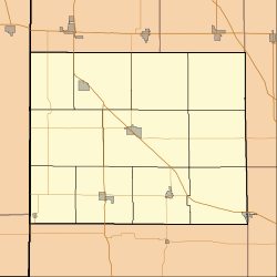 Freeland Park Freeland Park's location in Benton County | |
| Coordinates: 40°36′52″N 87°29′28″W | |
| Country | United States |
| State | Indiana |
| County | Benton |
| Township | Parish Grove |
| Elevation | 722 ft (220 m) |
| Time zone | UTC-5 (Eastern (EST)) |
| • Summer (DST) | UTC-4 (EDT) |
| ZIP code | 47944 |
| Area code(s) | 765 |
| FIPS code | 18-25792[2] |
| GNIS feature ID | 434812 |
History
Freeland Park was named for Antoine Freeland, the original owner of the town site.[4] It stood at the terminus of the Freeland Park branch of the Chicago and Eastern Illinois Railroad. A fire in 1914 badly damaged the town's business district. In the 1920s Freeland Park had two grain elevators, a high school, a Presbyterian church and eight to ten businesses.[5]
A post office was established at Freeland Park in 1901, and remained in operation until it was discontinued in 1957.[6]
Geography
Freeland Park is located at 40°36′52″N 87°29′28″W, half a mile south of the intersection of Indiana State Roads 18 and 71 and a little under two miles east of the Illinois state line. A small waterway known as Salmon Ditch runs just north of town and flows west into Illinois where it becomes Cole Creek.
References
- "US Board on Geographic Names". United States Geological Survey. 2007-10-25. Retrieved 2008-01-31.
- "U.S. Census website". United States Census Bureau. Retrieved 2008-01-31.
- "Freeland Park, Indiana". Geographic Names Information System. United States Geological Survey. Retrieved February 29, 2020.
- Baker, Ronald L. (October 1995). From Needmore to Prosperity: Hoosier Place Names in Folklore and History. Indiana University Press. p. 138. ISBN 978-0-253-32866-3.
...and named for Antoine Freeland, who owned the land.
- Birch, Jesse Setlington (1942) [1928]. "Unincorporated community s of the County". History of Benton County and Historic Oxford. Oxford, Indiana: Craw & Craw. p. 202.
- "Benton County". Jim Forte Postal History. Archived from the original on 3 September 2014. Retrieved 26 August 2014.
Municipalities and communities of Benton County, Indiana, United States | ||
|---|---|---|
| Towns | Map of Indiana highlighting Benton County | |
| Townships | ||
| Unincorporated communities | ||
| Ghost towns | ||
| Footnotes | ‡This populated place also has portions in an adjacent county or counties | |