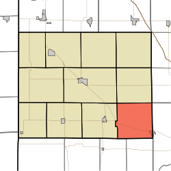
Bolivar Township, Benton County, Indiana
Bolivar Township is one of eleven townships in Benton County, Indiana.[3] As of the 2010 census, its population was 1,252 and it contained 548 housing units.[4] Bolivar Township was organized in March 1860 and named for South American liberator Simón Bolivar.[5]
Bolivar Township | |
|---|---|
 Location of Bolivar Township in Benton County | |
| Coordinates: 40°31′35″N 87°09′54″W | |
| Country | United States |
| State | Indiana |
| County | Benton |
| Organized | March 1860 |
| Named for | Simón Bolivar |
| Government | |
| • Type | Indiana township |
| Area | |
| • Total | 36.1 sq mi (93 km2) |
| • Land | 36.1 sq mi (93 km2) |
| • Water | 0 sq mi (0 km2) |
| Elevation | 712 ft (217 m) |
| Population (2010) | |
| • Total | 1,252 |
| • Density | 34.7/sq mi (13.4/km2) |
| Time zone | UTC-5 (EST) |
| • Summer (DST) | UTC-4 (EDT) |
| Area code(s) | 765 |
| FIPS code | 18-06328[2] |
| GNIS feature ID | 453122 |
Geography
According to the 2010 census, the township has a total area of 36.1 square miles (93 km2), all land.[4]
Cities and towns
- Otterbein (west half)
Adjacent townships
- Center (northwest)
- Oak Grove (west)
- Pine (north)
- Adams Township, Warren County (southwest)
- Medina Township, Warren County (south)
- Round Grove Township, White County (northeast)
- Shelby Township, Tippecanoe County (east)
Major highways
Cemeteries
The township contains one cemetery, Griffin.
Education
gollark: See, I thought to myself "wait, a 6 isn't really considered good where I am, but if you map it to the letter grades it's a **C**. And there are 5 grades below it now".
gollark: I'm GETTING to that.
gollark: Yes, essays bad.
gollark: I mean, also, I generally am not very good at English stuff. During our mock exams, I really struggled to write some essays in the 2-hour time we had and didn't think they were very good. And they weren't really, I got a 6.
gollark: I mean, GCSE maths isn't very hard. I don't even do that much revision.
References
- "Bolivar Township, Benton County, Indiana". Geographic Names Information System. United States Geological Survey. Retrieved 2009-09-24.
- United States Census Bureau cartographic boundary files
- "US Board on Geographic Names". United States Geological Survey. 2007-10-25. Retrieved 2008-01-31.
- "U.S. Census website". United States Census Bureau. Retrieved 2008-01-31.
- "Bolivar Township, Benton County, Indiana". Geographic Names Information System. United States Geological Survey. Retrieved March 1, 2020.
- "Population, Housing Units, Area, and Density: 2010 - County -- County Subdivision and Place -- 2010 Census Summary File 1". United States Census. Archived from the original on 2020-02-12. Retrieved 2013-05-10.
- Birch, Jesse Setlington (1942) [1928]. History of Benton County and Historic Oxford. Oxford, Indiana: Craw & Craw, Incorporated. p. 21.
This article is issued from Wikipedia. The text is licensed under Creative Commons - Attribution - Sharealike. Additional terms may apply for the media files.