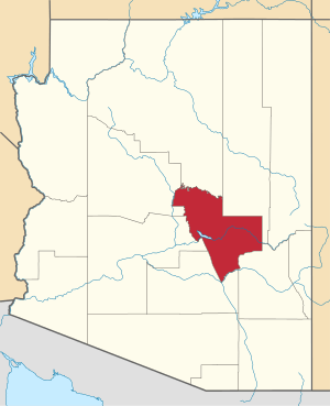
Pinal, Arizona
Pinal is a census-designated place (CDP) in Gila County, Arizona, United States. The population was 439 at the 2010 census.[3]
Pinal, Arizona | |
|---|---|
 Pinal  Pinal | |
| Coordinates: 33°22′44″N 110°45′14″W | |
| Country | United States |
| State | Arizona |
| County | Gila |
| Area | |
| • Total | 0.44 sq mi (1.14 km2) |
| • Land | 0.44 sq mi (1.14 km2) |
| • Water | 0.00 sq mi (0.00 km2) |
| Elevation | 3,800 ft (1,200 m) |
| Population (2010) | |
| • Total | 2,387 |
| • Estimate (2016)[2] | N/A |
| Time zone | UTC-7 (MST (no DST)) |
| Area code(s) | 928 |
| FIPS code | 04-55630 |
| GNIS feature ID | 0032906 |
Geography
The CDP is located in southern Gila County southeast of the center of Globe, the county seat. The CDP is bordered by the Globe city limits to the north, east, and south. U.S. Route 70 forms the northeast edge of the CDP; downtown Globe is 2.5 miles (4.0 km) to the northwest, and Peridot is 18 miles (29 km) to the southeast. According to the United States Census Bureau, the Pinal CDP has a total area of 0.44 square miles (1.14 km2), all of it land.[3]
Demographics
| Historical population | |||
|---|---|---|---|
| Census | Pop. | %± | |
| U.S. Decennial Census[4] | |||
gollark: For just keeping the server on, you probably don't even need an actual bot, just something which pokes the server's port enough to make it think the software automatically managing it think it's active.
gollark: OC can!
gollark: "Stable" and "high level"?
gollark: It is not.
gollark: That's the CURRENT existing krist. It says so.
References
- "2016 U.S. Gazetteer Files". United States Census Bureau. Retrieved Jul 18, 2017.
- "Population and Housing Unit Estimates". Retrieved June 9, 2017.
- "Geographic Identifiers: 2010 Demographic Profile Data (G001): Pinal CDP, Arizona". U.S. Census Bureau, American Factfinder. Retrieved November 2, 2016.
- "Census of Population and Housing". Census.gov. Retrieved June 4, 2016.
This article is issued from Wikipedia. The text is licensed under Creative Commons - Attribution - Sharealike. Additional terms may apply for the media files.