Geronimo Estates, Arizona
Geronimo Estates is both a census-designated place (CDP) and a populated place in Gila County, Arizona, United States. The population of the CDP was 60 at the 2010 census.[4]
Geronimo Estates, Arizona | |
|---|---|
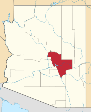
 Geronimo Estates Location within the state of Arizona  Geronimo Estates Geronimo Estates (the United States) | |
| Coordinates: 34°22′10″N 111°21′42″W | |
| Country | United States |
| State | Arizona |
| County | Gila |
| Area | |
| • Total | 1.32 sq mi (3.43 km2) |
| • Land | 1.32 sq mi (3.43 km2) |
| • Water | 0.00 sq mi (0.00 km2) |
| Elevation | 5,334 ft (1,626 m) |
| Population (2010) | |
| • Total | 1,314 |
| • Estimate (2016)[3] | N/A |
| Time zone | UTC-7 (MST (no DST)) |
| Area code(s) | 928 |
| FIPS code | 04-26780 |
| GNIS feature ID | 2582789 |
Geography
Geronimo Estates CDP is located in northern Gila County in the valley of Webber Creek, 12 miles (19 km) north of Payson via Paint Pony Drive. It is within Tonto National Forest, 3 miles (5 km) south of the Mogollon Rim. According to the United States Census Bureau, the CDP has a total area of 1.32 square miles (3.42 km2), all of it land.[4] Via Webber Creek, it is in the watershed of the East Verde River. The populated place of the same name is located nearby, at 34°22′01″N 111°21′31″W[5]
Demographics
| Historical population | |||
|---|---|---|---|
| Census | Pop. | %± | |
| U.S. Decennial Census[6] | |||
gollark: I'm sure they're aware of how much storage they need.
gollark: There might have been Larabee or something? But it was a failure.
gollark: ...s torage?
gollark: Intel doesn't make server GPUs yet.
gollark: The ESP32 microcontrollery thing comes on many different actual boards.
References
- "2016 U.S. Gazetteer Files". United States Census Bureau. Retrieved Jul 18, 2017.
- "Feature Detail Report for: Geronimo Estates". Geographic Names Information System. United States Geological Survey.
- "Population and Housing Unit Estimates". Retrieved June 9, 2017.
- "Geographic Identifiers: 2010 Demographic Profile Data (G001): Geronimo Estates CDP, Arizona". U.S. Census Bureau, American Factfinder. Retrieved October 31, 2016.
- U.S. Geological Survey Geographic Names Information System: Geronimo Estates
- "Census of Population and Housing". Census.gov. Retrieved June 4, 2016.
This article is issued from Wikipedia. The text is licensed under Creative Commons - Attribution - Sharealike. Additional terms may apply for the media files.