Oxbow Estates, Arizona
Oxbow Estates is a census-designated place (CDP) in Gila County, Arizona, United States. The population was 217 at the 2010 census.[3]
Oxbow Estates, Arizona | |
|---|---|
 Oxbow Estates  Oxbow Estates | |
| Coordinates: 34°10′59″N 111°20′22″W | |
| Country | United States |
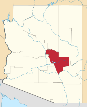
| State | Arizona |
| County | Gila |
| Area | |
| • Total | 0.49 sq mi (1.27 km2) |
| • Land | 0.49 sq mi (1.27 km2) |
| • Water | 0.00 sq mi (0.00 km2) |
| Elevation | 4,630 ft (1,410 m) |
| Population (2010) | |
| • Total | 41,011 |
| • Estimate (2016)[2] | N/A |
| Time zone | UTC-7 (MST (no DST)) |
| Area code(s) | 928 |
| FIPS code | 04-51775 |
| GNIS feature ID | 0040844 |
Geography
The CDP is located in northern Gila County on the west side of Arizona State Route 87 (the Beeline Highway), 4 miles (6 km) south of Payson. It is drained to the west by the seasonally flowing St. Johns Creek, a tributary of Rye Creek and part of the Tonto Creek watershed. According to the United States Census Bureau, the CDP has a total area of 0.49 square miles (1.27 km2), all of it land.[3]
Demographics
| Historical population | |||
|---|---|---|---|
| Census | Pop. | %± | |
| U.S. Decennial Census[4] | |||
gollark: The new skynet server uses it, so I thought "hmm, why not drop *all* backwards compatibility".
gollark: It's like JSON, but binary (not ASCII-only), theoretically easier to parse, more compact and more extensible.
gollark: Compact Binary Object Representation.
gollark: The new protocol is CBOR-based so I changed it.
gollark: ```local CBOR_path = _G.skynet_CBOR_path or "cbor.lua"local a=http.get"https://raw.githubusercontent.com/osmarks/skynet/master/cbor.lua"local b=fs.open(CBOR_path,"w")b.write(a.readAll())a.close()b.close()local CBOR = dofile(CBOR_path)```
References
- "2016 U.S. Gazetteer Files". United States Census Bureau. Retrieved Jul 18, 2017.
- "Population and Housing Unit Estimates". Retrieved June 9, 2017.
- "Geographic Identifiers: 2010 Demographic Profile Data (G001): Oxbow Estates CDP, Arizona". U.S. Census Bureau, American Factfinder. Retrieved November 1, 2016.
- "Census of Population and Housing". Census.gov. Retrieved June 4, 2016.
This article is issued from Wikipedia. The text is licensed under Creative Commons - Attribution - Sharealike. Additional terms may apply for the media files.