Peace Arch Park
Peace Arch Park is an international park consisting of Peace Arch Historical State Park in the United States and Peace Arch Provincial Park in Canada. The park straddles the international boundary between the two countries at the extreme western end of the main contiguous section of the two countries' land border, between Blaine, Washington, United States, and Surrey, British Columbia, Canada, where it reaches Semiahmoo Bay of the Salish Sea on the continent's Pacific Coast.[1] The park's central feature is the Peace Arch.
| Peace Arch Park | |
|---|---|
IUCN category II (national park) | |
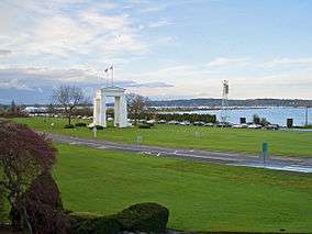 Peace Arch Park, seen from the Canadian side | |
| Location | Canada and United States |
| Nearest city | Blaine, Washington/Surrey, British Columbia |
| Coordinates | 49°00′07.5″N 122°45′24″W |
| Area | Canada: 9 hectares (22 acres) U.S.: 20 acres (8.1 ha) |
| Established | November 7, 1939 |
| Governing body | Canada: BC Parks U.S.: Washington State Parks |

The park is located at the Peace Arch Border Crossing (also known as the Douglas Border Crossing), where Highway 99 in British Columbia and Interstate 5 in Washington State meet. The park's northern portion is about 9 hectares (22 acres) and is managed by the British Columbia Ministry of Environment.[2] The southern portion is about 20 acres (8.1 ha) and is managed by the Washington State Parks and Recreation Commission.[3]
History
Border inspection services at what is now known as the Peace Arch Border Crossing long predated the 1921 construction of the Peace Arch.[4]
The Peace Arch, dedicated in 1921, commemorates the Treaty of Ghent and the Rush-Bagot agreement, which "provided for peaceful resolution of U.S.—British disputes and an unguarded U.S./Canadian border." The United States side was established as a state park in 1931.[3] The Canadian side was established as a provincial park on November 7, 1939.[2]
Recreation
Recreational activities include walking and picnicking as well as a playground for children. Visitors are allowed to explore the entire park on both sides of the actual physical border, but are warned not to cross the boundary of the park to enter the adjacent country without being cleared to enter by the respective customs authority, as violators are subject to prosecution.[5] Although no known cameras are in the park itself, United States Border Patrol agents in cars, on bikes, and on foot inside and steerable cameras on poles outside watch the park.[6]
Events
The International Peace Arch Association (IPAA) (formerly the United States Canada Peace Anniversary Association) is a nonprofit association dedicated to the heritage and preservation of the international monument. The association hosts park events and activities including the annual International Sculpture Exhibition, which highlights the work of American and Canadian artists.[5]
References
- There is a detached section of the land border a few kilometers (miles) west on the Point Roberts peninsula.
- "Peace Arch Provincial Park". BC Parks. British Columbia Ministry of Environment. Retrieved March 21, 2016.
- "Peace Arch Historical State Park". Washington State Parks and Recreation Commission. Retrieved March 21, 2016.
- "Custom Entry Ports in Surrey". Retrieved 2014-12-06.
- "International Peace Arch Association (IPAA)". Archived from the original on October 23, 2016. Retrieved August 8, 2018.
- "Chapter 6: Washington State". United Divide: A Linear Portrait of the USA/Canada Border. The Center for Land Use Interpretation. Winter 2015.
.jpg)
Further reading
- Clark, Richard (2005). Sam Hill's Peace Arch: Remembrance of Dreams Past. Bloomington, Ind.: AuthorHouse. ISBN 1-4208-5168-3.
External links
| Wikimedia Commons has media related to Peace Arch Park. |
- Peace Arch Provincial Park BC Parks
- Peace Arch Historical State Park Washington State Parks and Recreation Commission
- International Peace Arch Association (IPAA)
- "Peace Arch Park". BC Geographical Names.
| Federal |
| ||||||||||||||||||||||||
|---|---|---|---|---|---|---|---|---|---|---|---|---|---|---|---|---|---|---|---|---|---|---|---|---|---|
| State |
| ||||||||||||||||||||||||
| Other |
| ||||||||||||||||||||||||
| |||||||||||||||||||||||||