Caligata Lake Provincial Park
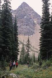
Caligata Lake Provincial Park is a provincial park in British Columbia, Canada, located northeast of Clearwater. The lake occupies a cirque below the north face of Raft Mountain. The park has no visitor facilities or services.
| Caligata Lake Provincial Park | |
|---|---|
IUCN category II (national park) | |
 North Face of Raft Mountain near Caligata Lake | |
_location_map.svg.png) Location of Caligata Lake Provincial Park | |
| Location | British Columbia, Canada |
| Nearest city | Clearwater |
| Coordinates | 51°44′N 119°50′W |
| Area | 153 ha |
| Established | 1996 |
| Visitors | less than 100 (in 2010) |
| Governing body | BC Parks |
Access is by Spahats Creek Road off the Clearwater Valley Road (also called Wells Gray Park Road), then there is a short hike to the lake.
Cross-country hiking routes lead from Caligata Lake to the nearby Cirque of Tarns and Spahats Hill. A more rigorous hike ascends to the east ridge of Raft Mountain from where a skyline walk can go in either direction to Raft's multiple summits.[1]
The name comes from the Latin for the hoary marmot, marmota caligata.
References
- Neave, Roland (2015). Exploring Wells Gray Park, 6th edition. Wells Gray Tours, Kamloops, BC. ISBN 978-0-9681932-2-8.

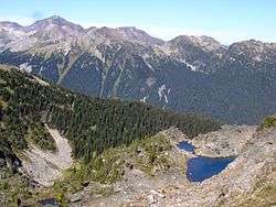
Cirque of Tarns above Caligata Lake. Trophy Mountain behind.
See also
- Wells Gray Provincial Park
- Trophy Mountain
- Spahats Falls
This article is issued from Wikipedia. The text is licensed under Creative Commons - Attribution - Sharealike. Additional terms may apply for the media files.