Oroqen Autonomous Banner
Oroqen Autonomous Banner (Mongolian: ᠣᠷᠴᠣᠨ ᠤ ᠥᠪᠡᠷᠲᠡᠭᠡᠨ ᠵᠠᠰᠠᠬᠤ ᠬᠣᠰᠢᠭᠤ, Orčon-u öbertegen jasaqu qosiɣu, Mongolian Cyrillic: Орчон өөртөө засах хошуу; Simplified Chinese: 鄂伦春自治旗, Pinyin: Èlúnchūn Zìzhìqí) is an autonomous banner that lies directly south of the urban district of Hailar in the prefecture-level city of Hulunbuir. It covers an area of 60,378 square kilometres (23,312 sq mi). As of the 2010 census, there were 223,752 inhabitants with a population density of 4.84 inhabitants per km². Its capital is the town of Alihe (阿里河镇). It includes Ganhe (甘河), Dayangshu (大杨树), Jiwen (吉文) but excludes the Jiagedaqi and Songling Districts.
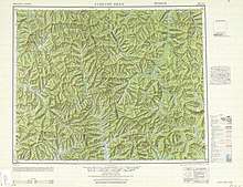
Map including part of Oroqen Autonomous Banner (AMS, 1951)

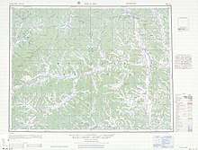
Map including part of Oroqen Autonomous Banner (AMS, 1951)
Map including part of Oroqen Autonomous Banner (AMS, 1951)
Oroqen Banner 鄂伦春旗 • ᠣᠷᠴᠣᠨ ᠤᠬᠣᠰᠢᠭᠤ | |
|---|---|
| Oroqen Autonomous Banner 鄂伦春自治旗 ᠣᠷᠴᠣᠨ ᠤᠥᠪᠡᠷᠲᠡᠭᠡᠨᠵᠠᠰᠠᠬᠤᠬᠣᠰᠢᠭᠤ | |
.jpg) | |
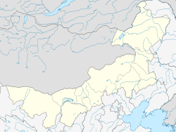 Oroqen Location in Inner Mongolia | |
| Coordinates: 50°35′N 123°43′E | |
| Country | People's Republic of China |
| Region | Inner Mongolia |
| Prefecture-level city | Hulunbuir |
| Time zone | UTC+8 (China Standard) |
Ethnic groups in Oroqin Autonomous Banner, 2000 census
| Nationality | Population | Percentage |
|---|---|---|
| Han | 257,861 | 88.28% |
| Mongols | 12,045 | 4.12% |
| Manchu | 8,743 | 2.99% |
| Daur | 6,379 | 2.18% |
| Evenks | 3,155 | 1.08% |
| Oroqen | 2,050 | 0.7% |
| Hui | 1,038 | 0.36% |
| Korean | 633 | 0.22% |
| Xibe | 54 | 0.02% |
| Russians | 37 | 0.01% |
| Others | 102 | 0.04% |
gollark: But it would be hypocritical since it already uses superglobals and stuff, and everything would break.
gollark: I could theoretically implement something in potatOS to make globals impossible.
gollark: Also it's mildly inefficient.
gollark: National security reasons.
gollark: Listen with a modem, that is.
This article is issued from Wikipedia. The text is licensed under Creative Commons - Attribution - Sharealike. Additional terms may apply for the media files.