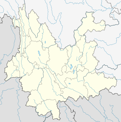
Menglian Dai, Lahu and Va Autonomous County
Menglian Dai, Lahu and Va Autonomous County (simplified Chinese: 孟连傣族拉祜族佤族自治县; traditional Chinese: 孟連傣族拉祜族佤族自治縣; pinyin: Mènglián Dǎizú Lāhùzú Wǎzú Zìzhìxiàn) is an autonomous county in the southwest of Yunnan Province, China, bordering Burma's Shan State to the south and west. It is the westernmost county-level division of Pu'er City
Menglian County 孟连县 | |
|---|---|
| 孟连傣族拉祜族佤族自治县 Menglian Dai, Lahu and Va Autonomous County | |
.png) Location of Menglian County (pink) and Pu'er City (yellow) within Yunnan province | |
 Menglian Location of the seat in Yunnan | |
| Coordinates: 22°19′44″N 99°35′02″E | |
| Country | People's Republic of China |
| Province | Yunnan |
| Prefecture-level city | Pu'er |
| GB/T 2260 CODE[1] | 530827 |
| Area | |
| • Total | 1,957 km2 (756 sq mi) |
| Elevation | 1,300 m (4,300 ft) |
| Population | |
| • Total | 107,908 |
| • Density | 55/km2 (140/sq mi) |
| Time zone | UTC+8 (China Standard Time) |
| Postal code | 665800[2] |
| Area code(s) | 0879[2] |
| Website | www |
| 1Yunnan Statistics Bureau 2Puer Gov. 3Yunnan Portal | |
Climate
| Climate data for Menglian (1981−2010) | |||||||||||||
|---|---|---|---|---|---|---|---|---|---|---|---|---|---|
| Month | Jan | Feb | Mar | Apr | May | Jun | Jul | Aug | Sep | Oct | Nov | Dec | Year |
| Record high °C (°F) | 29.7 (85.5) |
32.0 (89.6) |
33.2 (91.8) |
35.8 (96.4) |
36.0 (96.8) |
34.7 (94.5) |
35.2 (95.4) |
34.4 (93.9) |
32.7 (90.9) |
32.5 (90.5) |
30.1 (86.2) |
28.8 (83.8) |
36.0 (96.8) |
| Average high °C (°F) | 24.2 (75.6) |
26.0 (78.8) |
29.0 (84.2) |
30.6 (87.1) |
30.2 (86.4) |
29.2 (84.6) |
28.2 (82.8) |
28.7 (83.7) |
28.7 (83.7) |
27.9 (82.2) |
25.5 (77.9) |
23.5 (74.3) |
27.6 (81.8) |
| Daily mean °C (°F) | 14.0 (57.2) |
15.8 (60.4) |
19.0 (66.2) |
21.6 (70.9) |
23.3 (73.9) |
24.0 (75.2) |
23.7 (74.7) |
23.6 (74.5) |
22.8 (73.0) |
21.2 (70.2) |
17.7 (63.9) |
14.5 (58.1) |
20.1 (68.2) |
| Average low °C (°F) | 7.5 (45.5) |
8.2 (46.8) |
11.2 (52.2) |
14.8 (58.6) |
18.5 (65.3) |
21.0 (69.8) |
21.1 (70.0) |
21.0 (69.8) |
19.8 (67.6) |
17.8 (64.0) |
13.5 (56.3) |
9.5 (49.1) |
15.3 (59.6) |
| Record low °C (°F) | 1.8 (35.2) |
2.3 (36.1) |
4.2 (39.6) |
7.4 (45.3) |
12.7 (54.9) |
17.1 (62.8) |
17.3 (63.1) |
16.8 (62.2) |
12.1 (53.8) |
9.6 (49.3) |
5.0 (41.0) |
−0.7 (30.7) |
−0.7 (30.7) |
| Average precipitation mm (inches) | 8.3 (0.33) |
12.8 (0.50) |
17.7 (0.70) |
39.5 (1.56) |
135.5 (5.33) |
204.7 (8.06) |
285.3 (11.23) |
265.6 (10.46) |
188.0 (7.40) |
130.1 (5.12) |
57.7 (2.27) |
17.5 (0.69) |
1,362.7 (53.65) |
| Average relative humidity (%) | 79 | 73 | 69 | 71 | 77 | 84 | 86 | 86 | 86 | 86 | 85 | 83 | 80 |
| Source: China Meteorological Data Service Center | |||||||||||||
gollark: +rule apizzz ofozzz rmzzzz
gollark: +rule apio arachn oform
gollark: ++apioform
gollark: ++about
gollark: <@!332271551481118732> gib RPNCv4 code
See also
References
- "Archived copy". Archived from the original on 2009-02-21. Retrieved 2009-01-29.CS1 maint: archived copy as title (link)
- "Area Code and Postal Code in Yunnan Province". Archived from the original on 2007-11-07. Retrieved 2009-01-29.
This article is issued from Wikipedia. The text is licensed under Creative Commons - Attribution - Sharealike. Additional terms may apply for the media files.