North Crane, Indiana
North Crane is a small unincorporated community in Wea Township, Tippecanoe County, in the U.S. state of Indiana.[2]
North Crane, Indiana | |
|---|---|
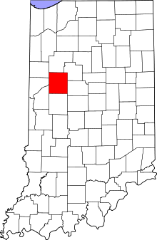 Tippecanoe County's location in Indiana | |
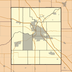 North Crane Location in Tippecanoe County | |
| Coordinates: 40°20′18″N 86°48′35″W | |
| Country | United States |
| State | Indiana |
| County | Tippecanoe |
| Township | Wea |
| Elevation | 679 ft (207 m) |
| Time zone | UTC-5 (Eastern (EST)) |
| • Summer (DST) | UTC-4 (EDT) |
| ZIP code | 47909 |
| Area code(s) | 765 |
| GNIS feature ID | 440239 |
History
The town began as a stop on the Indianapolis, Cincinnati and Lafayette Railroad line running southeast out of Lafayette and was known as Culver's Station, named for a nearby landowner.[3]
Geography
North Crane is located at 40°20′18″ N, 86°48′35″ W (40.338333, -86.809722) on the eastern edge of Wea Township. It has an elevation of approximately 679 feet.[4] One visible reminder of North Crane is the former Crane Station elevator, which can be seen from U.S. 52, just south of Lafayette.
gollark: Of course, they cannot be trusted.
gollark: According to truth cuboctahedrons, yes.
gollark: It's like they're using the majority of their computing power just to be mildly irritating.
gollark: You'd think so, but we found that they were actually somehow able to look into the future to determine the actual intended question being asked, and then give the wrong answer.
gollark: Your truth cuboctahedrons have been shown to have less than 3% accuracy.
References
- "US Board on Geographic Names". United States Geological Survey. 2007-10-25. Retrieved 2008-01-31.
- "North Crane, Indiana". Geographic Names Information System. United States Geological Survey. Retrieved August 4, 2017.
- Indiana Historical Society. Maps of Indiana Counties in 1876. 1968. (Reprinted from Illustrated Historical Atlas of the State of Indiana. Chicago: Baskin, Forster & Company, 1876.)
- "USGS Topographic Map Quad" (map). TopoQuest. Retrieved 2008-06-30.
External links
Municipalities and communities of Tippecanoe County, Indiana, United States | ||
|---|---|---|
| Cities | Map of Indiana highlighting Tippecanoe County | |
| Towns | ||
| Townships | ||
| CDPs | ||
| Other unincorporated communities |
| |
| Ghost towns | ||
| Footnotes | ‡This populated place also has portions in an adjacent county or counties | |
This article is issued from Wikipedia. The text is licensed under Creative Commons - Attribution - Sharealike. Additional terms may apply for the media files.